Team leader : Olivier Hagolle
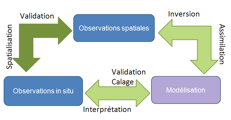
The « Observation Systems » team seeks to characterize and understand the spatial and temporal variability of vegetation and soil functioning. The team’s research is based on two pillars:
- remote sensing
- in-situ observation
We analyze these two kinds of data to :
- map vegetation at various scales, from field to continent
- help « Modelling » team to develop and validate vegetation models
- define strategies to reduce the environmental impacts of resource exploitation (agriculture, water)
- finding levers for mitigating climate change while maintaining sustainable production at a viable economic cost.
The OS team provides data and observation methods for the laboratory’s 3 thematic areas (water, agro-ecology, regional dynamics) and provides them with a platform for application.
Observation sites
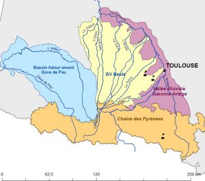
CESBIO developed the concept of a regional space observatory (OSR) at the beginning of the 2000s and implemented it in 2001, both in the Occitania region in France and in the Marrakech region (Tensift) with its Moroccan partners. The CESBIO’s projects linked to these observatories are essential to the development of the laboratory’s scientific dynamics.
- The South-West worksite enables the development of scientific activities around land use, agro-ecology and agricultural water management (crop needs and consumption).
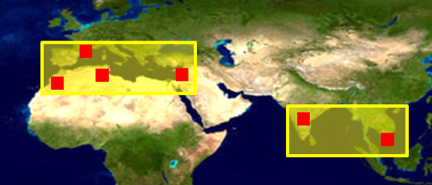
- The South worksite is split in several countries: Morocco (Tensift), Tunisia (Merguellil), Lebanon, Berambadi (India), Vietnam. It focuses on the evolution of water resources, in an arid context in most cases, or on the theme of rice cultivation in Vietnam.
The scientific activity of the sites relies heavily on data from the observatories and feeds them back. These observatories play an essential role as CAL/VAL sites for various space missions. The various observatories pursue a dual strategy of observation and experimentation which consists of 1) maintaining and enriching a certain number of permanent sites and 2) developing shorter experiments (e.g. space campaigns) in response to targeted scientific questions. The South West Regional Space Observatory (SW OSR) is an INSU facility recognized as a National Observation Service (SNO).
Space missions
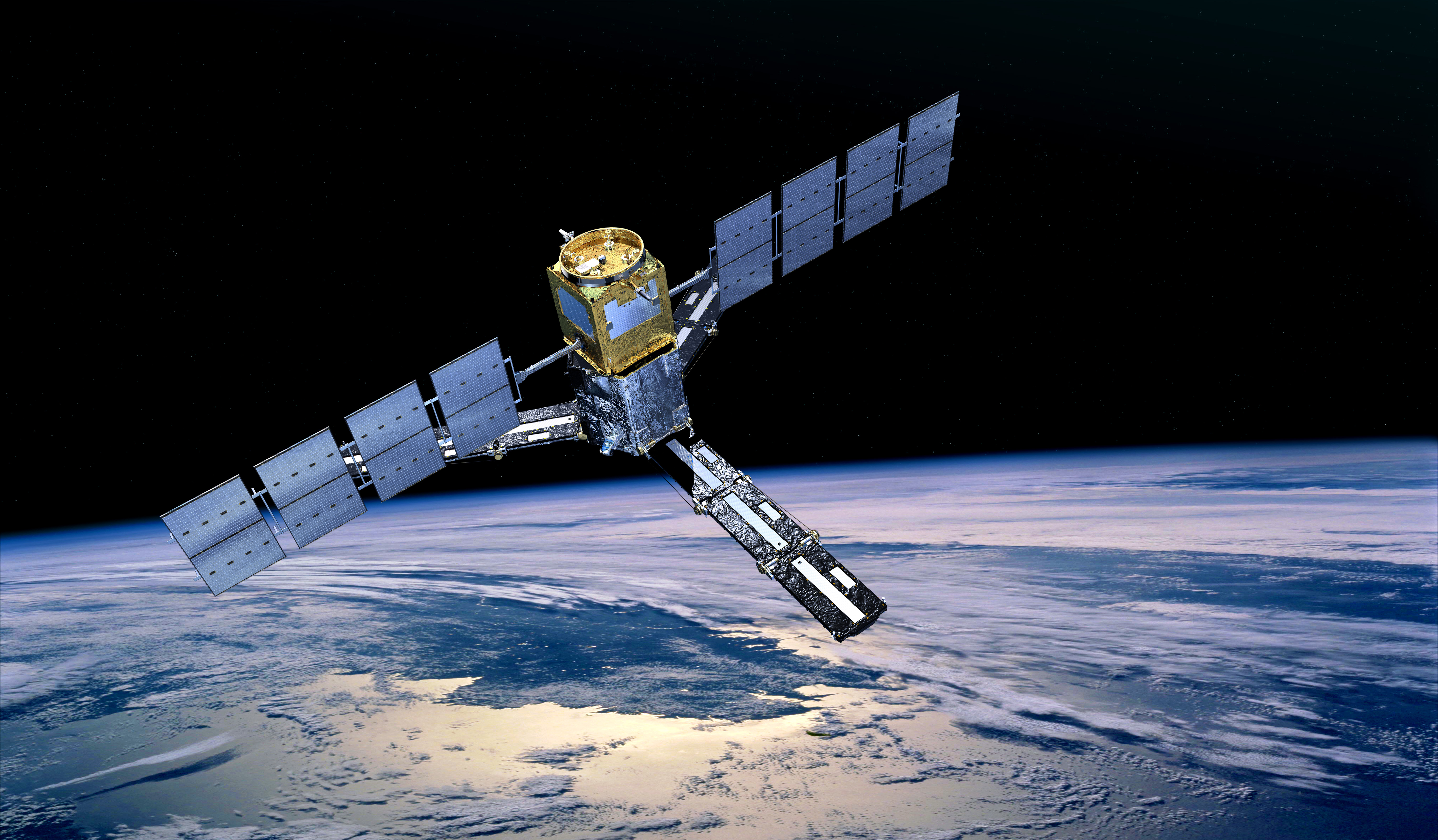
CESBIO carries four space missions, two of which are already in orbit (SMOS and VENµS) and two are decided and in development, BIOMASS and TRISHNA.
CESBIO carries four space missions, two of which are already in orbit (SMOS and VENµS) and two are decided and in development, BIOMASS and TRISHNA.
[wpdatatable id=2 table_view=regular]
Two other missions are also in the pre-project phase. These are the ULID (Unconnected L-Band Interferometer Demonstrator) and SMOS-HR (Soil Moisture and Ocean Salinity, High Resolution) missions. SMOS-HR is a continuation of the SMOS mission with improved resolution at 10km, while ULID is a technological mission that aims to demonstrate the possibility of further improving this resolution using a cloud of micro-satellites.
The program committee of the CNES has recommended the passage of the Sentinel-HR mission in phase 0. This mission, proposed by CESBIO, aims to monitor the earth’s surfaces at metric resolution with a revisit of about 20 days. The laboratory is of course also heavily involved in other missions in orbit (Sentinel-1, Sentinel-2, SMAP, etc) or in preparation (SWOT, FLEX, etc).
Use of remote sensing data
Physics of measurement
Through the space missions carried by CESBIO and other in situ or airborne measurements, the Observation Systems team is developing a strong competence in measurement physics. This concerns different types of spectra and sensors:
- Optics including thermal infra-red
- Radar/GNSS-R
- Passive microwaves
The exploitation of synergies between different sensors plays a central role in the characterization of continental surfaces in our work. The main idea is to explore the complementarity of multi-modal, multi-resolution spatial and multi-temporal measurements for a better estimation of surface states. The team develops methods for the description of different surface properties:
- Land cover
- Soil properties
- Water or snow covered surfaces
- Vegetation properties (agriculture, forests, natural vegetation)
Time series analysis
Satellite series describing the evolution of vegetation cover (MODIS, SPOT-VGT), soil water content (SMOS, ASCAT, etc.) and temperature (MODIS, LANDSAT …) now reach sufficiently long time depths (~20 years) to perform statistical analyses. They are becoming essential for detecting anomalies linked to extreme events, such as drought, and also for detecting trends in surface conditions.