Internship offer: Inversion of satellite images of cities for studying their radiative budget
Collaboration: J. Tavares (VITO, Belgium), Z. Zhen (Jilin University, China), A. Kallel (CRNS, Tunisia)
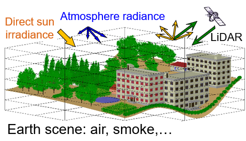
The radiative balance (RB) of cities is of growing interest, as it is a major component of their energy balance. Only remote sensing allows to evaluate it by inversion of satellite images in terms of the optical properties of urban elements (roofs, roads, trees,…). The CESBIO is developing a very original inverse modeling that derives a map of optical properties and temperature per urban element, using a satellite image and a 3D urban model. Thus, a Jacobian method compares satellite images and images simulated by the 3D radiative transfer model DART in an iterative way, and per pixel with consideration of its neighborhood. Results are very innovative. However, improvements are needed in order to improve the accuracy of the simulation of the temporal tracking of the urban radiation budget.
This internship includes 3 steps.
1) Improvement of the inversion model (Python language) of satellite images of cities in terms of maps of optical properties and temperatures per type of urban element.
2) Evaluation of this improved inversion model with satellite images simulated by the DART model using 3D urban schematic models. It will allow us to assess the accuracy of the inversion as a function of the configuration of the satellite observation (e.g., atmospheric conditions, solar direction,…).
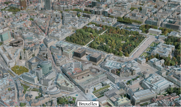
3) Inversion of actual satellite images (Sentinel-2 , ECOSTRESS,…) of the cities of Basel (Switzerland) and Brussels (Belgium), using 3D models of these cities. The new inversion model will be implemented in the version of DART published by the University of Toulouse III.
Requirements: bases in physics of remote sensing and digital image processing, as well as programming language skills (if possible Python).
Full offer and contacts for submission : HERE