Using PEPS to compute the ground surface displacement after the Palu earthquake
The 7.5 magnitude Palu earthquake in 2018 was a disaster that left 2,081 people dead, 1,309 missing and 206,494 displaced. An impressive surface slip associated with the earthquake was visible in optical satellite imagery like Sentinel-2.
I used this case to test the new tool that has been made availabe by the PEPS team (https://peps.cnes.fr/). This tool enables to compute the surface displacement from two Sentinel-2 images without the need to download the images. Just edit and run this shell script. The documentation is in French but if you need help you should contact the PEPS folks or follow these guidelines.
#!/bin/bash
REFERENCE=S2A_MSIL1C_20180902T022321_N0206_R103_T50MRE_20180902T054453
TARGET=S2A_MSIL1C_20181002T022321_N0206_R103_T50MRE_20181002T054141
DMINNBCOL=-4
DMAXNBCOL=4
DMINNBLIG=-4
DMAXNBLIG=4

REQUEST="http://peps.cnes.fr/resto/wps?request=execute&service=WPS&version=1.0.0&identifier=MEDICIS&datainputs=refImage=${REFERENCE};targetImage=${TARGET};dMinNbCol=${DMINNBCOL};dMaxNbCol=${DMAXNBCOL};dMinNbLig=${DMINNBLIG};dMaxNbLig=${DMAXNBLIG}&status=true&storeExecuteResponse=true"
curl -u email:passwd ${REQUEST}
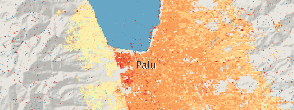
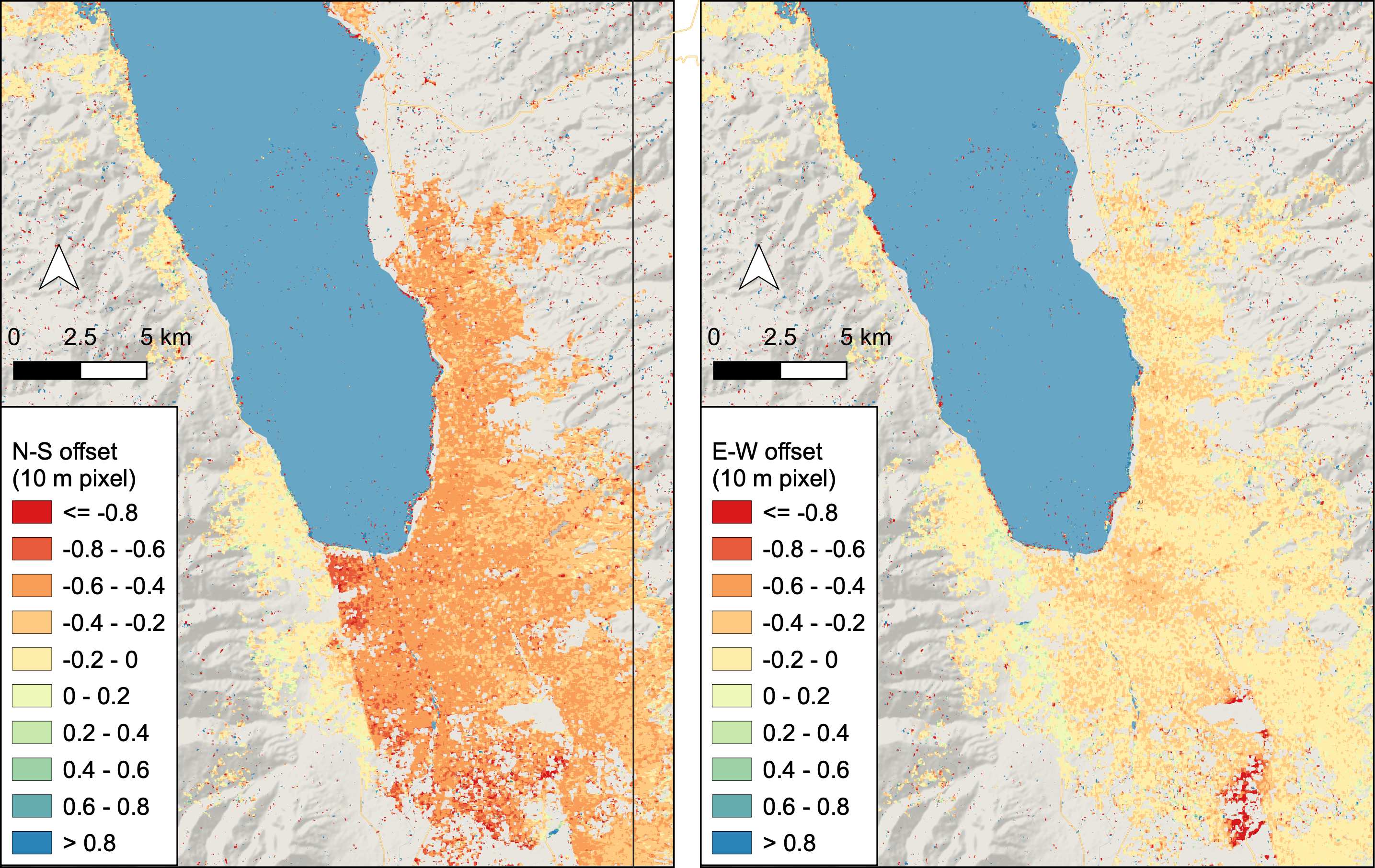
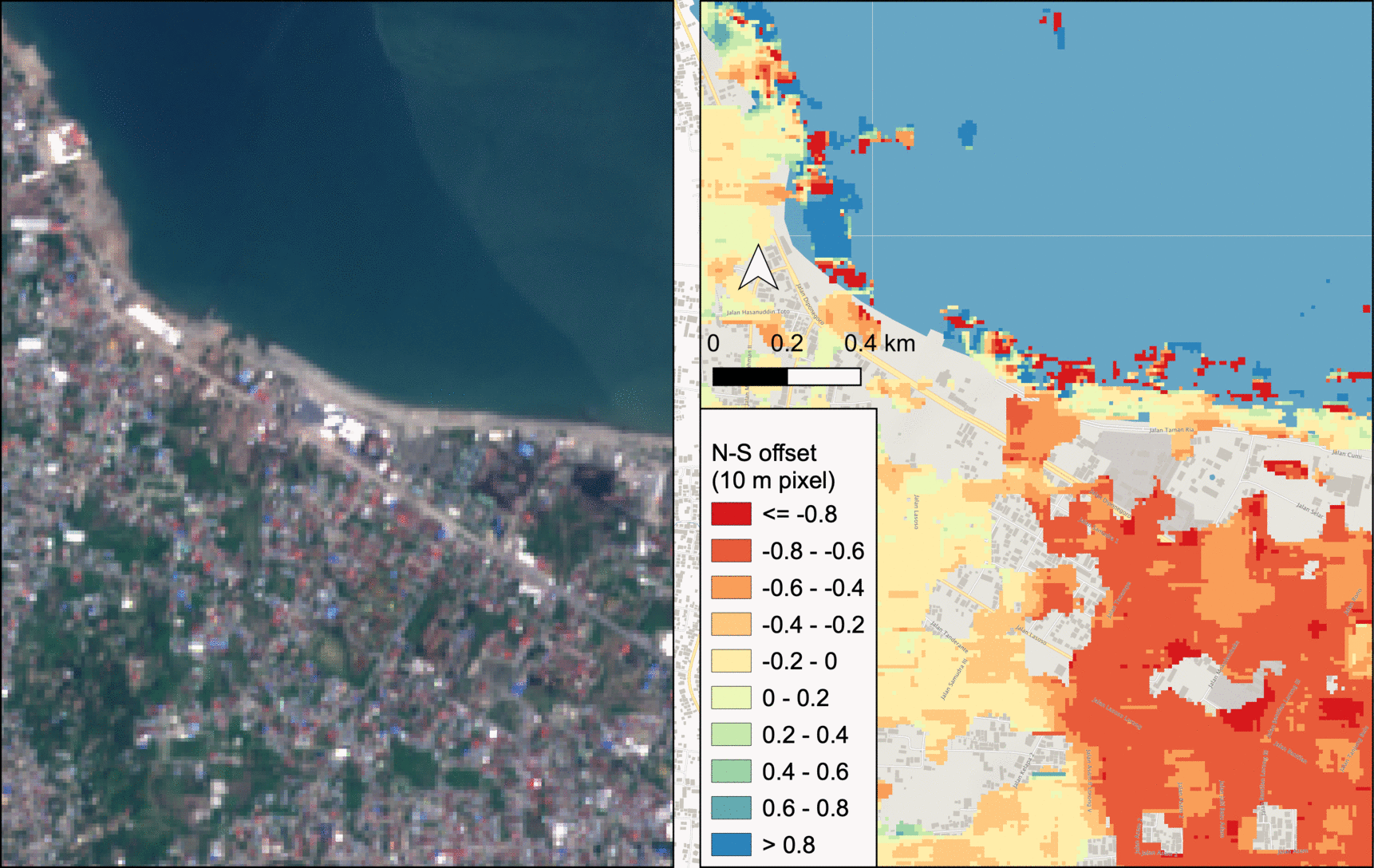
Here I used Sentinel-2A images from the same orbit acquired before (2018-09-02) and after (2018-10-02) the quake. After some trials I eventually managed to get the results. The fault line is well identified by the algorithm, with surface displacement of 2 to 8 m in the N-S direction, in agreement with this 2019 article by Anne Socquet et al.. or this tweet by Sotiris Valkaniotis.
The Palu earthquake was a major disaster because it triggered landslides. Recent studies have shown that rice irrigation had saturated soil, helping to set off the landslides.
Reference
2D Sub-Pixel Disparity Measurement Using QPEC / Medicis, Cournet, M., Giros, A., Dumas, L., Delvit, J. M., Greslou, D., Languille, F., Blanchet, G., May, S., and Michel, J., Int. Arch. Photogramm. Remote Sens. Spatial Inf. Sci., XLI-B1,291-298, http://dx.doi.org/10.5194/isprs-archives-XLI-B1-291-2016