🇬🇧 This app shows the snow cover duration in the High Atlas since January 01 until today in comparison with the average over the same period of the year between 2001-2023. The snow cover was obtained from Nasa’s Terra/MODIS satellite observations. The app is automatically updated when new observations are available.
🇫🇷 Cette application montre la durée de l’enneigement dans le Haut Atlas depuis le 01 janvier jusqu’à aujourd’hui par rapport à la moyenne sur la même période de l’année entre 2001-2019. L’enneigement a été obtenu à partir des observations satellitaires Terra / MODIS de la Nasa. L’application est automatiquement mise à jour lorsque de nouvelles observations sont disponibles.
Click here to view in full screen.
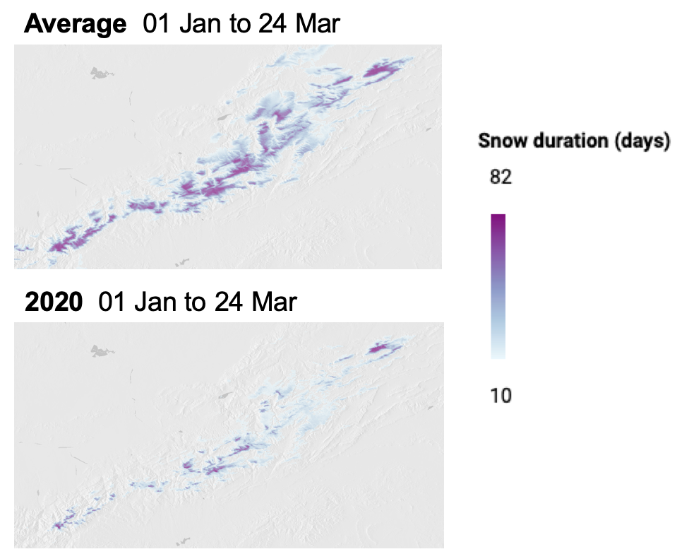
Below is an example on Mar 24, showing the impact of the 2020 snow drought.
Method
- The daily NDSI is extracted from the MOD10A1.006 collection (~500 m spatial resolution). Missing values are filled using a linear interpolation in the time dimension [1].
- The resulting series of daily gap-free NDSI is converted to a series of binary snow maps (snow / no-snow) using the threshold NDSI>0.2.
- The snow duration is the sum of the snow maps along the time axis.
- The snow maps over 2001-2023 were pre-computed and stored as an asset to reduce the app loading time (but it’s still slow).
Earth Engine users can get the source code in my Apps repository:
git clone https://earthengine.googlesource.com/users/sgascoin/apps
[1] Although more sophisticated algorithms exist to fill gaps in MODIS snow cover maps, the linear interpolation in the time dimension is a good trade-off between efficiency and accuracy.