Reappearance of the Dnieper river after the destruction of Kakhovka dam

The Kakhovka Reservoir was created in 1956. As the level of the reservoir drops at a staggering rate of two meters per day, it is now possible to see the ancient river reappear in satellite images.

I have georeferenced a 1943 German military map published by Defense Express in their article « 1943 Maps Show What Ukraine’s Kakhovka Reservoir Will Look Like When the Waters Settle Down » to verify if the Dnieper returns to its original state before the dam was constructed.
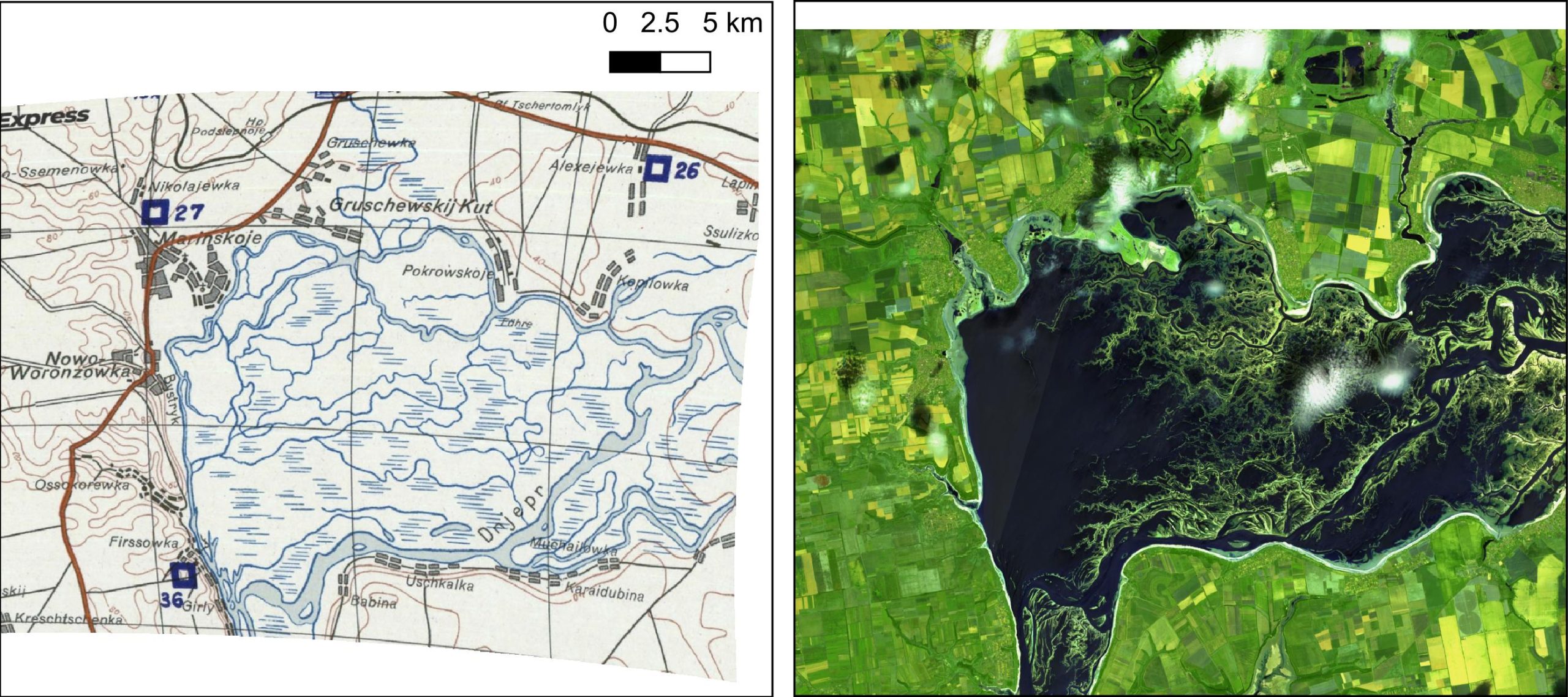
German General Staff map issued in 1943 and Sentinel-2 image acquired on 18 June 2023


18 June 2023 vs 1943


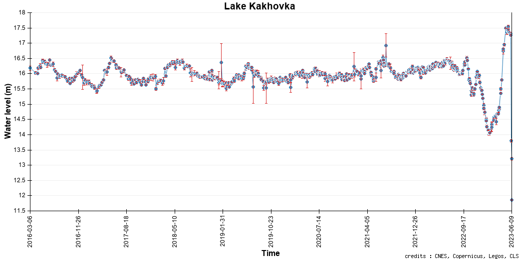
The former river is also visible near the Zaporizhzhia Nuclear Power Plant. According to the French Institute for Radiation Protection and Nuclear Safety the dikes of the cooling pond can withstand a Dnieper level of 10 m in the vicinity of the power plant. The level reached 11.8 m on June 9. It should be already well below 10 m by now but the cooling pond remains full.

The lake water level can be monitored by satellite altimetry in Theia’s HydroWeb website. However, the data are no longer updated due to the lack of water to reflect the signal emitted by the altimeter.
 

Update on June 21, with a new Sentinel-2 image acquired on June 20:

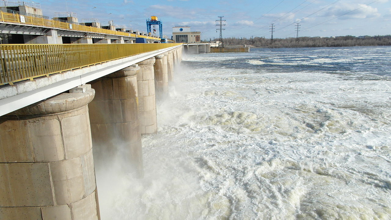
Top picture by Katerina Polyanska – Own work, CC BY-SA 3.0, https://commons.wikimedia.org/w/index.php?curid=32883338

Plus d'actualités

Near real time snow cover maps in the Copernicus Browser!

Copernicus provides near real time snow cover maps at 20 m resolution (fractional snow cover, code name: FSC OG). These products have been recently reprocessed and are now available through the Copernicus Data Space Ecosystem (CDSE) API and visualization tool, the Copernicus Browser! The latter is very useful to explore the data, for example if […]

Suivi du manteau neigeux dans les parcs naturels des Alpes franco-italiennes

Dans les Alpes, le manteau neigeux est un stock d’eau saisonnier naturel dont dépendent la faune, la flore et les humains pour de multiples usages (refuges, bétail, etc.). Dans le cadre du projet ACLIMO financé par le programme européen Interreg ALCOTRA, le Cesbio a été sollicité pour mettre en oeuvre un outil d’estimation de l’équivalent […]

The missing link to valorize CESBIO’s applicative research works

=>  My colleagues at CESBIO are extremely creative! Over the past ten years, they have developed a wide range of new products and methods for extracting information from Copernicus data. They don’t just develop and validate the method on a few sites; they continue their work until they have produced data for the whole of […]

Rechercher