
Dozens of landslides after the 2018 Hokkaido earthquake

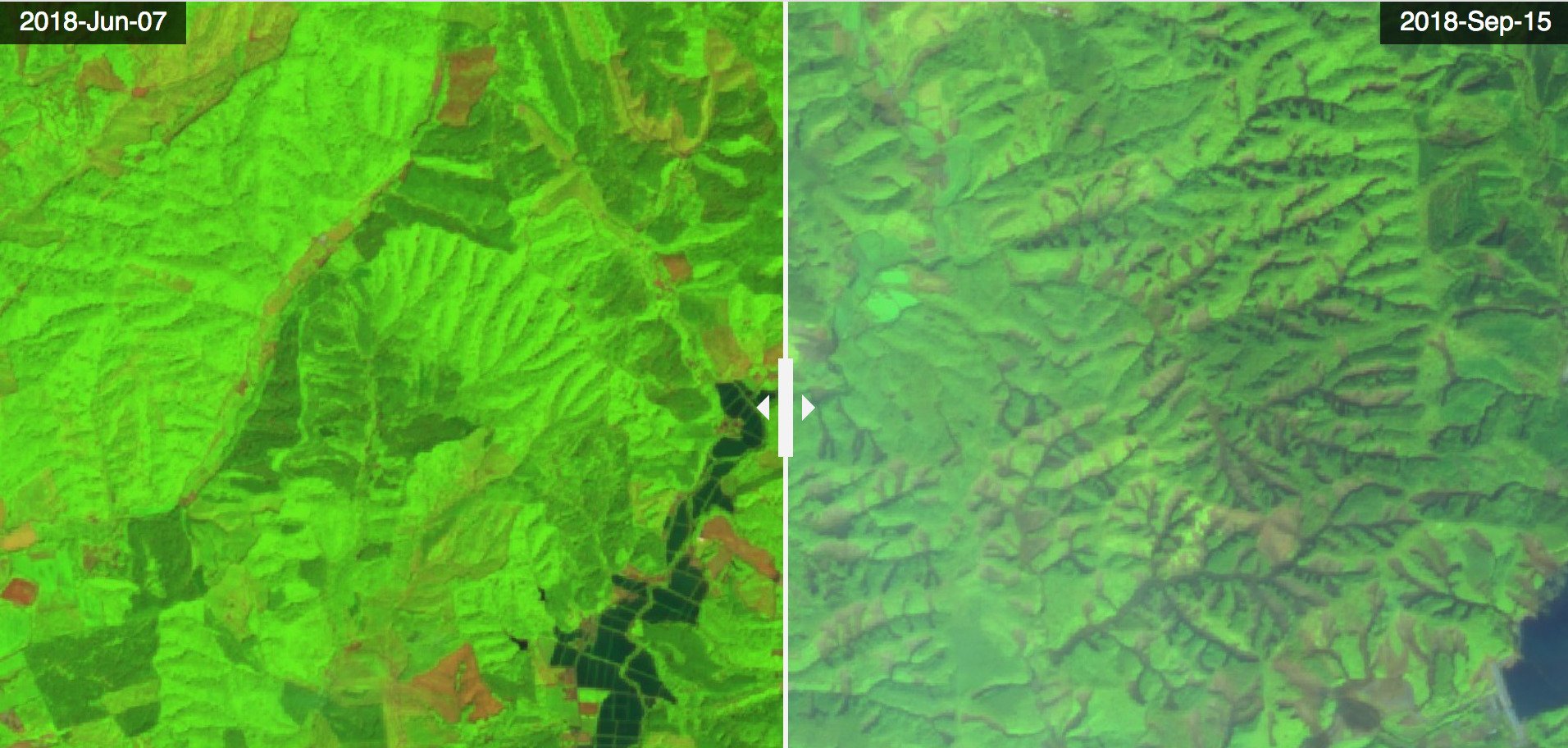
An earthquake with magnitude 6.7 occurred on 06 Sep 2018 in Hokkaido, Japan, killing at least 17 people and leaving nearly 3 million households in Hokkaido without electricity. The quake came two days after typhoon Jebi, « the strongest storm of 25 years« .  Below is an image comparison near Atsuma dam lake in the south of Hokkaido, before and after the earthquake, showing multiple landslides in the forest areas. Both images were acquired by Sentinel-2 and are shown as false color composites of bands 11-8-2.
Image


The heavy rainfalls brought by typhoon Jebi probably explain why the earthquake triggered so many landslides. I would like to count the landslides in this area, but the Sep 15 image is not yet available in my favorite image processing engine. I will check later.

Links:

in the AGU landslide blog

– Google published a crisis map but it seems that the imagery is not publicly available  Thanks to Laurent Longuevergne for letting me know about this!

Plus d'actualités

How long is the cooling effect of a cloud shadow ?

How long does it take for the cannon barrel to cool down after firing a shell ? Fernand Raynaud => This quote is from a famous old French funny sketch by Fernand Raynaud, which was based on a question in a French manual for soldiers: the sketch is rather long, so I’ll give you the […]

Impact of the August 12, 2026 eclipse on photovoltaic electricity generation in Spain

Photovoltaic (PV) energy supplies more 20% of Spain’s total electricity, and this share hit a new high in July 2026 (28.3% of the nation’s monthly electricity mix). Some media outlets were concerned about the drop in photovoltaic power generation during the 12-Aug-2026 eclipse. Le Monde explained that « the drop is expected to be particularly pronounced […]

Near real time snow cover maps in the Copernicus Browser!

Copernicus provides near real time snow cover maps at 20 m resolution (fractional snow cover, code name: FSC OG). These products have been recently reprocessed and are now available through the Copernicus Data Space Ecosystem (CDSE) API and visualization tool, the Copernicus Browser! The latter is very useful to explore the data, for example if […]

Rechercher
