In English

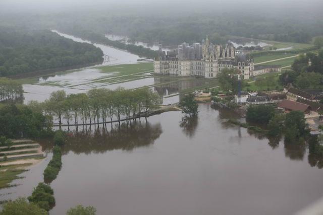
Chambord flooding: An update to « Mapping flooded areas using Sentinel-1 in Google Earth Engine » from Simon

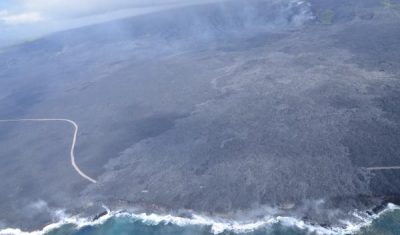
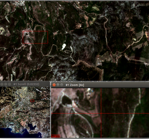
Short after working with Simon on the script for the  article about the mapping of flooded areas, I wanted to be sure that our short script was realistic. I had some time to loose at the airport, so, after finding a wifi connection, I looked for pictures of the flooded areas of the north of […]

02.09.2016

Sentinel-2A and Landsat-8 team up to track Kilauea Volcano’s lava flow

=> Kilauea Volcano in the largest active volcano in Hawaii and one of the most active on Earth. It has been erupting for over 30 years now but hit the headlines recently because a large lava flow traveled up to the ocean, adding 2 brand new hectares to the Hawaiian Islands.

01.09.2016

Sentinel-2A (and Landsat-8) capture a giant ice avalanche in Tibet

After reading my previous post about the Rutog ice avalanche, my distinguished colleagues Antoine R. and Olivier H. challenged me to look for a pre-event image to better highlight the avalanche area. The closest clear-sky image that I could find is a Landsat-8 image that was acquired on June 24 (23 days before the slide).

25.08.2016

Sentinel-2A captures a giant ice avalanche in Tibet

The Nature News website reported yesterday on a massive ice avalanche that happened in Rutog, Tibet, on 17 July 2016. This ice avalanche killed 9 people and may be one the largest ever observed. The ice and rock mixture spread over 6 km from the collapse point up to the Aru Co lake shoreline.

TOMCAR-Sat : Remote Sensing on the Yenisei river!

Since October 2015, the TOMCAR-Sat project aims to use high resolution satellite products to monitor Dissolved Organic Carbon (DOC) fluxes on the Arctic river Yenisei. Specifically, its objectives consist to calibrate a DOC retrieval model from time-series of satellite images and to characterize dynamics of the factors that may affect DOC concentrations, i.e. the snow […]

19.08.2016

Sentinel-2 time series are smooth !

=>  In a previous post, I showed a time series of pixels showing the good data quality of time series we get with Sentinel-2, processed to Level 2A by THEIA using MACCS  processor. However, I concluded that the plot I showed still had some low noise, and that a part of it was due to […]

18.08.2016

Sentinel-2 MACCS L2A reflectance stability

As MACCS was used to produce a large amount of images (all the images acquired over France), we were able to make some more validation tests, such as checking the surface reflectance stability. To do that, the region of Arles in Provence (France), tile 31TFJ, is a good site, with a lot of clear skies, […]

05.08.2016

Some summer news about Sentinel-2 and THEIA’s level 2A production

=>  Theia – MUSCATE I had a week of work in the middle of my holidays, which enabled be to see how the work on Sentinel-2  L2A data distribution is progressing. My colleagues who worked all July (Dominique, Joelle, Céline…) did a great job : they were able to process a large data set of […]

04.08.2016

The iota2 Land cover processor has processed some Sentinel-2 data

=> You already heard about iota2 processor, and you must know that it can process LANDSAT 8 time series et deliver land cover maps for whole countries. These las days, Arthur Vincent completed the code that allows processing Sentinel-2 time series. Even if atmospherically corrected Sentinel-2 data are not yet available above the whole France, we used  the […]

03.08.2016

Rechercher