Sentinel-2 MACCS L2A reflectance stability
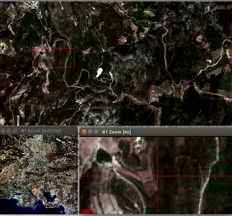
As MACCS was used to produce a large amount of images (all the images acquired over France), we were able to make some more validation tests, such as checking the surface reflectance stability. To do that, the region of Arles in Provence (France), tile 31TFJ, is a good site, with a lot of clear skies, and the chance to be observed from two different orbits by Sentinel-2. Here is an example for a coniferous forest (Pines probably): The reflectances of the 4 Sentinel-2 10m spectral bands are stable indeed, as it may be seen on the top plot, while the bottom plot shows the variation of the aerosol optical thickness measured by MACCS. You may have noticed that towards the summer, we can see a few couples of points, acquired 3 days apart, with small differences in surface reflectance, noticeable in the NIR infrared (black dots). These differences are probably due to directional effects as the observation from two different orbits are made with different viewing angles. These effects may be corrected. We do that for instance in our level 3 products.
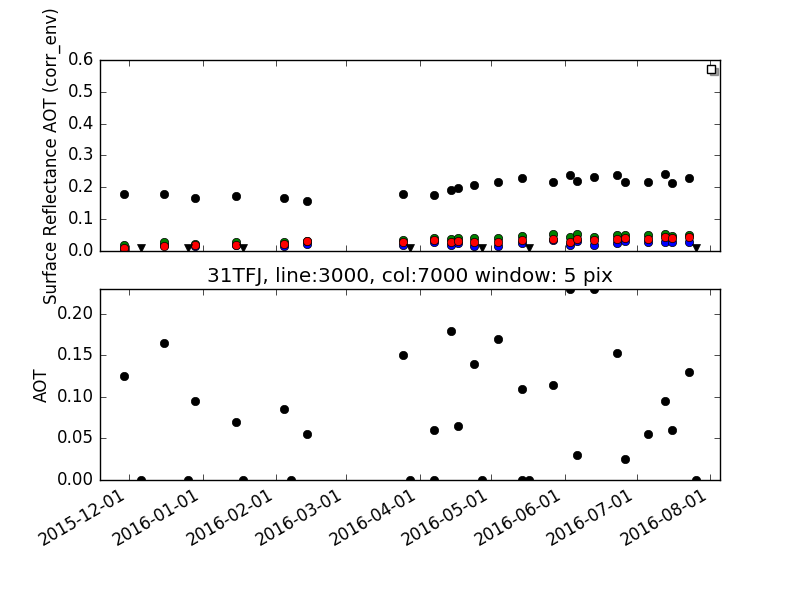
The overall stability of surface reflectances is clearly a good sign of the quality of MACCS processing. 

Plus d'actualités

How long is the cooling effect of a cloud shadow ?

How long does it take for the cannon barrel to cool down after firing a shell ? Fernand Raynaud => This quote is from a famous old French funny sketch by Fernand Raynaud, which was based on a question in a French manual for soldiers: the sketch is rather long, so I’ll give you the […]

Impact of the August 12, 2026 eclipse on photovoltaic electricity generation in Spain

Photovoltaic (PV) energy supplies more 20% of Spain’s total electricity, and this share hit a new high in July 2026 (28.3% of the nation’s monthly electricity mix). Some media outlets were concerned about the drop in photovoltaic power generation during the 12-Aug-2026 eclipse. Le Monde explained that « the drop is expected to be particularly pronounced […]

Near real time snow cover maps in the Copernicus Browser!

Copernicus provides near real time snow cover maps at 20 m resolution (fractional snow cover, code name: FSC OG). These products have been recently reprocessed and are now available through the Copernicus Data Space Ecosystem (CDSE) API and visualization tool, the Copernicus Browser! The latter is very useful to explore the data, for example if […]

Rechercher