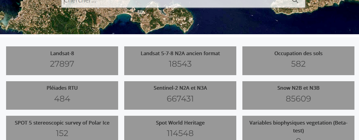
The Million : The MUSCATE data center at CNES already delivers one million products
 =>
=> 
The Million !
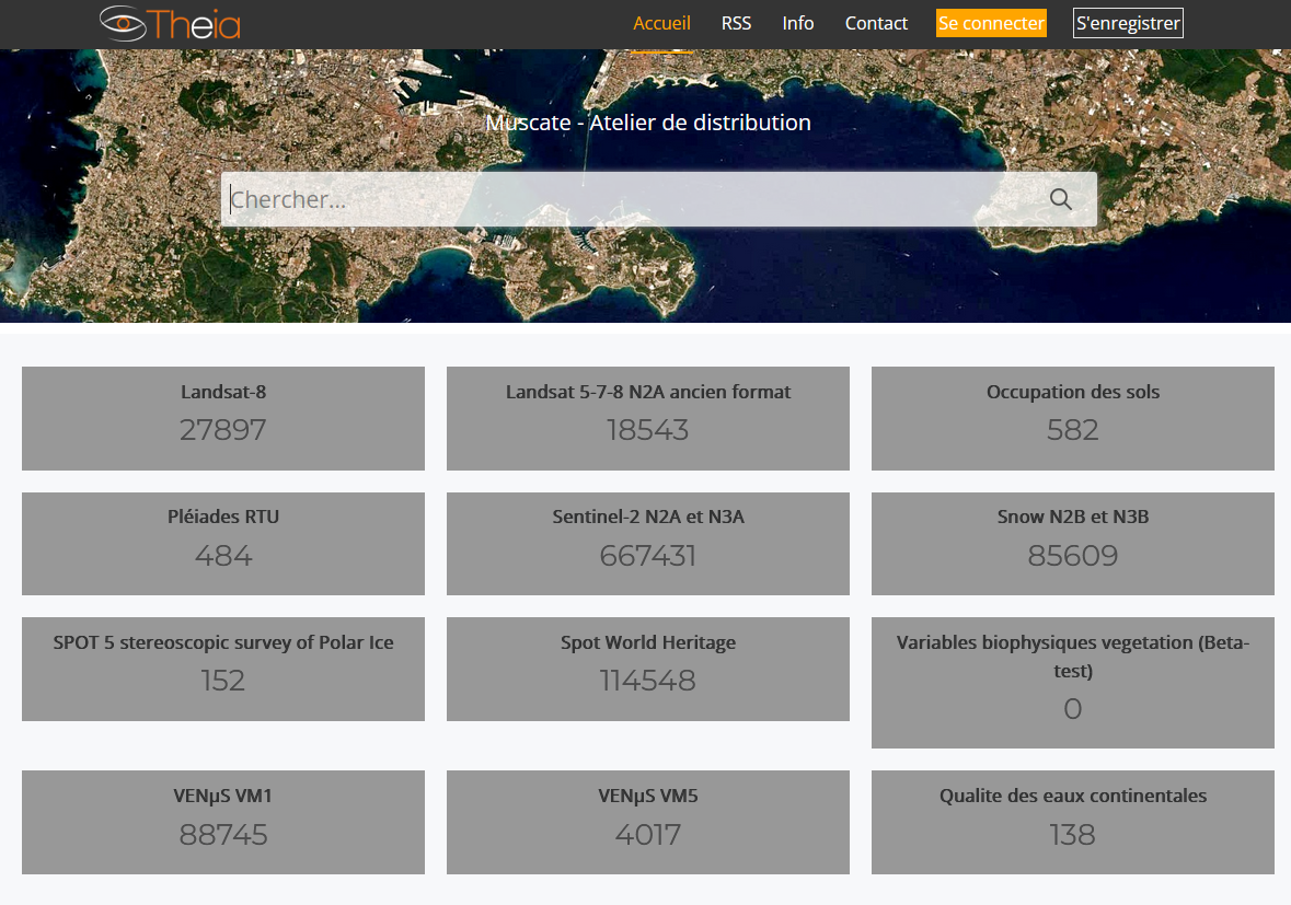
If you sum up the numbers of products distributed by CNES for THEIA, you can see that our center is now distributing more than one million products (1,000,000!). Readers who follow this blog may remember our initial struggles related to the production, after which we celebrated 10,000 (in April 2017) or 100,000 products (in August 2018).
The MUSCATE platform (MUlti Satellite, multi-CApteurs, multi-TEmporal data), which produces and distributes all these datasets, is one of Theia‘s data centers. It is operated by CNES in Toulouse.
Among the available products are surface reflectances from the Sentinel2 and VENµS missions generated by the MAJA processing chain, which then feed the monthly syntheses made by the WASP (Weighted Average Synthesis Processor) processing chain, snow cover products from the LIS (Let It Snow) processing chain, land cover maps from the IOTA2 soil classification chain, etc.
Through this site, 14,000 users have downloaded at least one product and over 15.5 million products have been downloaded since mid-September 2016. At the top of the ranking, the surface reflectance product from the Sentinel-2 mission followed by the surface reflectance product from the VENµS mission. Our users are 57% French, 71% European, and 29% from outside the European Union. Worldwide, there are more than 43 countries with at least 30 users each.
By 2024, we will tell you about the next generation of this data center, which should provide a greater diversity of products (with the distribution of ARD products based on Sentinel-1, processed with S1-Tiling), and maybe increase the covered areas tenfold. The 10,000,000 products are thus not far away :). The products will soon be distributed through the GeoDataHub, and it will be possible to work on the data directly on the server, without downloading.
In any case, we owe a big BRAVO and a big THANK YOU to all the MUSCATE team which makes this service live every day, the functioning of which is not an easy task!
Theia et Data Terra
The Theia cluster aims to meet the needs of the national scientific community and the community of actors in charge of public policies, related to the observation of continental surfaces from space, at all scales, for research on the environment and territories and its applications to management and public policies. It allows to document the following themes: Agriculture, Biodiversity, Water, Forests, Coastal, Snow & Ice, Natural Risks, Health, Urban.
The construction of the Theia cluster has always been carried out in a multi-agency framework. The current agreement for the period from 2022 to 2026 brings together the following 10 partners: CEA, CEREMA, CIRAD, CNES, CNRS, IGN, INRAE, IRD, Météo-France, ONERA.
The Theia cluster is part of the Data Terra Research Infrastructure (RI), as are the three other national data clusters Aeris, Odatis, Form@Ter and the DINAMIS service.
This post is based on a paper by Therèse Barroso published on CNES intranet, with contributions from Marie France-Larif (but I couldn’t help but put my two cents in)