Upgrade of let-it-snow to compute the fractional snow cover

In preparation for the next Pan European high resolution snow and ice monitoring service, I have upgraded the let-it-snow (LIS) processor to enable the computation of the fractional snow cover (FSC) within the pixel.

Binary vs. fractional snow cover in the Pyrenees (tile T31TCH on 12 June 2019). Here the FSC was computed using the MOD10A1.005 equation (SCF=−0.01+1.45×NDSI) by Hall et al. (2001). Source of the binary product: Theia.

So far LIS was only used to compute a « binary snow mask » (in fact ternary: snow, no-snow, cloud). However, the EEA requested that the service provides the snow fraction in every 20 m Sentinel-2 pixel. The EEA also specified that the FSC should be computed from the Normalized Difference Snow Index. Hence, the latest version of the LIS processor (currently in the develop branch) can now read a custom function in the configuration file to compute the FSC from the NDSI (see this template).

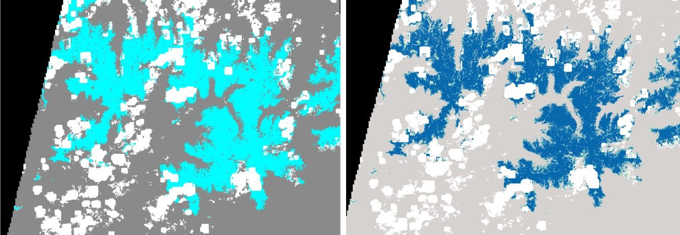
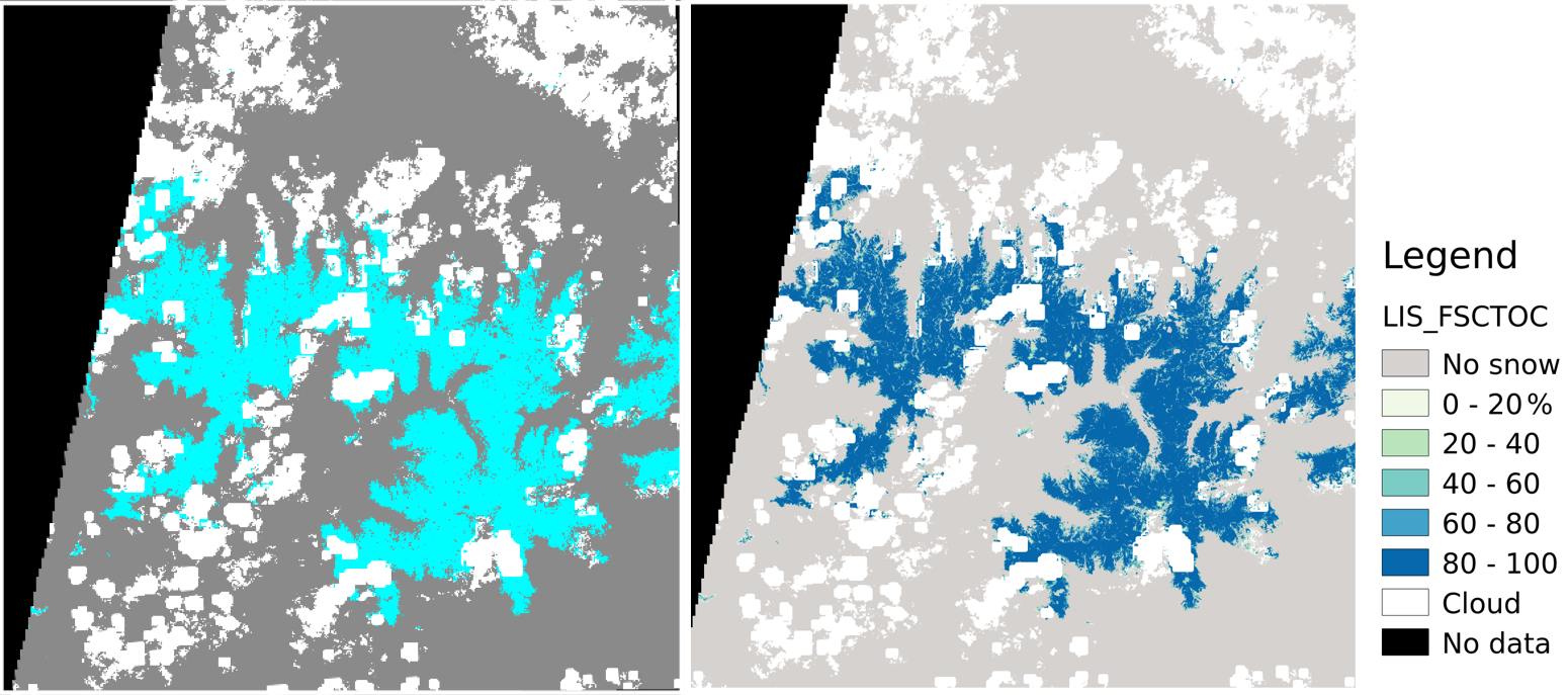
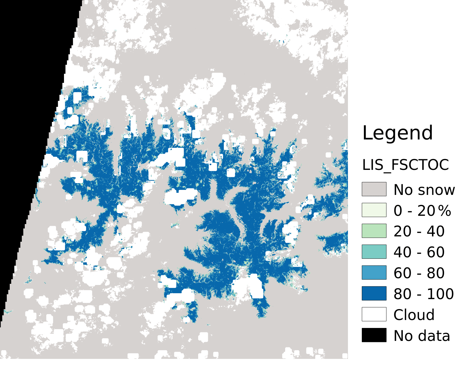
In forest areas, the function f(NDSI) provides a “top-of-canopy” FSC (FSCTOC), which can be adjusted based on the tree cover density (TCD) to estimate the “on-ground” FSC (FSCOG) (Raleigh et al., 2013).

$$FSC_{OG} = FSC_{TOC} / (1-TCD)$$

« On ground » snow fraction computed with LIS (Sentinel-2 on 2019-06-12 tile T31TCH)

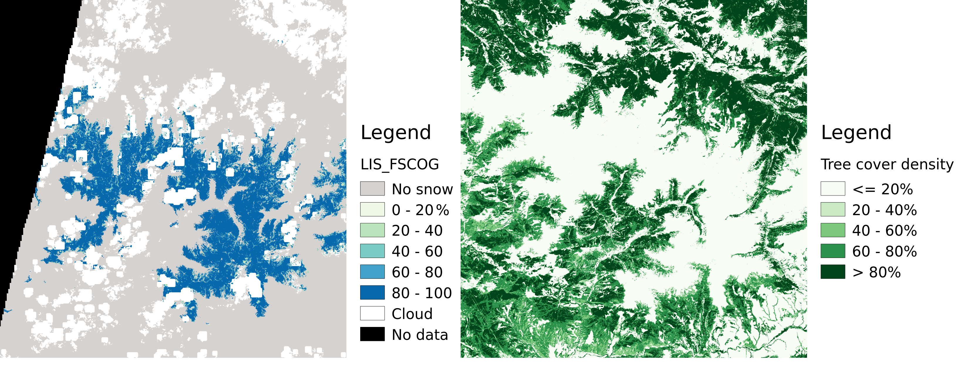
The TCD is given at 20 m resolution by the Copernicus High Resolution Layer Tree Cover Density status map (current release is 2015). The example below illustrates how this correction increased the snow fraction near the edges of the snow cover area, where the forest partially masked the snow cover.

Snow fraction: top-of-canopy vs. on-ground


We will now focus on the calibration of the FSC=f(NDSI) function using ground truth data (read this if you’re interested in contributing!).

Plus d'actualités

BIOMASS, the third launched satellite mission designed at CESBIO !

After SMOS in 2009, and VENµS in 2017, the CESBIO Laboratory is very proud to see its third proposed mission, Biomass, reach orbit. As always, it has been a long journey from the idea, at the beginning of the century, to the selection in 2013 as the seventh Earth Explorer Mission by ESA, to the […]

Sentinel-2 reveals the surface deformation after the 2025 Myanmar earthquake

Sentinel-2 captured several clear-sky images of Myanmar before and after the 28 March 2025 earthquake. The animation below shows a 5-day apart sequence of images captured by Sentinel-2B and Sentinel-2C (10 m resolution) near the epicenter located close to Mandalay. The surface slip due to the earthquake follows the Sagaing Fault, a major fault in […]

Evolution de l’altitude de la ligne de neige au cours des 41 dernières années dans le bassin versant du Vénéon (Oisans)

Pour contribuer à caractériser les conditions hydrométéorologiques lors de la crue torrentielle qui a frappé la Bérarde en juin, j’ai analysé une nouvelle série de cartes d’enneigement qui couvre la période 1984-2024 [1]. Grâce à la profondeur temporelle de cette série, on constate que l’altitude de la ligne de neige dans le bassin versant du […]

Rechercher