
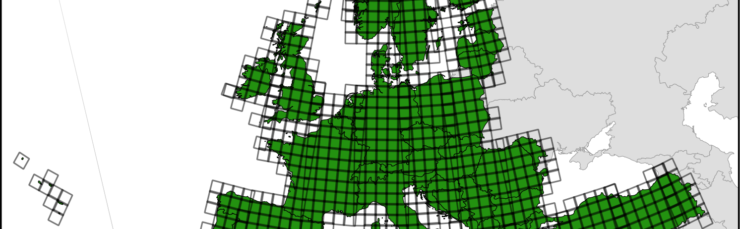
EEA 34 countries and corresponding Sentinel-2 tiles

MAJA and LIS selected for the next Pan European high resolution snow and ice monitoring service

The European Environment Agency (EEA) has selected a consortium led by Magellium to implement the next Pan European high resolution snow and ice monitoring of the Copernicus Land Monitoring Service.
click to enlarge
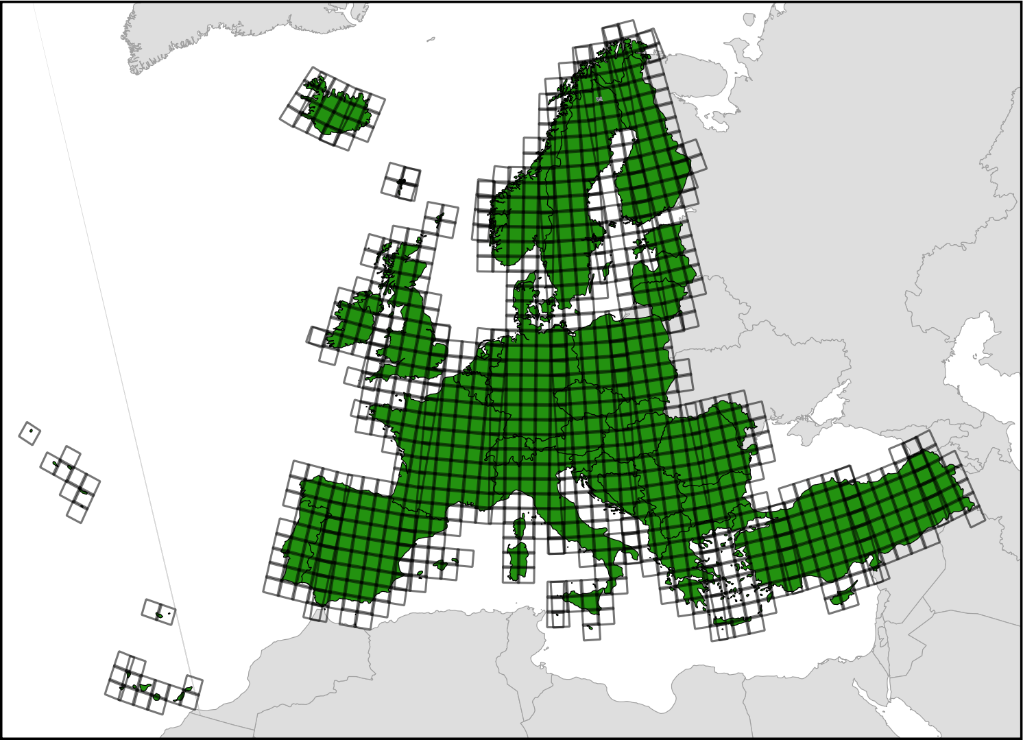
EEA 34 countries and corresponding Sentinel-2 tiles

This future service aims to monitor three variables at 20 m resolution over the tiles displayed above:

  1. Fractional Snow Cover (FSC)
  2. Permanent Snow Line (PSL)
  3. River and Lake Ice (RLI)

All products should be generated from atmospherically corrected Sentinel 2 data. For FSC and RLI the product should be available no later than 3 hours after the input Sentinel-2 is published on the Copernicus Open Access Hub. Cesbio and Cnes provide MAJA software for the atmospheric correction and cloud detection and LIS for the snow cover detection and permanent snow mapping. Astri Polka is responsible for the RLI implementation. Meteo-France contributes to the FSC and PSL evaluation and University of Oslo to the RLI. Magellium is in charge of developing the production system and to operate it on one of the DIAS centers. The products will be freely distributed to any user.
click to enlarge
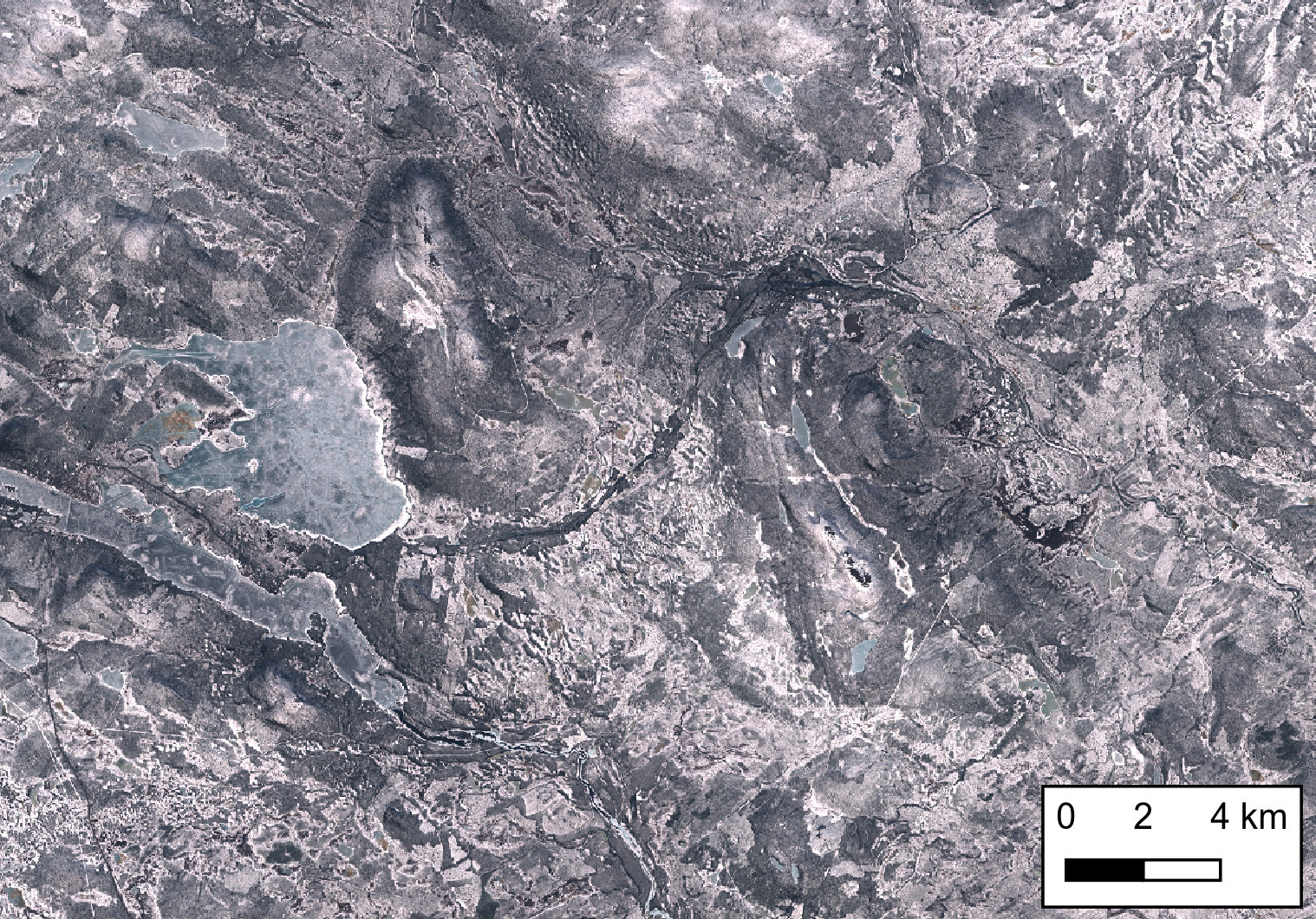
Snow and ice in the Swedish Lapland by Sentinel-2. The image is centered on Salmijärvi near Kiruna where is located the prime ground station for Sentinel-2 mission control. The image was acquired on 23 Apr 2019, the day of the EEA contract award notice.

PS. If you’d like to join the project we are recruiting! https://emploi.cnrs.fr/Offres/CDD/UMR5126-EMIBAS-003/Default.aspx?lang=EN


Plus d'actualités

Pléiades © CNES 2026 Distribution Airbus DS

Clear-sky Pléiades acquisition of the Rasuwa landslide source area

After many attempts, CNES’s Pléiades satellites finally captured a clear-sky view of the source area of the devastating flood in Nepal. The stereoscopic acquisition enables the generation of a high-resolution DEM and consequently a geometrically accurate orthorectified image. Although I’m not involved in the scientific analysis, I could not resist taking a closer look at […]

New clear-sky image of the Rasuwa rock-ice avalanche

On 08 Sep 2026, Sentinel-2 acquired a clear-sky image near the release area of the landslide which caused the catastrophic flood in Nepal. Using this image and a pre-event digital elevation model (Berthier 2026) we can analyze the upper part of the avalanche runout profile. The block of rock and ice was released near 5120 […]

How long is the cooling effect of a cloud shadow ?

How long does it take for the cannon barrel to cool down after firing a shell ? Fernand Raynaud => This quote is from a famous old French funny sketch by Fernand Raynaud, which was based on a question in a French manual for soldiers: the sketch is rather long, so I’ll give you the […]

Rechercher