India water crisis: Sentinel-1 detects surface water, ForEarth app restitutes and shares water stresses
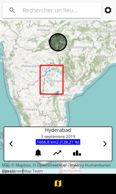
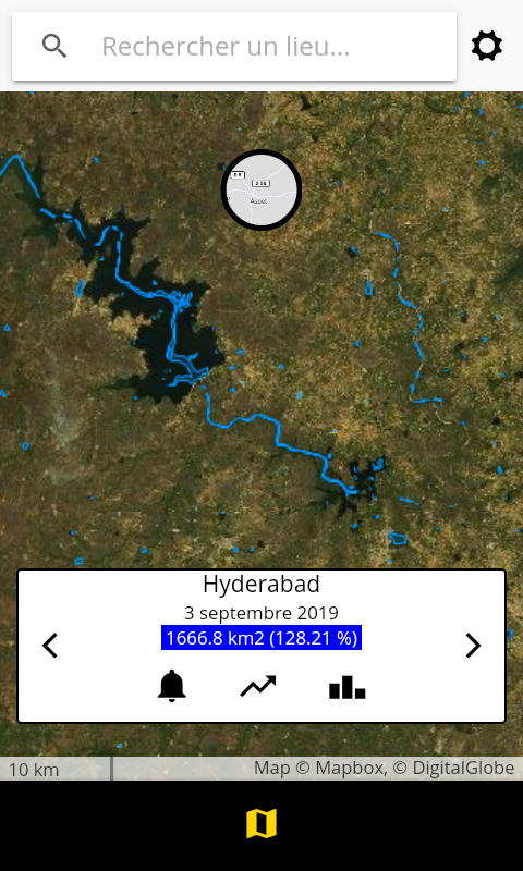
In the framework of an open call Science4society funded by ESA, researchers at CESBIO have implemented a surface water detection algorithm from radar data Sentinel-1 on a cloud computing system. An API developed by Geomatys and JeoBrowser, two Information Technologies companies in France, is used to send the resulting surface water masks to a smartphone App named ForEarth, which display the surface water fluctuation in time for Indian regions. The beta version is available on PlayStore and iOS displays statistics and water masks for the Hyderabad region, Telangana, India.
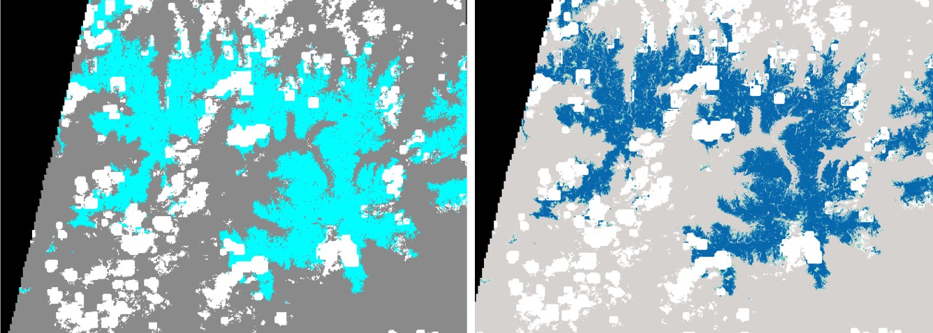
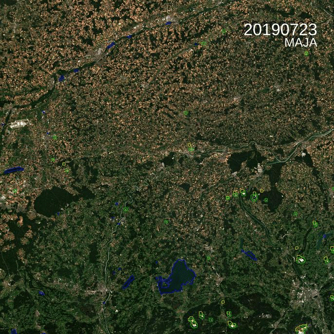
The radar data are able to monitor for any weather the numerous small surface water reservoirs that are used for agriculture as well as the biggest dammed reservoirs used for both irrigation and domestic water (Figures below). This technical aspect is essential in India as the replenishment of surface reservoirs occur during the monsoon season, a cloudy season lasting for 4 months.
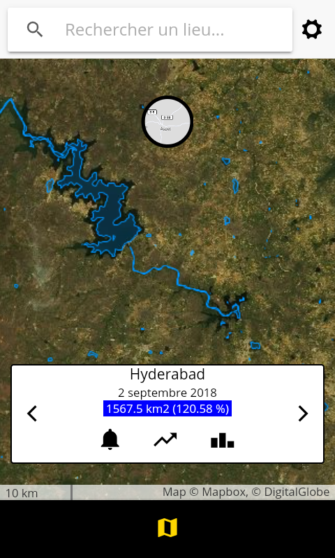
Contrary to existing data base for largest reservoirs, this app deliver surface water extent fluctuation in the water harvesting system, a typical network of small dams maintained by local farmers and village communities to catch monsoon runoff. It provides fresh water for rice irrigation, cattle and is supposed to enhance local aquifer recharge (figure below).
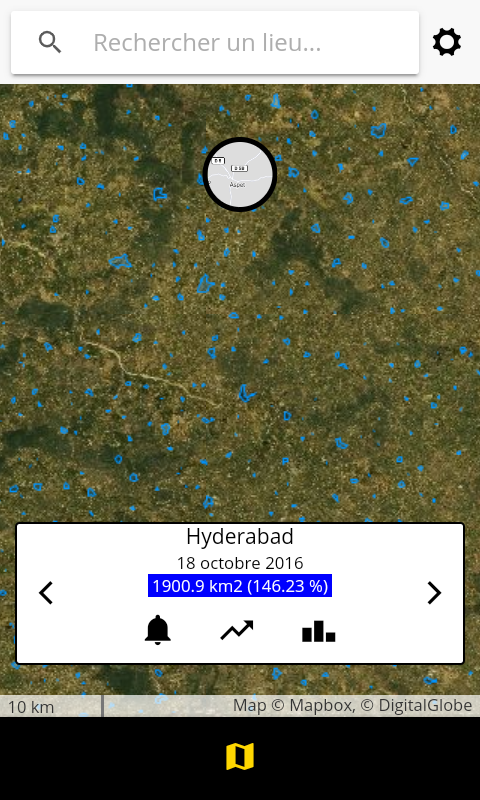
From this automated Sentinel-1 detection, the smartphone application aims at easily providing a domestic or agricultural water shortage alert system based on surface water fluctuation for lay users (figure below).
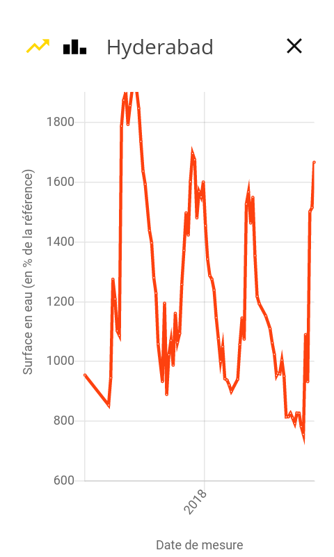
This second version of the App will be enriched over the ROI with surface water volume estimates. It is planned to deploy the surface water detection algorithm over South India.
We’re thankful to Marc Gorman who highly contributed to the obtainment of the ForEarth project and will not have the opportunity to see the outcome.