
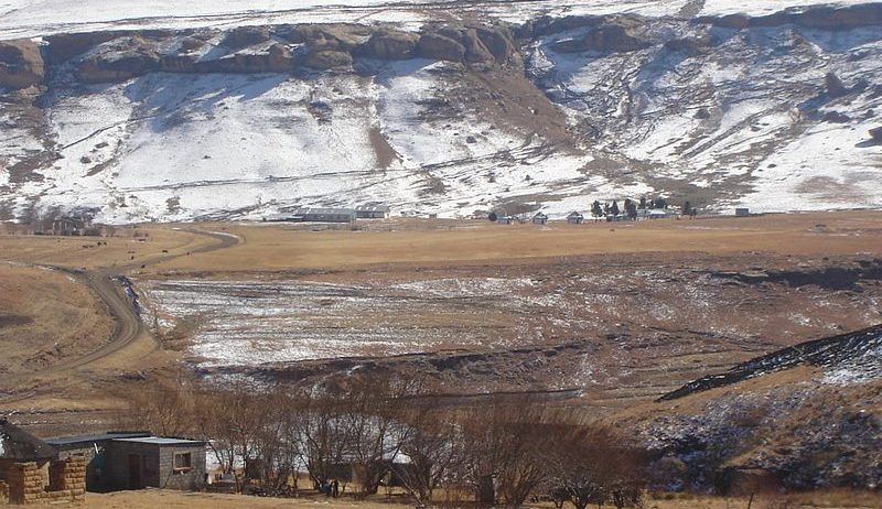
Snow and Fire in the Dragon mountains
NASA’s blog « Image of the Day » recently featured two beautiful MODIS images of the snow cover in Lesotho. In late July Lesotho experienced its heaviest snowfall in two decades. The snow is not uncommon in Lesotho given that over 80% of the country lies above 1800 m. However the frequency of such snow events has been reducing over the past decades due to the ongoing climate change. As a result the shepherds are less accustomed to the snow conditions so that « a severe storm like the one in July 2016 has greater potential to kill sheep and shepherds » [1, 2].
As a snow scientist I’m usually not really busy in August and have no choice but to take vacations… But this prompted me to check Sentinel-2 imagery in the Earth Engine to have a closer look at this remote snow. There are cloud free images on August 05 that can be used to map the snow extent over the whole country.
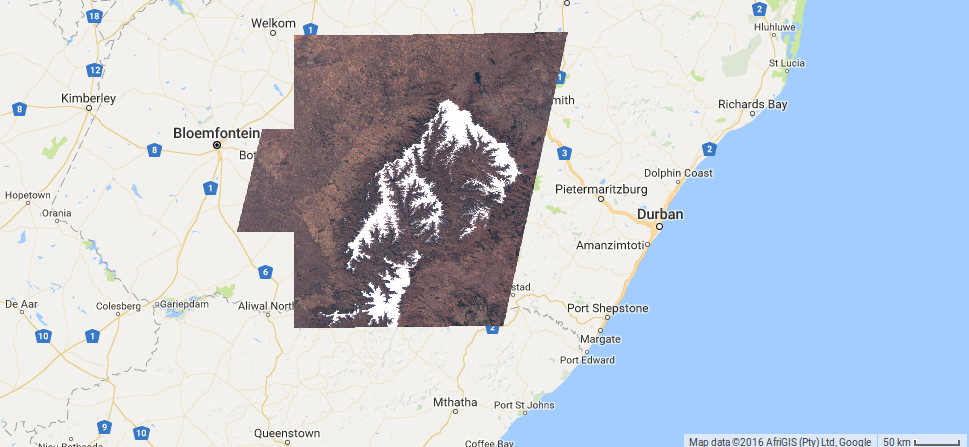
Here I used a threshold in the NDSI (NDSI>0.2) and the red band (red>0.2) to classify the snow pixels. In this particular case it worked quite well although the images are top-of-atmosphere reflectances and a better approach would be to use images that were corrected for atmospheric and slope effects.
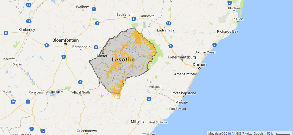
These data indicate that 19% of the Kingdom of Lesotho was still covered by the snow on Aug-05, i.e. 10 days after the the snowfall. There are more Sentinel-2 images that can be used to map the snow extent on the eastern part of the country.
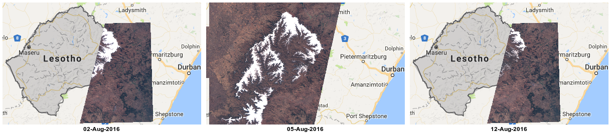
I drew a polygon over the common region covered by the available images to analyze a bit further the evolution of the snow cover.
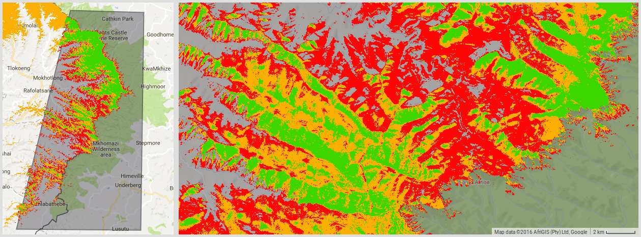
Using the SRTM digital elevation model we can then extract the elevation of the snow pixels in the ROI on every date.
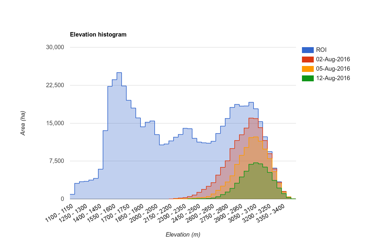
In this area, the snow cover has rapidly shrunk by 33% between Aug 02 and Aug 05 and then by 45% between Aug 05 and Aug 12, preferentially in the lowest elevation bands. Looking more closely at the images, I accidentally noticed these abrupt reflectance changes in the Mkhomazi Wilderness area in South Africa near the border with Lesotho:
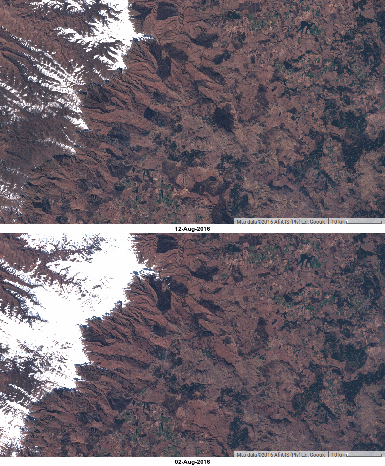
The apparition of dark patches is the result of planned fires. A fire smoke is even visible near the center of the 02-Aug image. According to South Africa’s fire agency « Fires are, and always have been, a part of the South African landscape » and the dry winter months are favorable to prescribed burning in the foothills of the Drakensberg (one picture is worth a thousand words). Sentinel-2 enables to capture fast land changes at high resolution over the globe, which was not possible before. This is relevant for many applications from snow to fire monitoring!
If you’re not afraid of the Mrs-Armitage-on-Wheels Syndrom, the script to reproduce this post in GEE is here: https://code.earthengine.google.com/f53ff695513c3e474908d686834a8a16
[1] « Lesotho Sees Its Heaviest Snowfall in Two Decades : Image of the Day. » 2016. July 27. http://earthobservatory.nasa.gov/IOTD/view.php?id=88509.
[2] Grab, S.W., Linde, J.H. Mapping exposure to snow in a developing African context: implications for human and livestock vulnerability in Lesotho. Nat Hazards 71, 1537–1560 (2014). https://doi.org/10.1007/s11069-013-0964-8

