MUSCATE S2 product versions
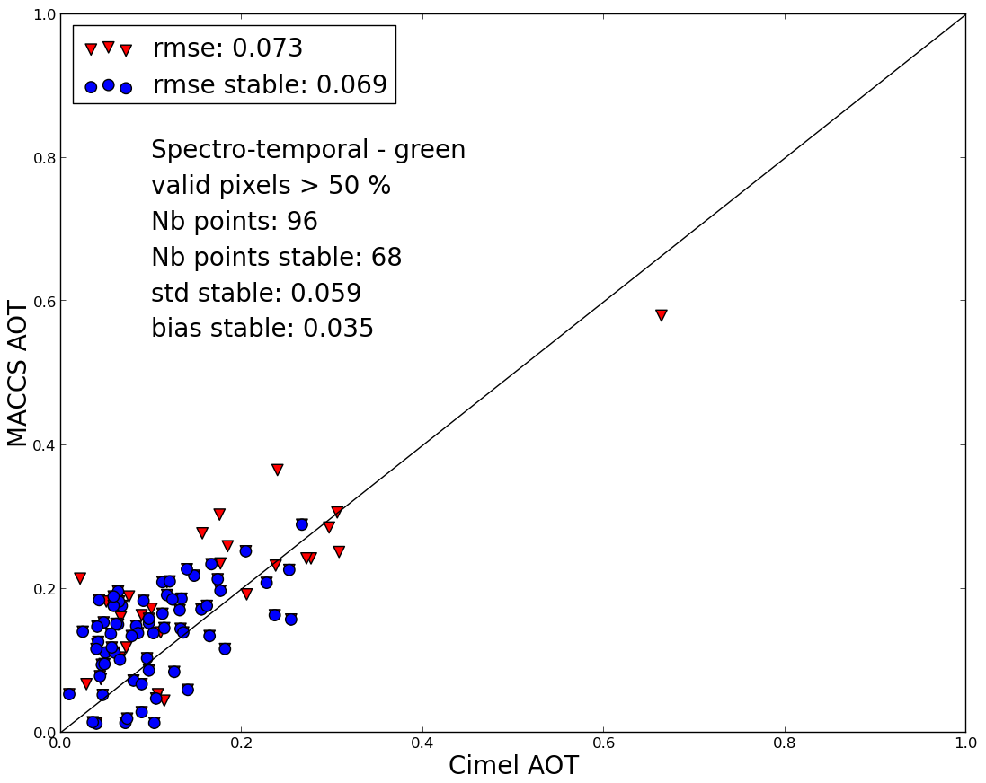
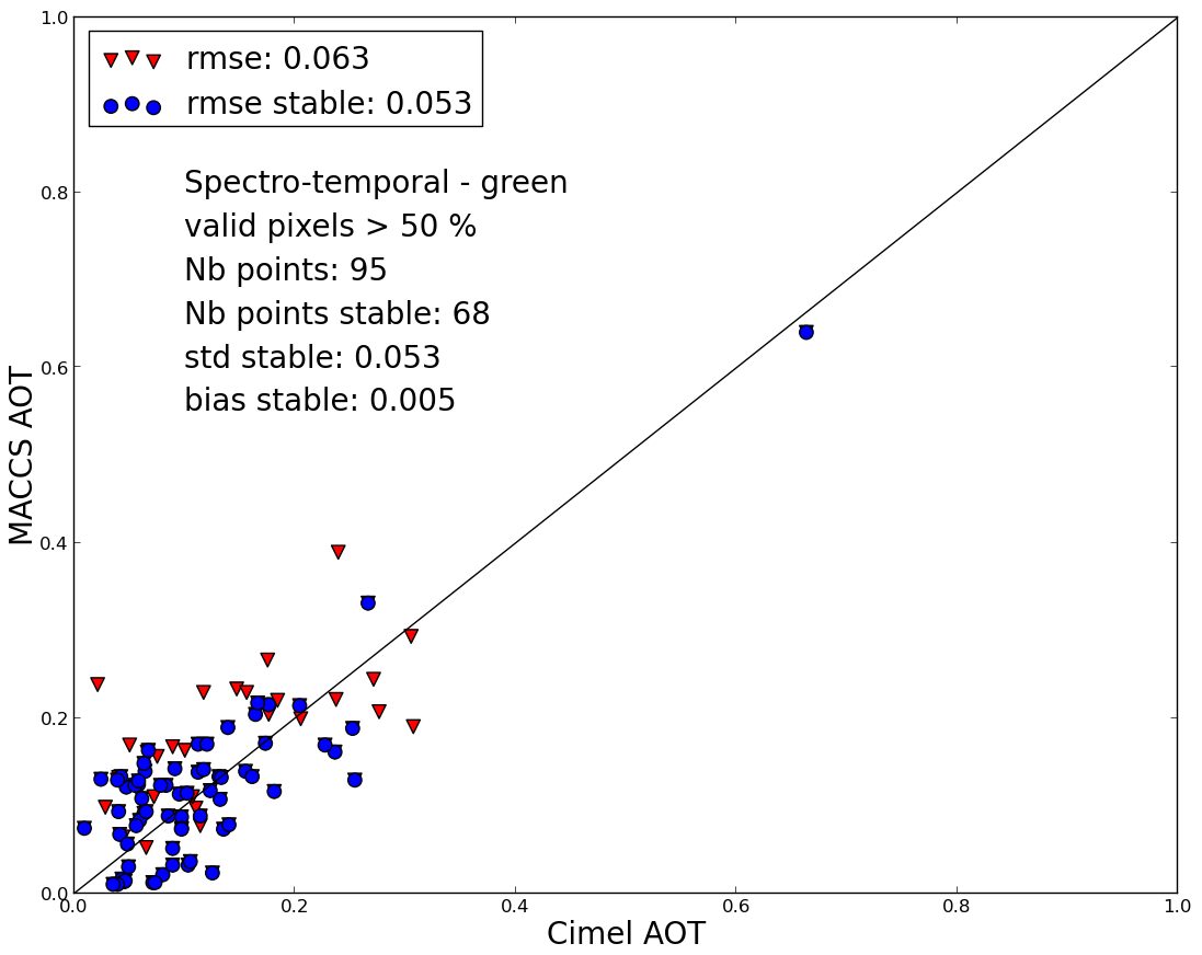
V1_0 was a preliminary processing performed with early version of MACCS adapted to Sentinel-2. It was plagued with a bug in the cloud shadow mask : when more than 255 clouds were present in one image, shadow detection went completely wrong and shadows were detected anywhere. V1_0 was not produced in MUSCATE operationnal context, but in an earlier validation context. Production was available over France only. V1_1 replaces V1_0 over France, Production started mid November, but was only released in February because of many difficulties encountered by MUSCATE. It corrects for the bug related to cloud shadows observed with V1_0, and was fully processed by the operational MUSCATE center. V1_2 was used in another context not related to MUSCATE, you will not find any product with this version number within MUSCATE server. V1_3 was applied starting from February 2017, to data sets produced above Reunion, Burkina, Senegal, Tunisia, Morocco.The aerosol estimate is improved compared to V1_1. Together with Bastien Rouquié, from CESBIO, we worked on the tuning of the blue-red ratio which is used in the multi-spectral method to estimate aerosols (which is combined with a multi-temporal method). Initially, we used bands B2 (Blue) and B4 (Red), with a ratio of 0.45. We found out that better results were obtained with B1 (Blue) and B4 (Red), still with a ratio of 0.45. More accurate studies tend to recommend a higher value, closer to 0.5 As can be seen in the figure below, the estimates obtained with V1_3 are not biased anymore, and have a reduced standard deviation. As a consequence of getting a lower aerosol optical thickness, the surface reflectances of V1_3 products are 2% higher than those of the earlier versions (some user feedbacks from V1_0 said reflectances were sometimes too low).
V1_4 will be provided with a better shadows mask, as it has been found that the shadows masks are too severe and contain too many commission errors. It is in its final stages of validation.