Satellite Stereoscopy for Water Resource Monitoring?
In arid or semi-arid regions, where irrigation is widespread, monitoring agricultural water resources is essential to anticipate shortages. These resources may come from large dams, small reservoirs, or groundwater aquifers.
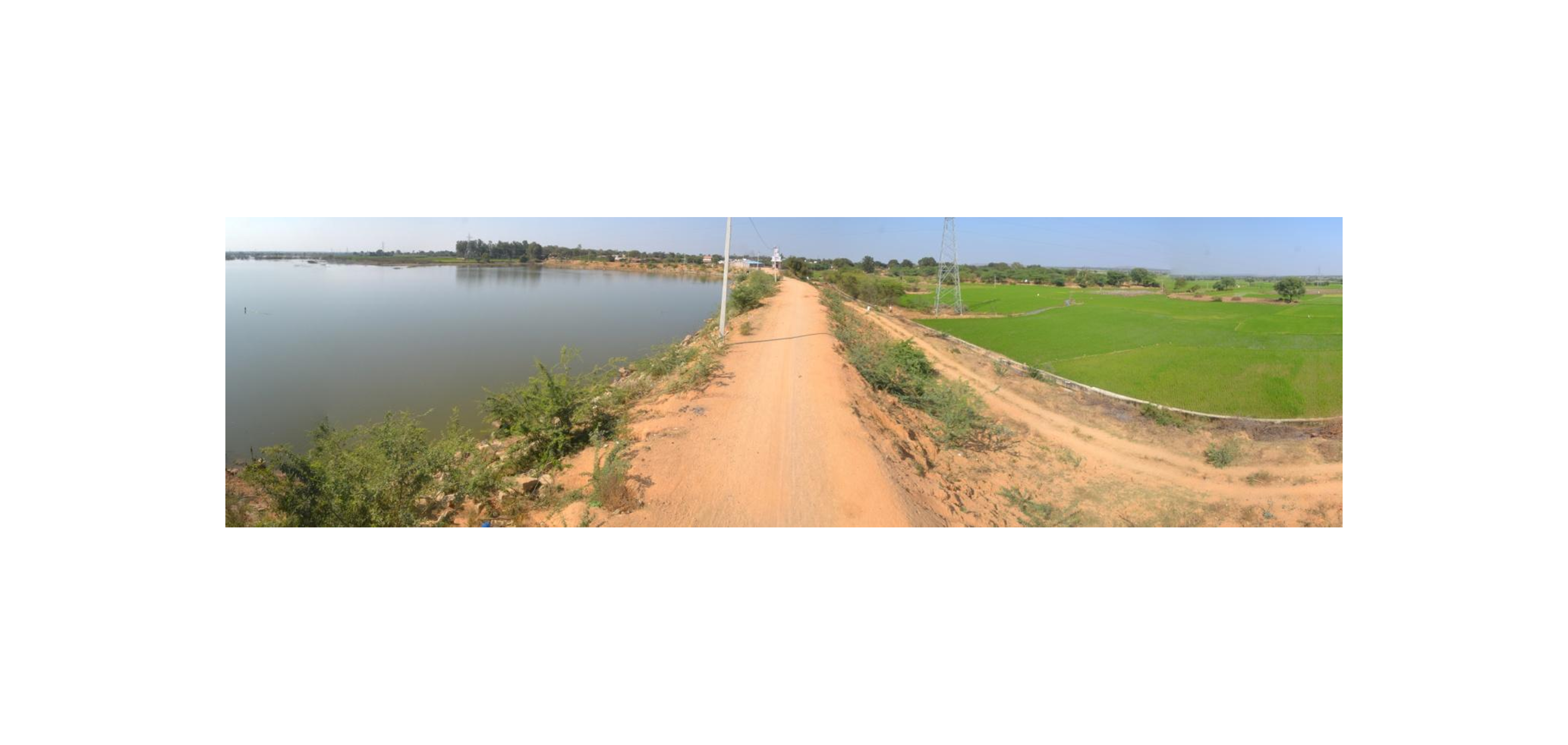
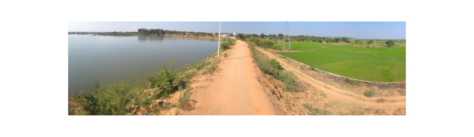
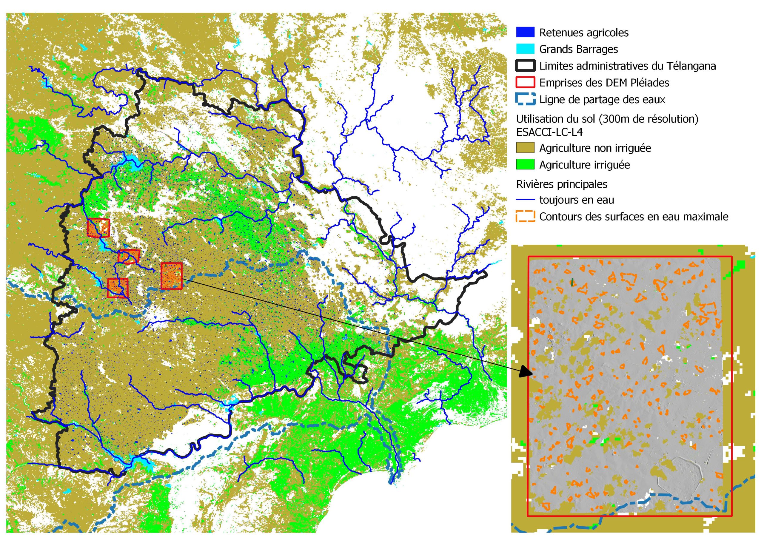
This is the case in the state of Telangana, in South India, where numerous large dams (shown in cyan blue in the figure below) built on rivers in the 1980s have enabled the creation of vast irrigated areas . In upstream areas disconnected from perennial rivers (which flow year-round, shown in dark blue), agriculture relies on groundwater as well as thousands of agricultural reservoirs. These reservoirs form an ancient cascading storage system that captures monsoon runoff, maintaining surface water availability throughout the dry season (a myriad of blue dots in the figure below).
These 20-meter-wide embankment systems create a deep basin a few meters deep over a few hectares (<5-10 ha). They are generally maintained and managed locally at the village level but are not gauged. The arrival of Sentinel-2 nearly ten years ago has enabled the monitoring of regional water surface dynamics in these small agricultural reservoirs.
Estimating volumes behind these surfaces is much more complex. Because they are numerous and small, traditional nadir altimetry used in space hydrology rarely captures these water surfaces. Moreover, recent data from the SWOT mission do not guarantee high elevation accuracy for these small reservoirs.
A recent study conducted as part of Claire Pascal’s PhD at CESBIO, published in PLOS Water, explores an alternative approach. It assesses the reliability of volume estimations at the scale of Telangana state using Sentinel-2 water surfaces, leveraging global Digital Elevation Models (DEMs) such as SRTM, ALOS World 3D e and Copernicus DEM), ou regional models such as CartoDEM.
These volumes were assessed over 1% of the state’s surface using stereoscopic acquisitions from Pléiades satellites. These very high-resolution spatial data (50 cm), acquired through the DINAMIS program, covered areas containing 500 small reservoirs, all of which were dry—these reservoirs empty every 5 to 6 years—allowing their 3D structures to be mapped using satellite stereoscopy.
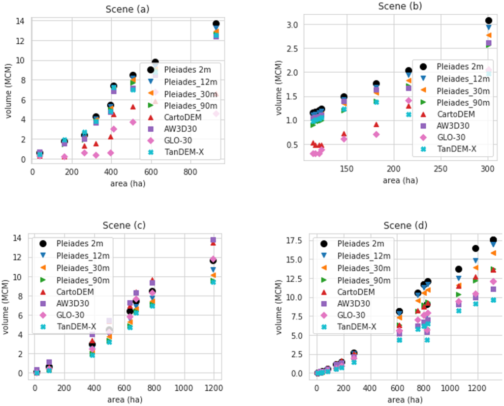
We reconstructed hypsometric relationships for each reservoir, meaning the relationship linking stored volume to the water surface area. Using these relationships and Sentinel-2 water surface dynamics, we reconstructed, during dry seasons (October to May, cloud-free), time series of water volume depletion (in millions of cubic meters) across the 500 reservoirs. This reference dataset was compared to volume estimates derived from global or regional DEMs, as well as an evaluation of the maximum storage capacity of this hydrological system at the regional scale.
This work estimated a maximum storage of 30 mm, which can be compared to the 200 mm capacity reported in the National Register of Large Dams (NRLD).
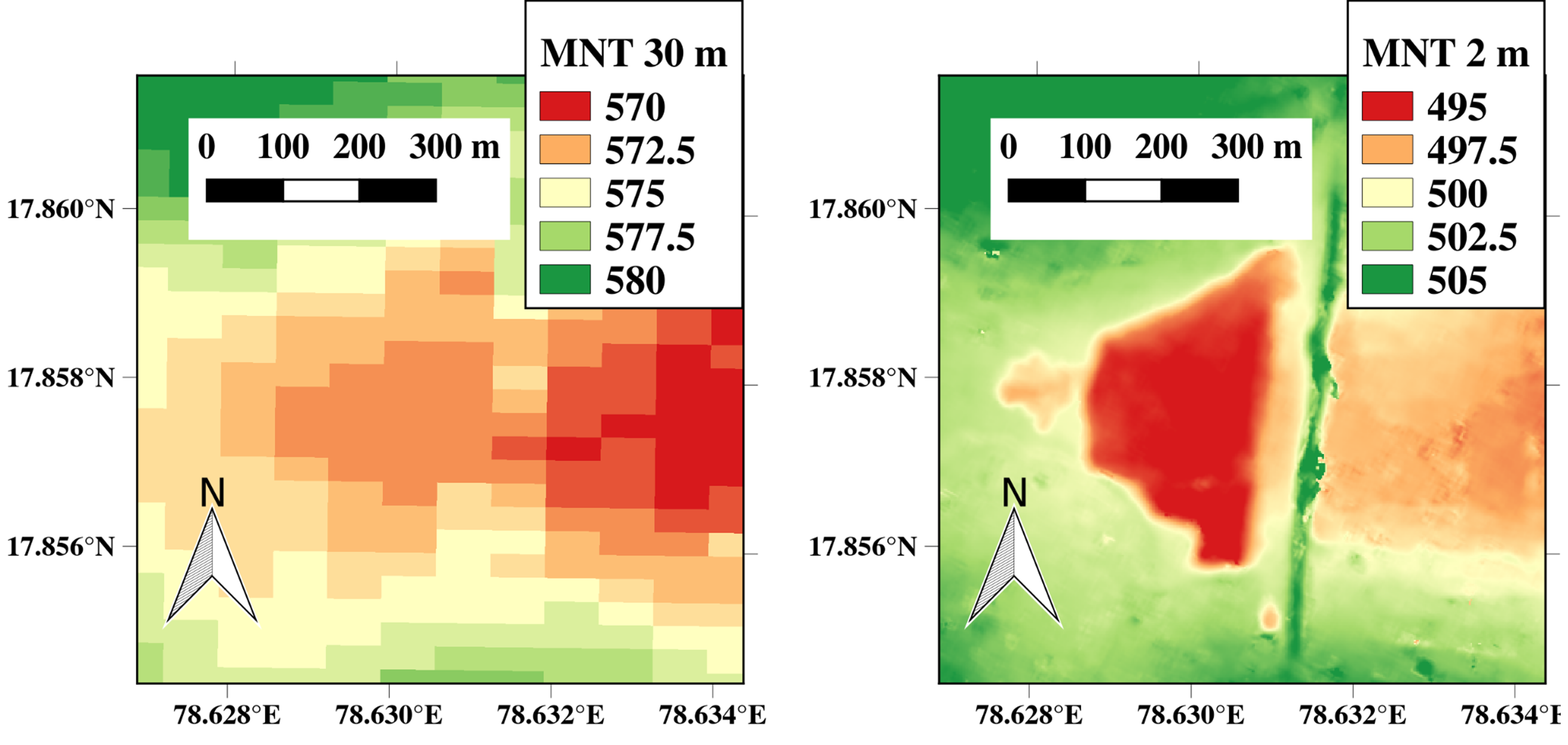
Unsurprisingly, the 30 to 90 m resolution of global and regional DEMs, along with the fact that they may have been generated when the reservoirs were not empty, leads to volume underestimations of 47% to 78% compared to estimates derived from 2 m resolution Pléiades DEMs. Moreover, a simple degradation of the Pléiades DEM resolution from 2 m to 30 m systematically results in a 29% underestimation of volumes.
These errors—expected but now quantified in this agro-hydrological context—can still be useful for correcting filling estimates of this hydro-system, which has never been gauged at a regional scale before, using freely available data.
The study also highlights the strong potential of future very high-resolution stereoscopic missions—such as CO3D, the successor to Pléiades, Pléiades Neo, or the preliminary 4D-Earth project—for monitoring these shallow reservoirs, with expected errors remaining limited (17% for a 12 m resolution DEM).
These errors can, in fact, be lower than the accuracy attributed to water surface elevations derived from SWOT data, when the water surface area of these reservoirs is large enough to be measured. Stereoscopic data enable and will continue to enable the mapping of hydrological systems that are currently unmonitored, provided that acquisitions are made at the right moments—i.e., when the system is empty or nearly empty, which occurs regularly in most semi-arid regions of the world.