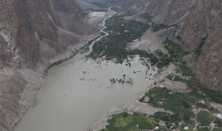
Debris flow in the Ishkoman Valley

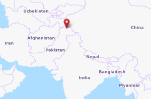
In July 2018, the Pamir Times has reported that a lake formed due to a debris flow in the Ishkoman Valley, Pakistan. This event caused the destruction of dozens of housed in Badswat and Bilhanz villages.

The flood debris running down the slope hit the mountain on the opposite side, and formed a barrier, blocking the gorge through which the Kurumbar River has been flowing for centuries.

Aerial photos show the fresh debris flow deposit and the flooded area (more pictures are available here).

Source: Pamir Times

The development of the lake can be clearly seen from Sentinel-2 imagery.
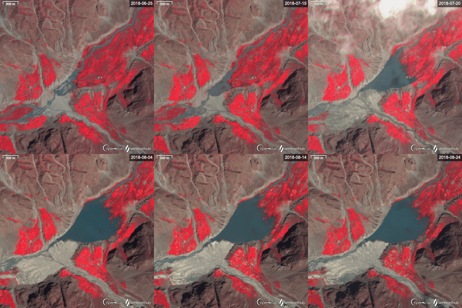
The debris flow originated from the Badswat glacier valley after the snow melt season.
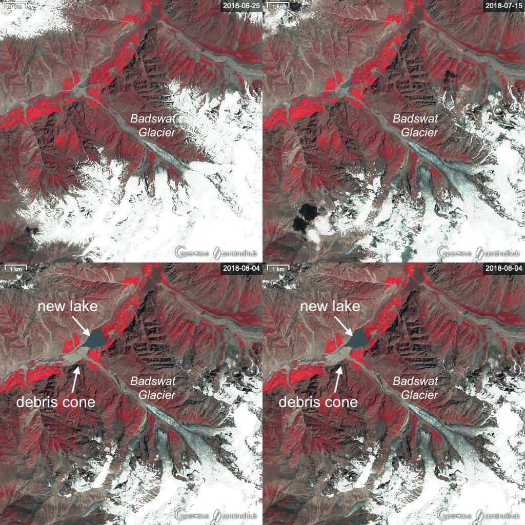
Interestingly a close-up near Blackswat glacier tongue shows that the glacier was undergoing a rapid movement, maybe a surge. It also shows that the debris flow came from the detachment of a proglacial terrain in an adjacent valley (and not from a glacier lake outburst flood near Blackswat glacier as written in local newspapers).
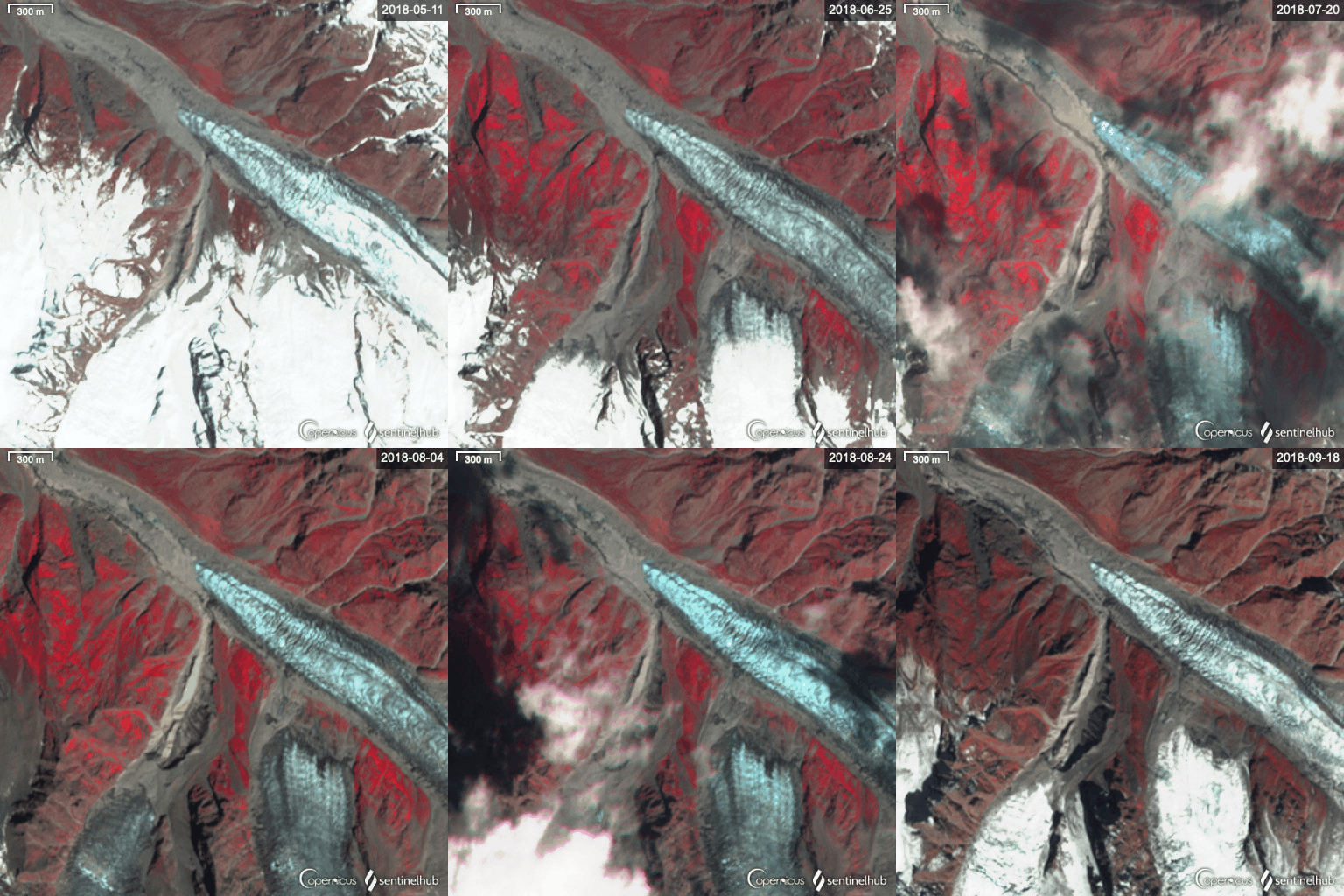
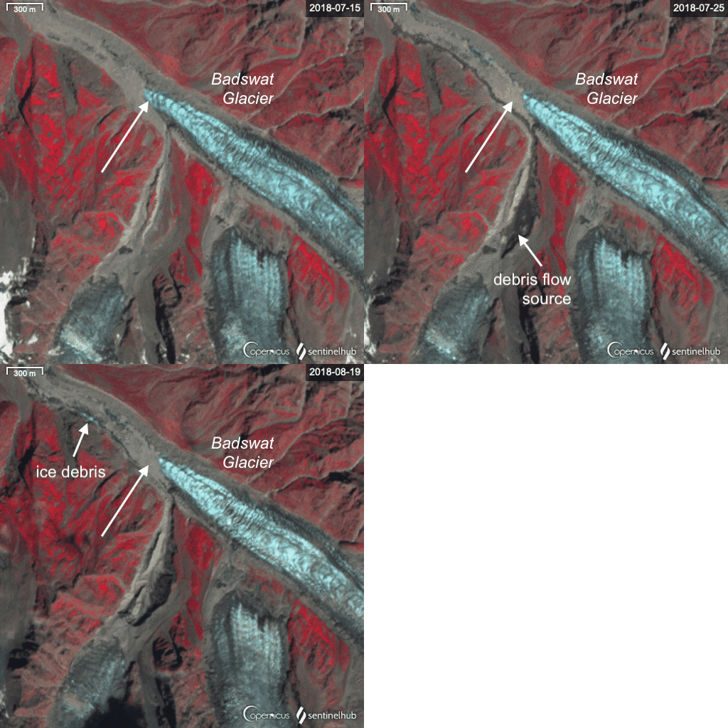
The debris flow pulled off a small fragment of the Bakswat glacier terminus
Glaciers in this region are prone to surging, which can cause the formation of ice-dammed lakes and eventually destructive outburst flood.  To mitigate this risk, the people of this region had deployed a network of beacon fires to warn the settlements in case of glacier lake outburst hazard even in the most remote valleys. This fascinating early warning telecommunication system was described by Iturrizaga (2019).
https://i.redd.it/o7ph1jlze0zx.jpg
The beacons fires of Gondor in the movie « The Lord of the Rings: The Return of the King »

Plus d'actualités

Pléiades © CNES 2026 Distribution Airbus DS

Clear-sky Pléiades acquisition of the Rasuwa landslide source area

After many attempts, CNES’s Pléiades satellites finally captured a clear-sky view of the source area of the devastating flood in Nepal. The stereoscopic acquisition enables the generation of a high-resolution DEM and consequently a geometrically accurate orthorectified image. Although I’m not involved in the scientific analysis, I could not resist taking a closer look at […]

New clear-sky image of the Rasuwa rock-ice avalanche

On 08 Sep 2026, Sentinel-2 acquired a clear-sky image near the release area of the landslide which caused the catastrophic flood in Nepal. Using this image and a pre-event digital elevation model (Berthier 2026) we can analyze the upper part of the avalanche runout profile. The block of rock and ice was released near 5120 […]

How long is the cooling effect of a cloud shadow ?

How long does it take for the cannon barrel to cool down after firing a shell ? Fernand Raynaud => This quote is from a famous old French funny sketch by Fernand Raynaud, which was based on a question in a French manual for soldiers: the sketch is rather long, so I’ll give you the […]

Rechercher