In English

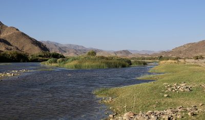
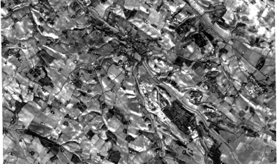
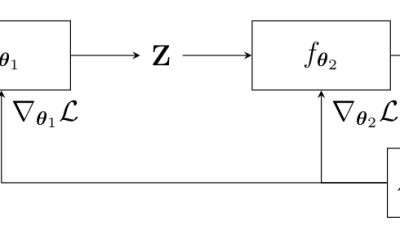
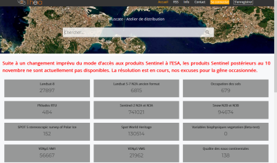
How do we use Remote Sensing data at CESBIO ?

=>  Several data access centres are being renovated at CNES, ESA, and their first versions often lack some of the features we need. Together with colleagues from CESBIO, we have made a presentation of the way we use remote sensing (RS) data: here is a text version of this presentation. Of course, there are as […]

03.04.2024

A sneak peak at the first SWOT hydrology products

SWOT, the Surface Water and Ocean Topography mission was successfully launched more than a year ago (Dec 16, 2022). Hydrologists are eagerly awaiting the release of SWOT products, which will allow them to study for the first time the water levels variations of more than a million lakes and rivers around the globe! A first […]

22.02.2024

Iota2 can also do regression

Iota2 is constantly evolving, as you can check at the gitlab repository. Bugs fix, documentation updates and dependency version upgrade are done regularly. Also, new features are introduced such as the support of Landsat 8 & 9 images, including thermal images, or for what concerns us in this post, the support of regression models. In […]

29.01.2024

End-to-end learning for land cover classification using irregular and unaligned satellite image time series

The results presented here are based on published work : V. Bellet, M. Fauvel, J. Inglada and J. Michel, « End-to-end Learning For Land Cover Classification Using Irregular And Unaligned SITS By Combining Attention-Based Interpolation With Sparse Variational Gaussian Processes, » in IEEE Journal of Selected Topics in Applied Earth Observations and Remote Sensing, doi: 10.1109/JSTARS.2023.3343921. This […]

19.01.2024

THEIA : a tricky transition period caused production delays, but the production resumes

=> Update the 8th of January, 2024 : A new change in the interface from the Copernicus Dataspace on January the 2nd, implemented without prior notice, has caused a new interruption of our downloads, and the real time processing at THEIA, at a moment when no one was available to change things on the our […]

21.12.2023

A new operational method for monitoring oak dieback in the Centre-Val de Loire region

=>  The results presented here are based on work published in the journal paper: F. Mouret, D. Morin, H. Martin, M. Planells and C. Vincent-Barbaroux, « Toward an Operational Monitoring of Oak Dieback With Multispectral Satellite Time Series: A Case Study in Centre-Val De Loire Region of France, » in IEEE Journal of Selected Topics in Applied […]

22.11.2023

Glacier changes in the Lingtren–Khumbutse catchment using Pléiades

The iconic Khumbu Glacier in Nepal is fed by several tributaries, such as this branch in the Lingtren–Khumbutse catchment. Recently a new Pléiades triplet covering the Khumbu region was added into the DINAMIS repository (acquisition date 22 Oct 2023). There is another triplet in the same area acquired on 11 Mar 2016 hence we can […]

13.11.2023

The pros and cons of systematic global processing

=>  As the resolution of our satellite missions improve, the data volume of output products increases, and the share of the computing and storage costs of its products increases too. Let’s assume we are preparing a new satellite mission, for instance a Sentinel-like mission, with the hope of potential use by operational or private users, […]

04.10.2023

Test of spatio-temporal fusion of Sentinel-2 New Generation data with a potential VHR mission

Three years ago, we started the phase-0 study of a mission named Sentinel-HR : S-HR would be a satellite mission to complement Sentinel-2 new generation (S2-NG) with In that study, one of our assumptions was that a lower revisit frequency than that of Sentinel-2 was sufficient. This seems possible because, in most cases, the high frequency […]

28.09.2023

Rechercher