In English

EEA 34 countries and corresponding Sentinel-2 tiles

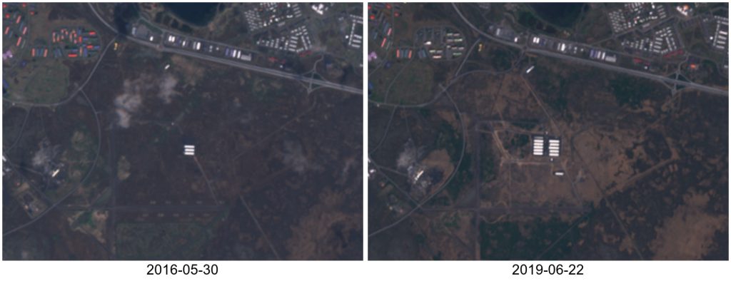
MAJA and LIS selected for the next Pan European high resolution snow and ice monitoring service

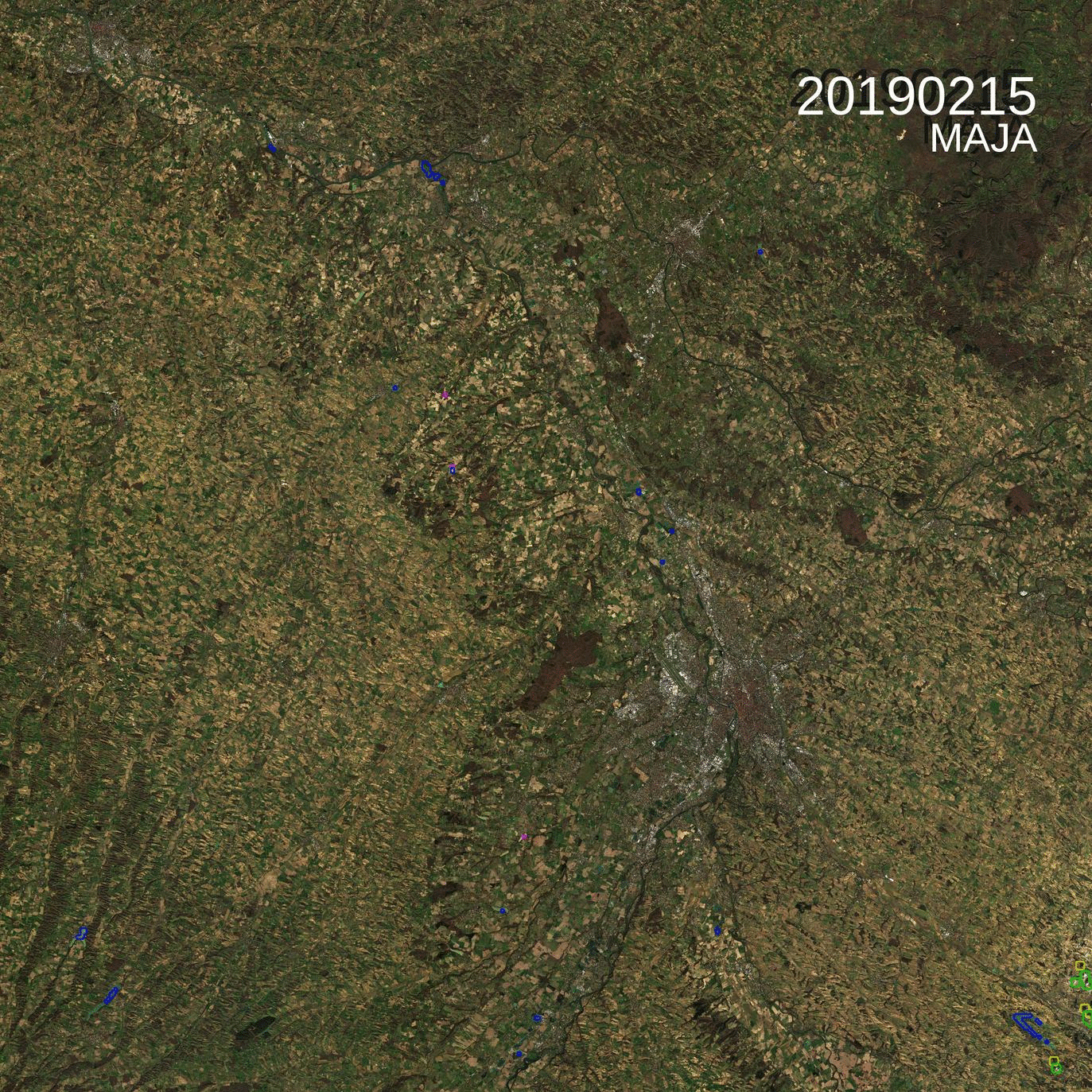
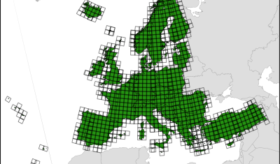
The European Environment Agency (EEA) has selected a consortium led by Magellium to implement the next Pan European high resolution snow and ice monitoring of the Copernicus Land Monitoring Service. This future service aims to monitor three variables at 20 m resolution over the tiles displayed above: All products should be generated from atmospherically corrected […]

27.06.2019

Sentinel-2 captures new data centers in Iceland

In a remote sensing study published in Nature, the authors claimed that they used « 101 CPU-core years of computation (..) within the Google data centres ». This made me wonder what could be the carbon footprint of such a study?. I estimated that it should be 65 tonnes of carbon dioxide, but a Google engineer replied: […]

23.06.2019

Detecting geolocation errors in glacier outlines with Sentinel-2 snow cover duration maps

Two years ago I posted an animation of the snow cover area evolution near Zermatt, Switzerland from Sentinel-2 L2A data processed by LIS. From this time series of snow maps I generated a snow cover duration map and then I added the glacier outlines from the Randolph Glacier Inventory 5.0. I was satisfied by the […]

19.06.2019

More than 1000 downloads of MAJA atmospheric correction software

=> We started distributing MAJA as a free software in July 2017, less than 2 years ago, and it already reached 1000 downloads (1043, as a mater of fact).  MAJA was in fact downloaded twice per working day, and in the very last weeks, we had about 4 downloads a day ! Of course it […]

10.06.2019

Near real time detection of deforestation in French Guiana

Marie Ballère started in October 2018 a Ph.D. funded by WWF and CNES. The aim of her Ph.D. is to characterize animal habitats in tropical forest using radar and optical data. The first results on near real time forest disturbances assessment using radar Sentinel-1 data in French Guiana were shown at the ESA Living Planet […]

21.05.2019

Combined exploitation of VENμS, Sentinel-2 and Landsat-8: the spectral bands

=> The combined use of VENμS, Sentinel-2 and Landsat-8 data can increase the likelihood of obtaining cloud-free images or may allow detailed tracking of rapidly evolving phenomena. In order to facilitate this combination, the table below summarizes the correspondences between the spectral bands of the instruments. VENμS does not have a spectral band in the […]

09.05.2019

MAJA 3.3 is available, with a LOT of improvements

What’s new ? Pfew ! It has been quite long, but MAJA 3.3 is available, and it improves a LOT of things ! Moreover, when we validated the results, we figured out that one of the parameters in our settings had a wrong value (10 instead of 1). It is easy to make such errors, […]

08.05.2019

VENμS: there is still snow in the Pyrenees

From Mont Valier to la Roca Foradada, on April 30 (left) and May 6th, 2019(right)   3D View : download KMZ files for KMZ pour Google Earth :April 30, 2019May 6 2019

07.05.2019

Spot the odd one out

=> There is an odd image in this time series of L2A products of the 31TCJ Sentinel-2 tile (Toulouse region). Can you guess which one ? Yes it is the last one, acquired on the 26th of February. But what’s odd with it ?

22.04.2019

Rechercher