Applications

Multitemporal snow metrics from Sentinel-2

Our let-it-snow (LIS) processor computes the extent of the snow cover from Sentinel-2 surface reflectance (level 2 products). However, it can also compute multi-temporal composites (level 3 products) such as the snow cover duration, snow onset and snow melt out date from a time series of snow cover maps with a cloud mask. Aurore Dupuis […]

20.07.2022

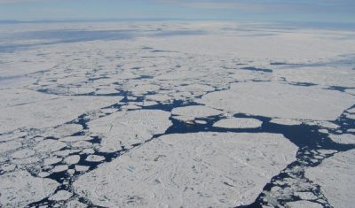
Sensing wave patterns in sea ice with Sentinel-2

Collard et al. (2022) have shown that Sentinel-2 can be used to estimate the wave spectrum in the presence sea ice. The waves tilt the sea ice surface and therefore modulate the reflected radiation that is received by Sentinel-2 sensor. The wave spectrum extracted from the image can even be used to invert the wave […]

15.07.2022

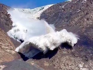
Kyrgyzstan viral avalanche. First views of the glacier scar using Pléiades images

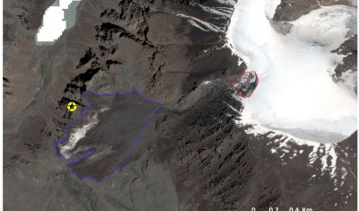
Last week, Simon Gascoin and I spent quite some time working on the Marmolada event. Just a week-end to rest and Twitter reminded us Monday morning that this summer 2022 was special for glaciers. Not only are they out of balance with the climate and will probably suffer one of their most negative mass balance […]

12.07.2022

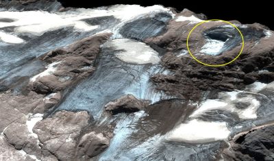
Estimation of Marmolada glacier collapse volume using Pléiades imagery

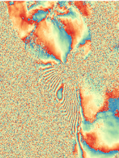
The deadly Marmolada glacier collapse happened on 3 July 2022. On 6 July 2022, Pléiades 1B (CNES, Airbus DS)  acquired a clear-sky stereo pair of the area. From these images we could estimate a detached volume of ice of 65’000 ± 10’000 cubic meters. First, we generated a digital elevation model (DEM) from Pléiades stereo […]

07.07.2022

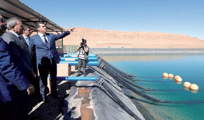
Les bassines de Boudnib

Alors que les bassines se développent en France pour stocker l’eau en particulier en Pays de la Loire, elles sont aussi utilisées au Maroc dans un environnement bien plus aride. Dans la région désertique entre Errachidia et Boudnib, près de la frontière algérienne, l’apparition de ces piscines géantes a transformé le paysage. L’eau est prélevée […]

18.05.2022

Towards 3D time series

=>  In our a priori definition of Sentinel-HR mission, we had included an option to observe the 3D topography at a high resolution, with a moderate accuracy ambition (lower than that offered by the  CO3D satellite, as shown in the table below), but globally and with a systematic revisit. But our mission advisory group insisted, […]

09.04.2022

Du relief pour nos séries temporelles

 => Dans notre définition initiale de la mission Sentinel-HR, nous avions inclus une option permettant d’observer le relief à haute résolution, avec un objectif de précision modéré (inférieur à celui offert par CO3D, comme le montre le tableau ci-dessous), mais avec une revisite systématique et sur le monde entier. Devant l’intérêt des membres de notre […]

Watching snow melt at 10 minute intervals from satellite

This is something new to me… The Geostationary Operational Environmental Satellites (GOES) capture images every 10 minutes at 1 km resolution over America… Such imagery makes it possible to watch the quick melt of a thin snow cover over the US Great Plains during a single day. Sub-daily monitoring of the snow cover at such […]

17.03.2022

Lowest snow cover area in the Alps since 2001

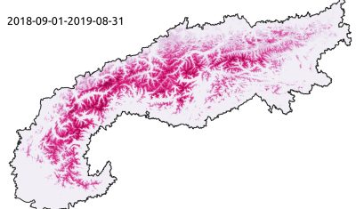
On March 2nd, the snow cover area in the Alps has reached its lowest value since 2001. Only 43% of the alpine range was covered by snow (about 82’000 square kilometers), whereas the average is 63% on the same day over the period 2001-2021. The deficit in the number of snow covered days (map below, […]

05.03.2022

Rechercher