En Français

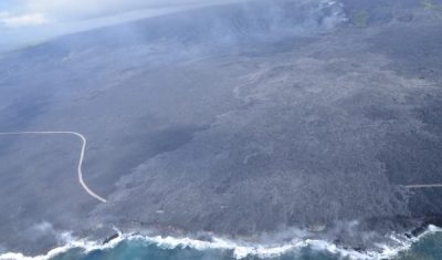
Sentinel-2 et Landsat-8 font équipe pour suivre la coulée de lave du volcan Kilauea

=> Le volcan Kilauea à Hawaï est un des plus actifs au monde. Cela fait déjà plus de trente ans qu’il est entré en éruption, mais il a fait les gros titres récemment car ses coulées ont atteint l’océan Pacifique, agrandissant le territoire hawaïen de deux hectares d’un coup ! Voilà une technique efficace pour […]

Applications

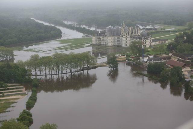
Chambord flooding: An update to « Mapping flooded areas using Sentinel-1 in Google Earth Engine » from Simon

Short after working with Simon on the script for the  article about the mapping of flooded areas, I wanted to be sure that our short script was realistic. I had some time to loose at the airport, so, after finding a wifi connection, I looked for pictures of the flooded areas of the north of […]

In English

Sentinel-2A and Landsat-8 team up to track Kilauea Volcano’s lava flow

=> Kilauea Volcano in the largest active volcano in Hawaii and one of the most active on Earth. It has been erupting for over 30 years now but hit the headlines recently because a large lava flow traveled up to the ocean, adding 2 brand new hectares to the Hawaiian Islands.

Non classé

Formosat-2 de-commissionned

=> It is with a deep nostalgia that I learned that Formosat-2 has just been decommissionned, after some of its components broke down after 12 years of acquisitions (nominal life extended by 8 years !). When the satellite was launched, we were searching for data sets that would allow us simulate the features of VENµS satellite (which […]

En Français

La fin de l’exploitation de Formosat-2

=>C’est avec nostalgie que je vous fais part de la fin d’exploitation du satellite Formosat 2, dont un certain nombre de composants sont tombés en panne récemment, après 12 ans de fonctionnement (8 de plus que prévu). Au moment de son lancement, nous cherchions des données nous permettant de simuler les caractéristiques du satellite VENµS (prévu pour […]

In English

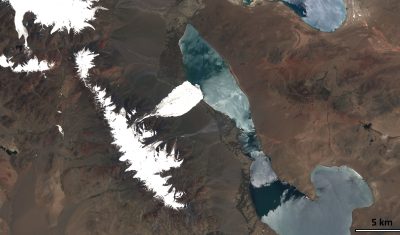
Sentinel-2A (and Landsat-8) capture a giant ice avalanche in Tibet

After reading my previous post about the Rutog ice avalanche, my distinguished colleagues Antoine R. and Olivier H. challenged me to look for a pre-event image to better highlight the avalanche area. The closest clear-sky image that I could find is a Landsat-8 image that was acquired on June 24 (23 days before the slide).

In English

Sentinel-2A captures a giant ice avalanche in Tibet

The Nature News website reported yesterday on a massive ice avalanche that happened in Rutog, Tibet, on 17 July 2016. This ice avalanche killed 9 people and may be one the largest ever observed. The ice and rock mixture spread over 6 km from the collapse point up to the Aru Co lake shoreline.

En Français

Les séries temporelles de Sentinel-2 sont bien lisses !

=> Dans un précédent billet, j’ai montré un exemple de série temporelle obtenu sur un pixel de forêt de pins, qui met en valeur la bonne qualité des séries temporelles que l’on obtient avec les données Sentinel-2, traitées au niveau 2A par THEIA en utilisant la chaîne MACCS. (les données de niveau 2A sont corrigées […]

In English

TOMCAR-Sat : Remote Sensing on the Yenisei river!

Since October 2015, the TOMCAR-Sat project aims to use high resolution satellite products to monitor Dissolved Organic Carbon (DOC) fluxes on the Arctic river Yenisei. Specifically, its objectives consist to calibrate a DOC retrieval model from time-series of satellite images and to characterize dynamics of the factors that may affect DOC concentrations, i.e. the snow […]