Wildfires in California spotted by Sentinel-2A
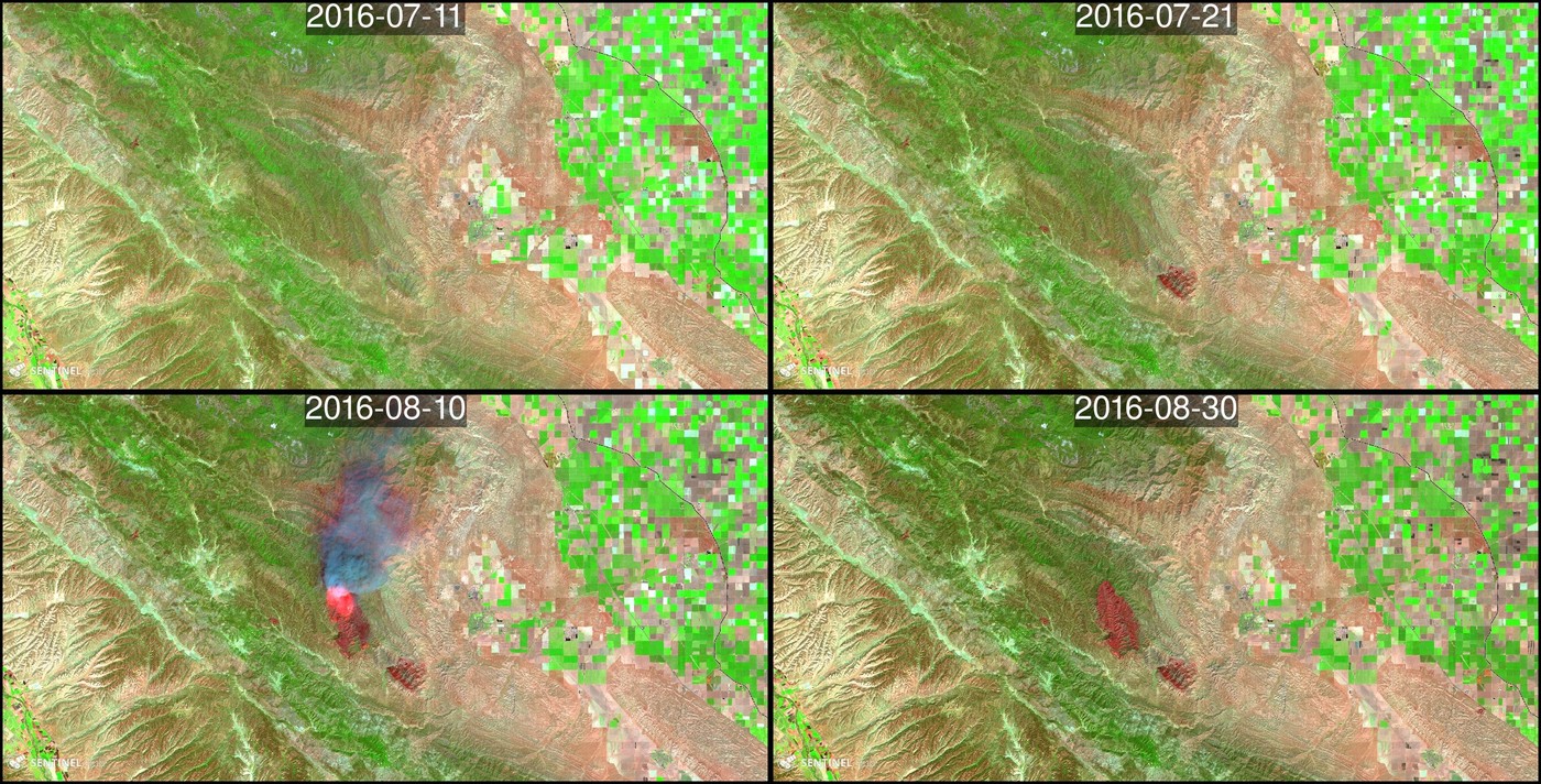
Wildfires were raging in California this summer. Let’s see if we can spot some of them in Sentinel-2A images with the new Sentinel-Playground by Sinergise. The combination of the SWIR and NIR bands of Sentinel-2 or Landsat enables to produce accurate maps of burnt areas. The SWIR band is sensitive to the water content in the soil and vegetation, while the NIR band is sensitive to the vegetation health (photosynthetic activity). In addition, the radiance measured by a spaceborne sensor in the SWIR wavelengths increases if the surface is very hot (as taught us Prof. Planck in Hawaïï). As a result, a simple color composite of bands SWIR/NIR/Red gives a stunning view of burnt areas and can highlight ongoing fire areas if the smoke is not too opaque. In Coalinga, the Mineral Fire burnt nearly 3000 ha close to the city of Coalinga.
Near Lake Nacimiento, Chimney Fire [1] has burnt over 18’000 ha in August.
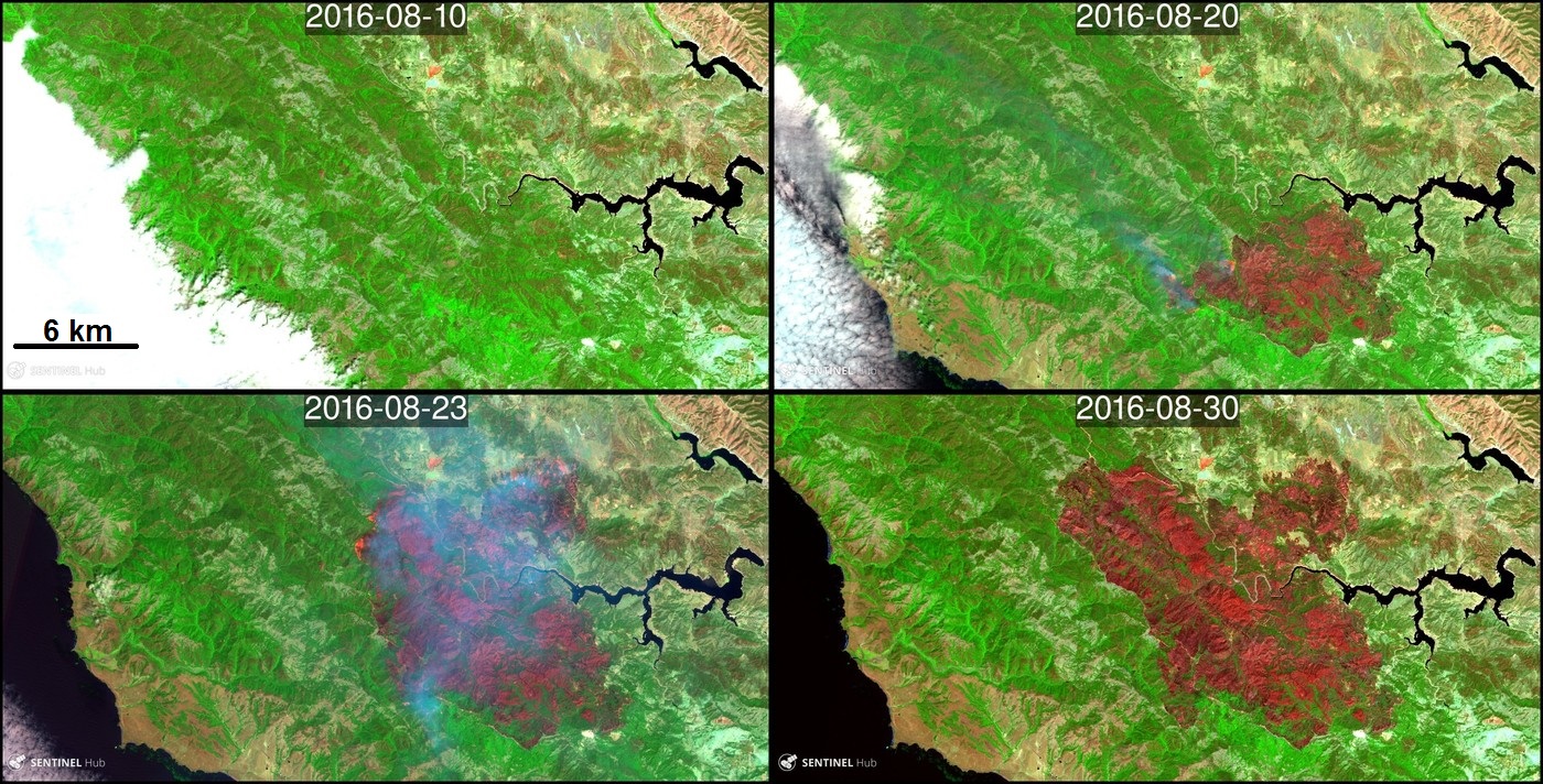
What I really like with Sentinel-Playground is that you can easily share the view that you selected via its URL. For example, here is the Chimney fire aftermath. You can explore by yourself the region and maybe spot other wildfires. You can check this updated status map of the 2016 wildfires in California to verify if you guessed right. [1] Chimney Fire is not necessarily … a chimney fire! It is a wildfire that started at Chimney Rock road, south of Lake Nacimiento. The cause of the fire remains under investigation. Do you wonder how wildfires get their names in the USA? Read here.