En Français

Rupture du barrage de Kakhovka : que nous montrent les satellites ?

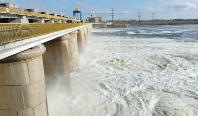
La rupture du barrage de Kakhovka au sud de l’Ukraine a eu lieu tôt le matin du 6 juin 2023. L’évolution de la hauteur d’eau du lac mesurée par altimétrie satellite est disponible sur Hydroweb. On peut constater que le niveau du lac est passé de 13,80 m le 8 juin à 08:18 à 11,86 […]

3D

Découvrir les structures cachées du paysage grâce au lidar

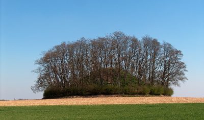
Le lidar est magique ! Cette technologie permet de mesurer très précisément l’altitude du sol y compris sous la végétation. Voici un exemple qui montre des sentiers cachés dans une forêt du Jura :   L’image en teintes de gris est un « hillshade » c’est-à-dire un ombrage du relief. Ce relief est issu du RGE ALTI […]

Image quality

A new article on the validation of MAJA’s Sentinel-2 surface reflectances

Whether you are a user of the atmospheric correction processor MAJA or THEIA’s Sentinel-2 Level 2 products, you will probably be interested to read our new article on the validation of MAJA Sentinel-2 surface reflectances. The article is published in open access in Remote Sensing : Colin, J.; Hagolle, O.; Landier, L.; Coustance, S.; Kettig, […]

Data Terra

Protégé : Un nouveau domaine scientifique : la comitologie

Il n’y a pas d’extrait, car cette publication est protégée.

3D

Artificial snow accumulation detected from space

People often ask if we can detect artificial snow in satellite images. It’s not so easy except when the surrounding slopes are totally snow-free… But recently, I noticed some anomalous snow accumulations patterns in a satellite-derived map of the snow depth near Super Barèges ski resort (Pyrenees). This map was computed at 2 m resolution […]

En Français

Geodes, the next generation access platform for CNES EO data.

=> Context In 2021, CNES decided to implement a service hub for the dissemination of Earth Observation (EO) satellite data. Integrated in a national and European ecosystem, in the framework of Data Terra and at the service of scientific communities and CNES projects, the GeoDataHub project (GDH, which has more recently been renamed Geodes) will […]

En Français

Ceci était ma dernière revue pour MDPI Remote Sensing, et voici pourquoi

=> Récemment, j’ai accepté de relire le papier suivant, qui est maintenant publié en ligne : Ce papier avait trois relecteurs. J’ai choisi de faire une relecture signée et publique, et le rapport du premier tour de revue est accessible ici. Comme vous pouvez le voir, j’avais beaucoup à dire sur ce papier, qui à […]

In English

This was my last review for MDPI Remote Sensing, and here is why

=> Recently, I agreed to review the following paper, which is now online: https://www.mdpi.com/2072-4292/15/7/1827 The paper had 3 reviewers. I opted for signed, public review so you can find my review for the first round here. As you can see, I had quite a lot to say about this paper, which to my opinion required […]

En Français

The Million : The MUSCATE data center at CNES already delivers one million products

=> The Million ! If you sum up the numbers of products distributed by CNES for THEIA, you can see that our center is now distributing more than one million products (1,000,000!). Readers who follow this blog may remember our initial struggles related to the production, after which we celebrated 10,000 (in April 2017) or […]