Applications

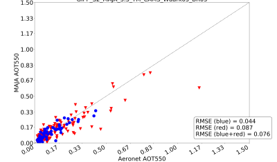
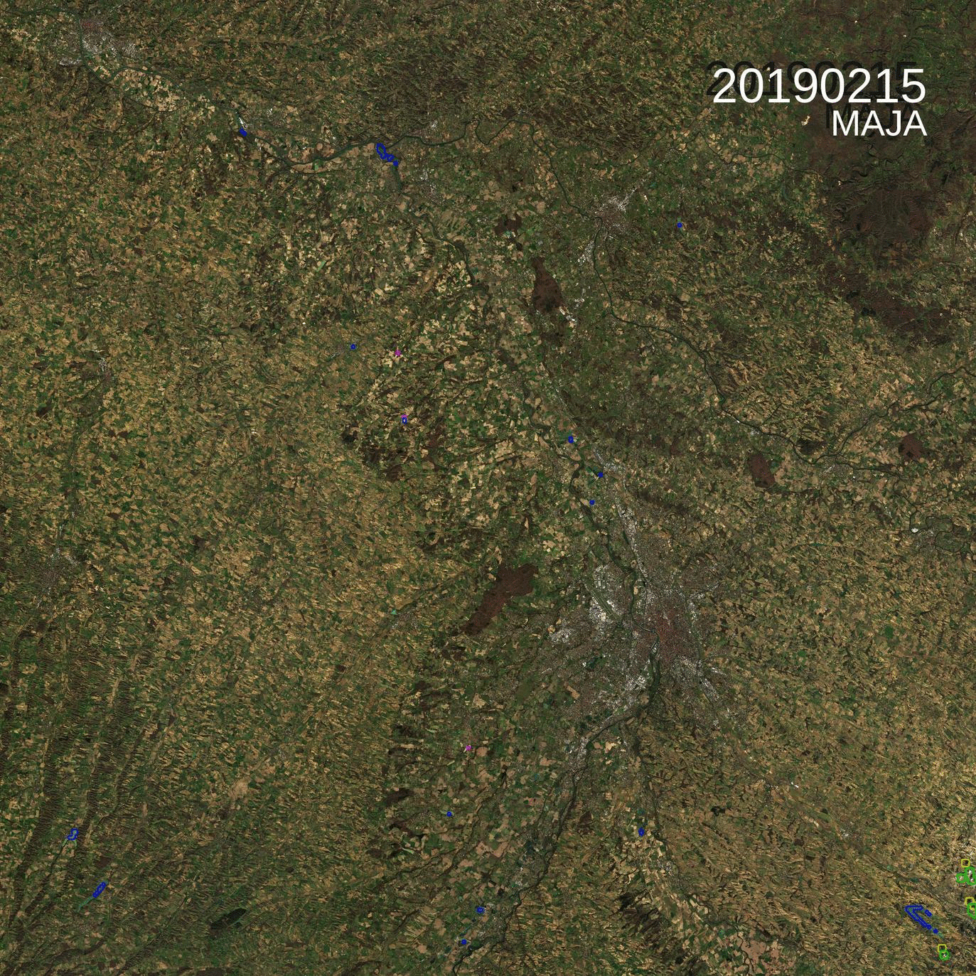
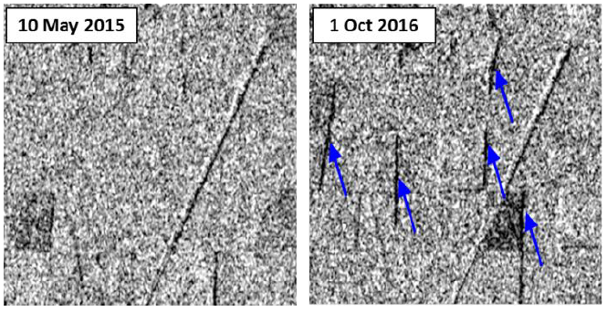
Near real time detection of deforestation in French Guiana

Marie Ballère started in October 2018 a Ph.D. funded by WWF and CNES. The aim of her Ph.D. is to characterize animal habitats in tropical forest using radar and optical data. The first results on near real time forest disturbances assessment using radar Sentinel-1 data in French Guiana were shown at the ESA Living Planet […]

CESBIO

Combined exploitation of VENμS, Sentinel-2 and Landsat-8: the spectral bands

=> The combined use of VENμS, Sentinel-2 and Landsat-8 data can increase the likelihood of obtaining cloud-free images or may allow detailed tracking of rapidly evolving phenomena. In order to facilitate this combination, the table below summarizes the correspondences between the spectral bands of the instruments. VENμS does not have a spectral band in the […]

CESBIO

Exploitation combinée de VENµS, Sentinel-2 and Landsat-8 : les bandes spectrales

=>L’utilisation combinée des données de VENµS, Sentinel-2 et Landsat-8 peut permettre d’augmenter la probabilité d’obtenir des images sans nuage ou de suivre de manière détaillée des phénomènes à évolution rapide.Afin de faciliter cette combinaison, le tableau ci-dessous présente de manière résumée les correspondances entre les bandes spectrales des instruments. VENµS ne comporte pas de bande […]

In English

MAJA 3.3 is available, with a LOT of improvements

What’s new ? Pfew ! It has been quite long, but MAJA 3.3 is available, and it improves a LOT of things ! Moreover, when we validated the results, we figured out that one of the parameters in our settings had a wrong value (10 instead of 1). It is easy to make such errors, […]

CESBIO

VENμS: there is still snow in the Pyrenees

From Mont Valier to la Roca Foradada, on April 30 (left) and May 6th, 2019(right)   3D View : download KMZ files for KMZ pour Google Earth :April 30, 2019May 6 2019

En Français

VENµS : il reste de la neige dans les Pyrénées

Du Mont Valier à la Roca Foradada, le 30 avril  (à gauche) et le 6 mai 2019 (à droite)   Visualisation 3D Télécharger un fichier KMZ pour Google Earth :30 avril 20196 mai 2019

snow-ice

Geomystery near Mount Everest

I noted a curious dark trace on the steep slope below South Col between Mount Everest and Lhotse in this 3D view of a Sentinel-2 image (2019 Mar 29)…

In English

Spot the odd one out

=> There is an odd image in this time series of L2A products of the 31TCJ Sentinel-2 tile (Toulouse region). Can you guess which one ? Yes it is the last one, acquired on the 26th of February. But what’s odd with it ?

En Français

Trouvez l’intrus

=>Parmi cette série temporelle d’images de niveau 2A de la tuile 31TCJ (Toulouse), il y a une intruse. Saurez vous déviner laquelle ? Oui, c’est la dernière,, acquise le 26 Février. Mais qu’a t’elle de spécial ?