5000+ L2A Sentinel-2A products released on Theia server
![]() =>
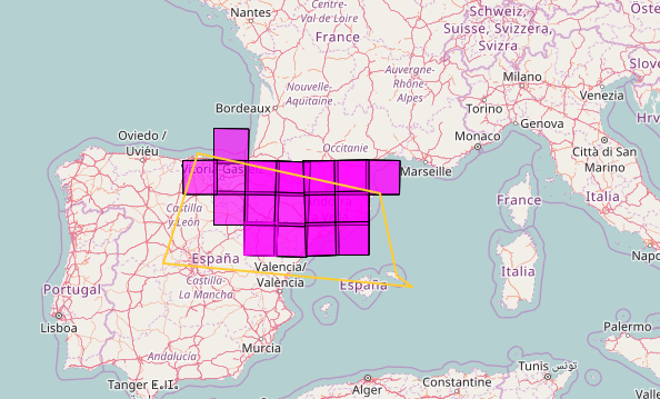
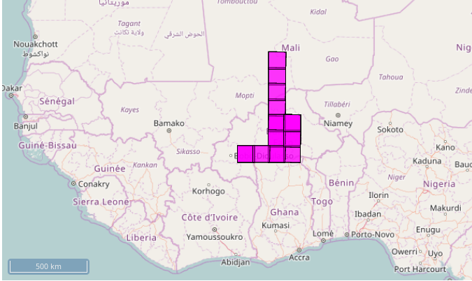
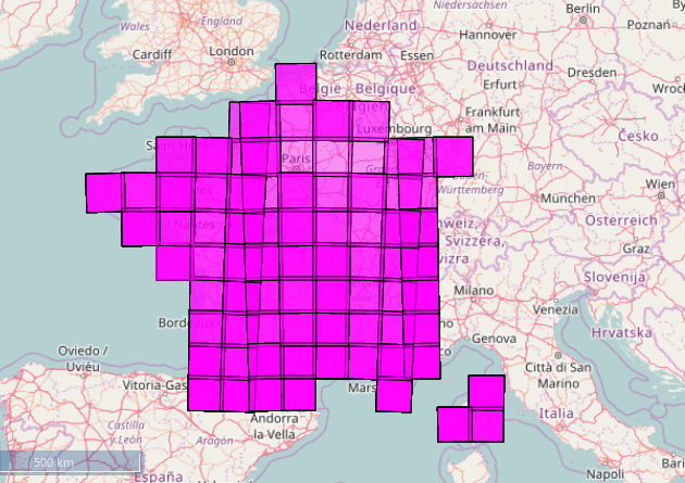
=> ![]() 🙂 🙂 🙂 After having repeated month after month » sorry, our L2A product production is late again for this ou that reason » in this blog, on the phone, during meetings, via email or on social networks, you can’t imagine my pleasure to announce that CNES just released large time series of Sentinel-2A L2A data, over France, Reunion Island, North of Spain, Belgium, Luxembourg, and on some large sites in Burkina Faso, Mali, Ethiopia, and Tunisia. We process one whole year of data from December 1st 2015 to December 1st 2016. More than 5000 tiles where just released. Processing over Tunisia goes on and Morocco and Senegal are next on the list. Then, we will process Madagascar, and the all the zones displayed here. The data were processed using the MACCS processor.Data are available here :
🙂 🙂 🙂 After having repeated month after month » sorry, our L2A product production is late again for this ou that reason » in this blog, on the phone, during meetings, via email or on social networks, you can’t imagine my pleasure to announce that CNES just released large time series of Sentinel-2A L2A data, over France, Reunion Island, North of Spain, Belgium, Luxembourg, and on some large sites in Burkina Faso, Mali, Ethiopia, and Tunisia. We process one whole year of data from December 1st 2015 to December 1st 2016. More than 5000 tiles where just released. Processing over Tunisia goes on and Morocco and Senegal are next on the list. Then, we will process Madagascar, and the all the zones displayed here. The data were processed using the MACCS processor.Data are available here :
https://theia.cnes.fr/
Please have a look at the help page to access the product format documentation and install the download tool. 
To process the acquisitions made after the 1st of December 2016, on the other hand… sorry ;( thevalidation of MUSCATE adaptation to the new Sentinel-2 format is a little late, and the new version will only be operational in only two weeks. I would like to thank our patient or impatient users but always polite and understanding, the MUSCATE developpment team, who beavered away to solve most bugs, and the production team, who managed to use at its best our system in ths difficult phase under the pressure of my impatience (always polite and understanding 😉 )