Irrigated crop maps for a better water management in agriculture
![]() =>
=>![]() In a previous post, i have briefly presented:
In a previous post, i have briefly presented:
- issues related to the inherent water use in irrigated maize growing in France;
- research projects related to this thematic where Cesbio is involved.

To classify irrigated farmland, within the growing period and at the scale of a territory, we focused on the use of optical remote sensing images. In the lines below, I will introduce the work to generate maps of irrigated crops usin Landsat-8 time series level 2A made available by Theia Land data center..
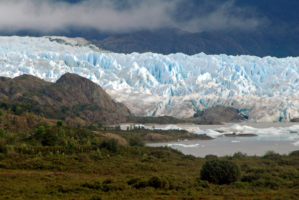
Study zone
The study area chosen for this work is mainly managed by the Compagnie d’Aménagment des Coteaux de Gascogne, who is a partner of CESBIO in MAISEO and SIMULTEAU programs.The site spatial extent includes two of Theia’s Landsat tiles, for a total area of almost 2.4 Million ha. Within this area, the main crops cultivated in summer are:
- irrigated corn and non-irrigated corn;
- soy;
- sunflower;
- sorghum.

Methodology
To perform our study, we set two lines of work:
- classify irrigated crops;
- identify the most feasible short time range that maximizes quality thematic maps.
To do this, we used the automated classification chain Iota 2 developed by Jordi Inglad’s team at Cesbio . Before making our tests, we connected the tool to the laboratory database that centralizes remote sensing images used in research projects as well as in-situ data. The joint use of the database and Iota 2 chain can easily make classifications at different spatial and temporal scales. The learning in-situ data come from plot surveys made by Claire Marais-Sicre and Marjorie Battude during the field season of 2015. We have 1332 samples for training the classifier and validating the thematic maps with the following nomenclature:
- irrigated corn silage;
- irrigated corn grain;
- irrigated soybean;
- non-irrigated corn;
- sorghum;
- sunflower.
The processing chain we have built to produce irrigated crop maps is divided into two stages:
- classify all landscape using nomenclature described above;
- apply the crop mask, to remove all irrelevant pixels1

In the first phase of our process, we used the Iota2 processing chain trained with samples to produce a classification according to our nomenclature. Then we applied the summer corp mask. Based on a threshold of multitemporal NDVI indices, the summer crops can distinguish very early in the season (early June) summer crops. At the end, we get a thematic image that provides the spatial distribution of irrigated crops, non-irrigated crops and winter crops in our study area.
Results
Classifications at the end of irrigation season
- For classification tests at the end of irrigation season (late August), we used a time series of 34 Landsat-8 images. With more than 92.3% of well detected pixels and a Kappa index of 0.84, the results are satisfactory.
- By year end, we used a time series of 53 Landsat8 images. With an overall accuracy of 92.8% and a Kappa index of 0.85, the results are the same as those of end campaign.
It is clear that the use of images acquired after the end of irrigation season does not brung much improvement compared to the map obtained end of August.
$(function () { $(‘#container’).highcharts({ chart: { zoomType: ‘xy’ }, title: { text: ‘Classification performances for 2015’ }, xAxis: [{ categories: [‘NB DOY: 180’ , ‘NB DOY: 210’, ‘NB DOY: 240’, ‘NB DOY: 365’] }], yAxis: [{ // Primary yAxis labels: { format: ‘{value} ‘, style: { color: Highcharts.getOptions().colors[1] } }, title: { text: ‘Kappa index’, style: { color: Highcharts.getOptions().colors[1] } } }, { // Secondary yAxis title: { text: ‘Nb images’, style: { color: Highcharts.getOptions().colors[0] } }, labels: { format: ‘{value}’, style: { color: Highcharts.getOptions().colors[0] } }, opposite: true }], tooltip: { shared: true }, series: [ { name: ‘Number of used images’, type: ‘column’, yAxis: 1, data: [24, 27, 34, 53], tooltip: {pointFormat: ‘{series.name}: {point.y:.1f} ‘} }, { name: ‘Kappa index’, type: ‘spline’, data: [0.696, 0.698, 0.842, 0.853], tooltip: {pointFormat: ‘{series.name}: {point.y:.1f} ‘} }, { name: ‘Confidence interval (95%)’, type: ‘errorbar’, data: [[0.5724, 0.8196], [0.5995, 0.7965], [0.7902, 0.8938], [0.7904, 0.9156]], tooltip: {pointFormat: ‘(error range: {point.low}-{point.high})
‘} }, { name: ‘Overall accuracy’, type: ‘spline’, data: [0.853, 0.854, 0.923, 0.928], tooltip: {pointFormat: ‘{series.name}: {point.y:.1f} ‘} }, { name: ‘Confidence interval (95%)’, type: ‘errorbar’, data: [[0.7938, 0.9122], [0.8057, 0.9023], [0.8987, 0.9473], [0.8965, 0.9595]], tooltip: {pointFormat: ‘(error range: {point.low}-{point.high})
‘} } ] });}); Classification during the irrigation campaignWe focused on two periods:
- early March to late J
une for an early detection; - early March to late July for a late detection.

Classifications performances are lower than those obtained for the end of the campaign but are still quite correct. Indeed with 24 and 27 images introduced in Iota chain 2, we still get an overall accuracy of respectively 85.3% and 85.4% for the two identified periods. Irrigated area estimationKnowledge of the spatial distribution of irrigated crops and estimated irrigated area, often unknown to the community, is an important issues for water managers. Until 2009, irrigation intentions were synthesized in the Land Parcel Identification System, known as Registre Parcellaire Graphique (RGP) in France, but this is no longer the case. Now, with our map we are able to estimate the irrigated areas at different scales (region, state, watershed, etc.).In 2015, we estimate at nearly 195,837 ha the sum of irrigated crops in the study area. According to the observations, with 85% of the irrigated area, grain corn is the main irrigated crop. Straddling the 3 departments of Gers, Hautes-Pyrénées and Pyrénées-Atlantiques, the watershed of the Adour-upstream is particularly affected by irrigation. Indeed, it occupies almost 13% of the total watershed (with about 16 800 ha of maize and 1600 ha of soybeans).
Some work ahead
| Departement | Crop | Total per irrigated crop (2015) | Agreste 2010 | Différence |
|---|---|---|---|---|
| Gers | Maïs | 41136 | 48427 | 7291 |
| Gers | Soja | 13098 | 7506 | -5592 |
| Total | 54234 | 55933 | 1699 | |
| Haute Garonne | Maïs | 20845 | 21484 | 639 |
| Haute Garonne | Soja | 5888 | 3611 | -2277 |
| Total | 26733 | 25095 | -1638 |
Although the results seem satisfactory, room for improvement remains. Indeed, estimates of crop surfaces of the Gers and Haute Garonne departments show:
- an underestimation of irrigated corn surfaces; 2 3;
- an overestimation of irrigated soybean surfaces. 2 3.
The analysis of the confusion matrix indicates that there is confusion between irrigated corn and soybean pixels. To improve the quality of our thematic maps, new work opportunities are open to us:
- the use of Sentinel-2 image that offers 12 spectral bands (7 Landsat8-Theia), a resolution of 10 m (30 m for Landsat8) and an improved repeatability.
- the contribution of Sentinel-1 radar images in the process of classification ot irrigated crops.
For nearly six months, Oliver Lienhard, who did a training period at Cesbio in the Casdar SIMULT’EAU project, worked on the classification method of irrigated crops under the supervision of Valerie Demarez and Frederic Baup. His internship key purposes and its first results on the contribution of radar that will be presented soon.
Sources
1 Claire Marais Sicre, Jordi Inglada, Rémy Fieuzal, Frédéric Baup, Silvia Valero, Jérôme Cros, Mireille Huc and Valérie Demarez, « Early Detection of Summer Crops Using High Spatial Resolution Optical Image Time Series »,Remote Sensing, Vol 8, July 2016
2 http://www.lrmp.chambagri.fr/uploads/media/Agriculture_en_bref_2012_32.pdf
3 http://www.lrmp.chambagri.fr/uploads/media/Agriculture_en_bref_2012_31.pdf