Sentinel-2 Agriculture
We are very proud to tell that our consortium was selected by ESA for the S2-Agri call for tender. Our consortium is built from the following partners :
- the catholic University of Louvain (UCL), which leads the project, with Pierre Defourny as project leader.
- the CESBIO lab, for Paul Sabatier University in Toulouse
- the CS-SI France company from Toulouse
- the CS-SI, Romania company from Craiova
The S2-Agri project, whose website was just created, aims at showing on a large scale project, the capabilities of Sentinel-2 mission for agriculture monitoring, by providing, after consulting several « champion » users, and open source processing software, that will provide the following types of products :
- periodic synthese of surface reflectances (Level 3A products)
- a crop mask
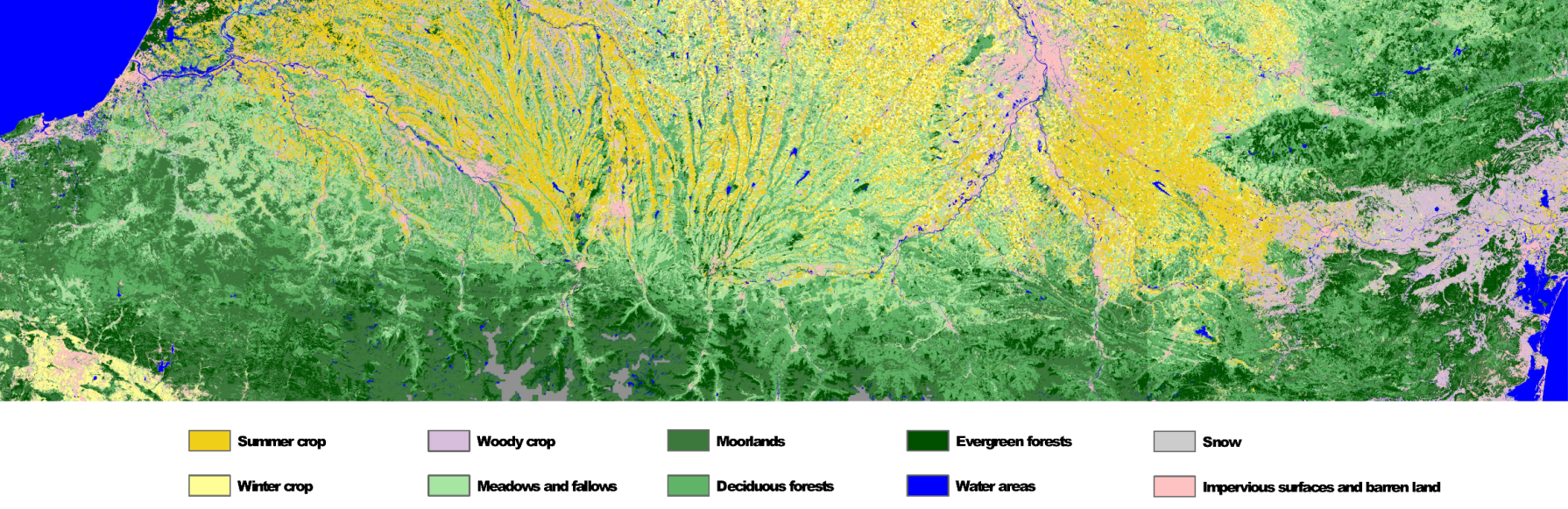
- a map of the main crops (see the image below, and the post on land cover maps)
- some vegetation indices or biophysical variables
This project, which started on January 31st, 2014, will be carried out in three phases, each with an approximative duration of 1 year.
- A test phase, to develop, tune and validate methods and products, on 13 sites scattered around the world, this phase will mainly rely on SPOT4-Take5 data, complemented by LANDSAT 8 or RapidEye images. Several sites will be selected within the JECAM network.
- A development phase, during which the production system will be built, and prototype products will be issued and tested.
- A demonstration phase, based on the first year of Sentinel-2 acquisitions, for which 3 entire countries (> 500 000 km²) plus 5 sites of 300×3000 km². At least 2 of selected the countries are in Africa.
At the end of the project, the production system will be released as an open source software by ESA, andA l’issue de ce projet, le système de production sera disponible en open source auprès de l’ESA, and given the amount of work, we will have won dark circles around our eyes!