Three Sentinel-2 satellites instead of two: impact on the retrieval of the snow disappearance date
Due to the success of Olivier’s petition, ESA kept Sentinel-2A operational after the launch of Sentinel-2C. Having three operational satellites instead of two increases the revisit, which should improve the quality of the derived products, and therefore the reliability of operational services based on Sentinel-2 data.
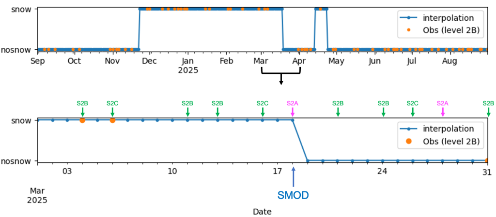
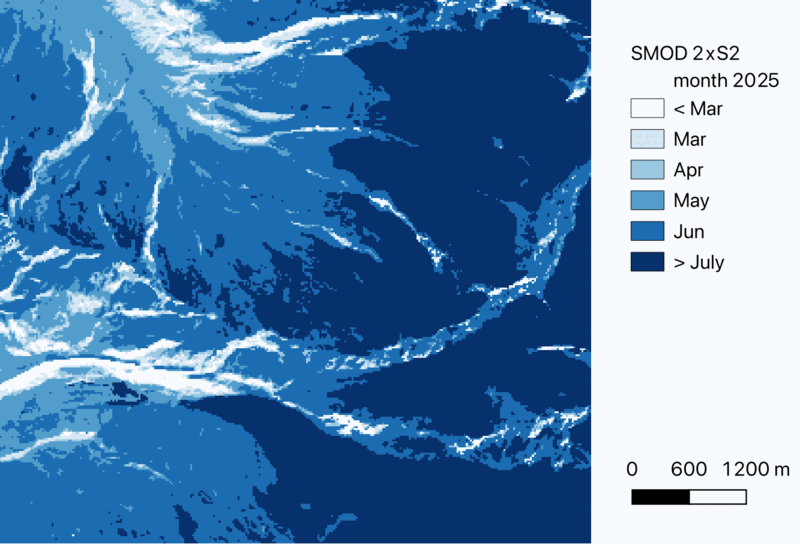
One of this service is the Copernicus’ High Resolution Water, Snow and Ice Monitoring. This service will soon provide annual snow phenology metrics based on our MAJA-LIS pipeline. These metrics include: snow cover duration, onset and disappearance date (also named snow melt-out date, SMOD). The snow phenology (or level 3 products) are computed using all level 2 products in a water year (1 Sep year to 31 Aug year+1), linearly interpolated to a daily, gap-free, time series of snow cover maps. The more Sentinel-2 images, the less interpolation. The same pipeline is also operated by CNES for Theia, which allows us to test and implement upgrades with shorter release cycles.
Here, we tested the impact of three Sentinel-2 satellites instead of two on the SMOD, using Theia snow products. We designed two scenarios:
- Nominal mode (2 x S2): two platforms are selected: S2A (or S2C) and S2B. The normal revisit is 5 days. Note that it can be less than 5 days in areas of where S2 swathes overlap..
- Enhanced mode (3 x S2): three platforms are used S2A, S2B, and S2C. The normal revisit is every ~3 days.. or less.
In « nominal » mode, in addition to S2B, we used S2A until January 21st (when it was replaced by S2C), then S2C. S2A extended campaign began on March 13, 2025, therefore the increased revisit of the « enhanced » mode was effective only after March 13.
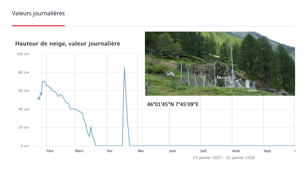
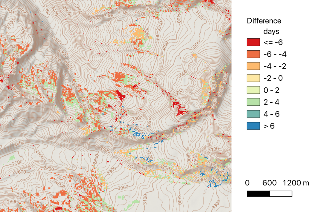
We processed all Sentinel-2 products of tile 32TMR near Zermatt, Switzerland. In this area there’s a weather station operated by MétéoSuisse and some snow depth data are available online. From these snow depth data, we can easily determine that the SMOD occurred on 20 March at this place. This is only 7 days after the beginning of the extended campaign (S2B + S2C + S2A), which is not ideal for our objective.
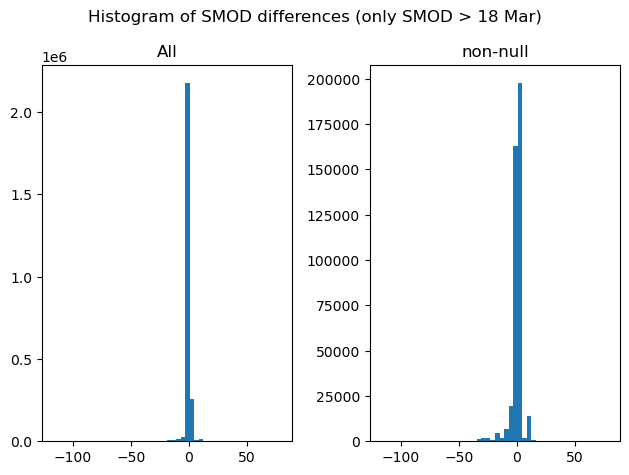
We can still have a look. Both SMOD products look very similar (which is good news). But there are some differences, positive or negative, of a few days.
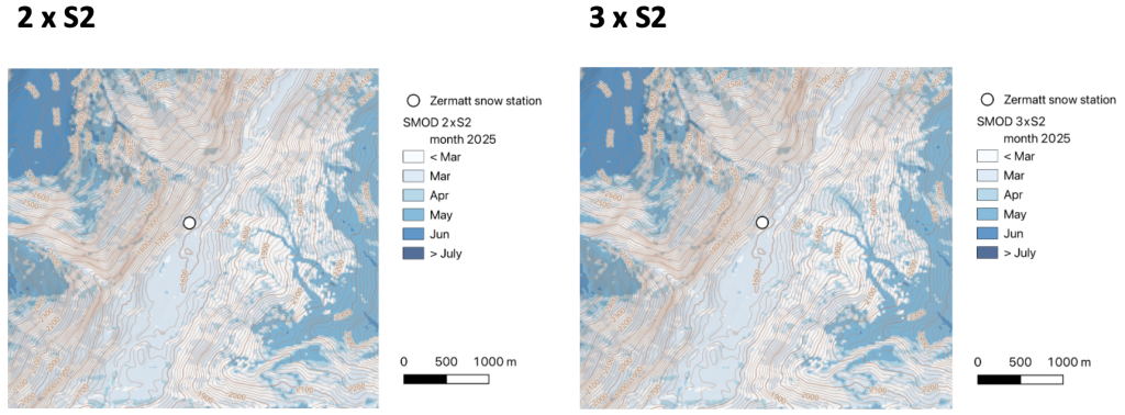
From Theia level 3 product, the SMOD is 18 March in both scenarios. A difference of 2 days with the ground truth is a very good result, but why is it identical in both scenarios? There was one extra image on 18 March thanks to the extended campaign but this image was defective. The next extra S2A image on 28 March was a bit cloudy and there’s a small cloud right above the station. The next clear-sky observation was acquired by S2B on 31 March. Since we use a linear interpolation to fill the gaps, the next S2A acquisitions in April have no effect on the SMOD retrieval in this area.

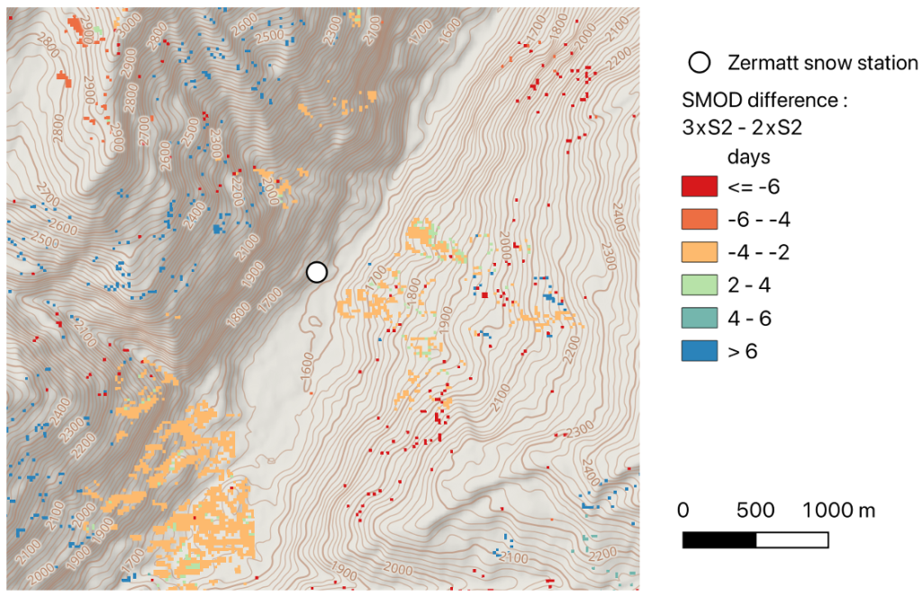
Larger differences can be observed in high elevation areas where the SMOD is later, and directly affected by the change in revisit. Most changes remain below 10 days, however such changes can be significant for ecological studies. In particular, SMOD variations in areas of late-lying snow cover can have a substantial impact on heat accumulation and plant growth. An earlier SMOD of 15 days corresponds to a 30 % increase in the number of growing degree days in an idealized late snow melting site modeled by Choler et al. 2024 (Fig. 2).
In conclusion, the effect of having 3 instead of 2 satellites on the calculation of the snow disappearance date is small but not negligible. It’s good news that the effect is small, because it confirms that our method with 2 satellites is robust (we knew it already from this study). However, this small effect may be relevant for high alpine vegetation studies. We are not able yet to say if these small changes have actually improved the accuracy of the product (in theory they should!). We shall extend this study in regions where we can obtain high elevation in situ SMOD measurements.
This work was done by Maël Lucas (Thales), Guillaume Eynard-Bontemps (CNES) and myself.