The Indian Water Rush
(credits: A. Selles, S. Ferrant)
(credits: A. Selles, S. Ferrant)
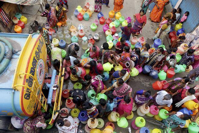
The South-Indian states suffer from insufficient -yet abundant- monsoon rainfalls that do not fulfill any more the current urban and agricultural water needs.
During the last decades, fast urban population growth has disrupted existing tap-water supply systems in big cities, challenging communities with regular tap-water shortages (last big one in Chennai).
In the same time, Indian food production system has been boosted by irrigation. First with collective canals bringing surface water to crops in irrigated command area, and then with millions of individual bore wells pumping collective groundwater resource.
The water supply is permanently challenged by a tremendous population increase, but also by emerging food demand behaviors resulting in an increasing demand of meat or wine and beer, productions with a higher water footprint than the traditional vegetarian Indian food.
This led to a drastic drop of groundwater levels and many perennial rivers drying.
But how to further increase water supply?
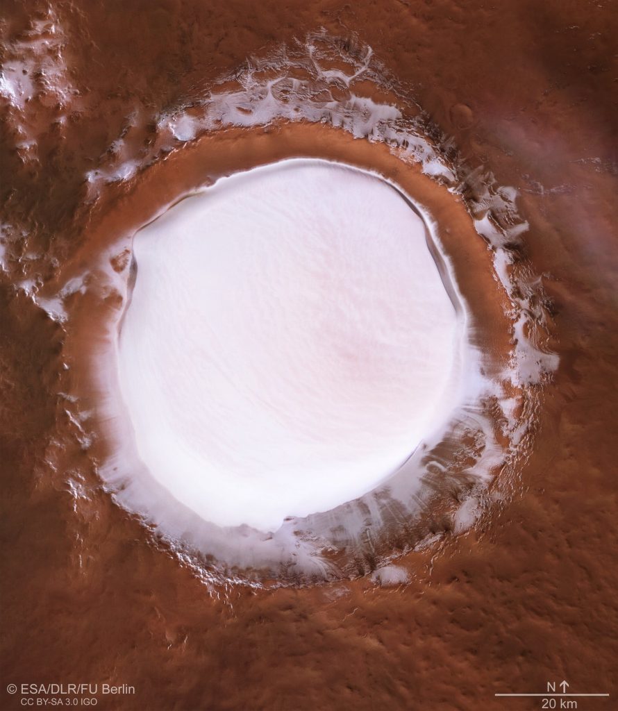
That’s the MBillion dollar question
… before the Colorado one!!
India’s adaptation strategy
to global changes
The case of Telangana, the youngest Indian state created in 2014 after Andhra Pradesh partition, reveals the Indian economy thirst for water. The urban area of its capital, Hyderabad, has grown from 6 to 12 million inhabitants in the last 10 years, as a result of the fast development of software industries (Google, Amazon, IBM etc.).
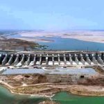
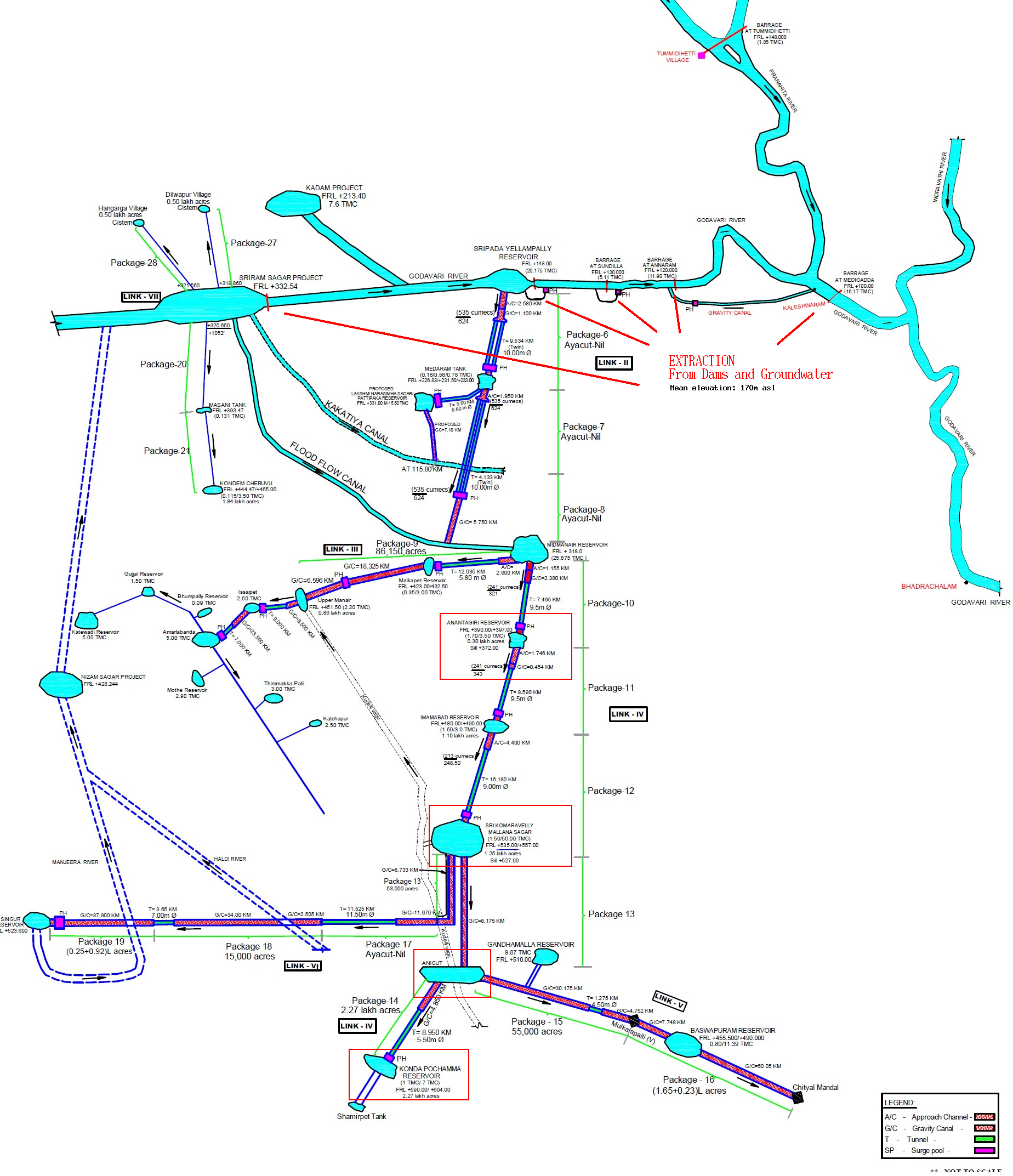
Located in the North of Telangana state, this mega project, initiated by the Telangana government, is a regional pride. It aims pumping the remaining Godaveri River base flow released from upstream dams, before entering the downstream Andhra Pradesh state. It then lifts water 200 meters higher with the world’s most powerful pumping system to a network of big reservoirs linked with huge canals.
I let Kalvakuntla Taraka Rama Rao (alias KTR), the son of Kalvakuntla Chandrashekar Rao, the current Chief Minister of Telangana, speak about this enchanting achievement.
The figure below shows the regional footprint of the project: water pumped in the downstream north, lifted through a network of tunnels and canals to the upstream southern region in big reservoirs, up to Hyderabad water supply system.
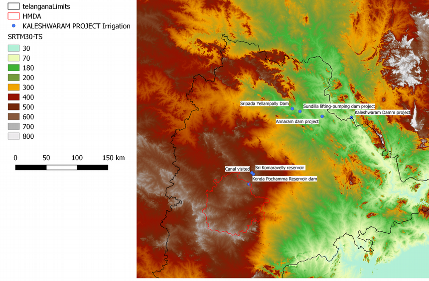
Telangana relief and locations of pumps downstream north) and big reservoirs upstream south toward Hyderabad city area (170 to 400 m Above the sea level).
Credit: A. Selles
The total cost of the project is estimated at 80 000 Crores Indian Rupees (9.7
Billions euros, funded by Telangana only). This is the costliest irrigation project undertaken by any state in India so far.
This mega lift program on Godaveri river could fuel the existing water war with the downstream Andhra Pradesh state (created after the partition in 2014) that regularly breaks out, caused by a water quota release (or not) from the southern Krishna river dams.
Monitoring Adaptation from space

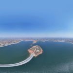
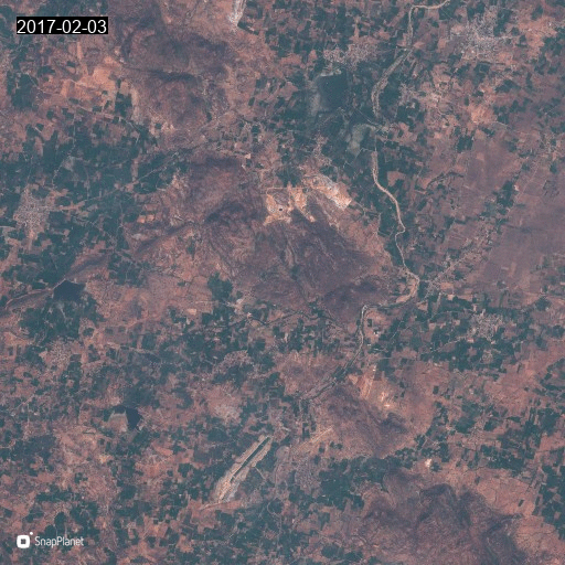
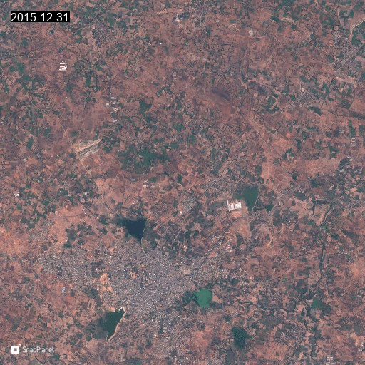
I have used two collections of Sentinel-1 images using Google Earth Engine, in September 2019 (blue) and 2020 (red) to extract surface water. Some of new big reservoirs appear in red and have been flooded during the last monsoon (July to September 2020).
The construction of those gigantic structures along the diagram (figure below) has been done in a short time as you can see with Sentinel-2 satellites. I have spotted 4 reservoirs among the 20 that are planned, the last monsoon period has filled up 3 of them. I have built the animated GIF (click on them to enlarge it) with the friendly smartphone app SnapPlanet.


January 2018 to August 2020
(Click to enlarge figures)
Several villages – which represent 1000 houses for both Konda Pochamma and Srikomaravelly reservoirs only – have been submerged.
Gajwel town area, where Konda Pochamma has been constructed, was a study site of the ANR SHIVA research project (from 2009 to 2013) – Socio-economic Assessment of the rural Vulnerability of water users under stressors of global changes in the Hard rock area of South India – in the framework of which I started working on the Indian Agro-hydrological context in 2010.
At this time, we, scientists, could not imagine such an adaptation strategy!
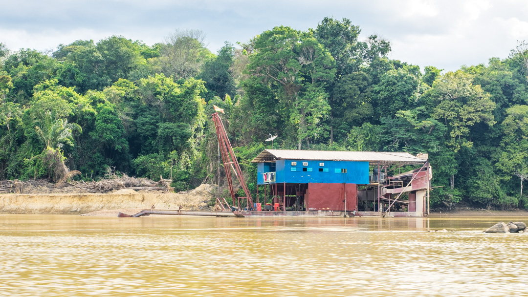
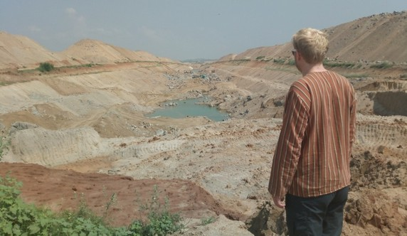
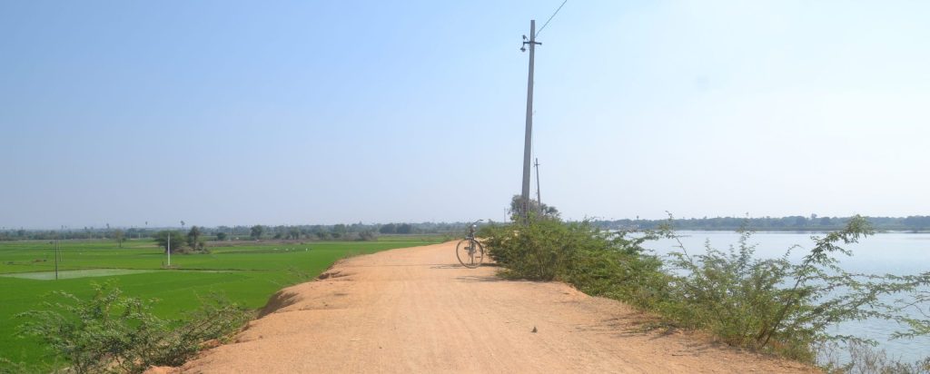
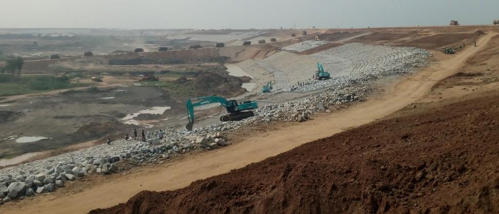
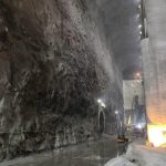
We have been visiting the Konda Pochamma construction site in October 2018 during a land use survey field trip and took those pictures of the structure (located here https://goo.gl/maps/7mMyvA6UWw22).
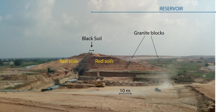
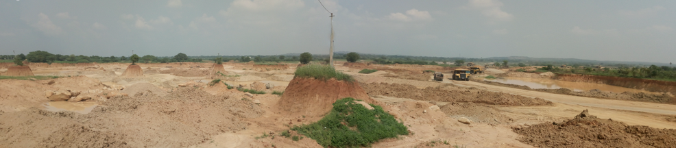
Those pictures illustrate a simple construction strategy entitled (by myself) « the sand box strategy »: excavate the soil and saprolite in the middle to raise surrounding walls, with a layer of clayey soils (Black soils found in this region) in the middle of the wall for waterproofing. The walls are consolidated with granite blocks on their side.
Nothing is made at the bottom to prevent infiltration of the Godaveri water into the underlying aquifer. An expected result would be the raise of groundwater level resulting from the recharge below those big reservoirs.
In this area where depleting groundwater levels have been studied by the Indo-French Center for Groundwater Research since 1999, this infrastructure project raises exciting scientific questions!
However, where will Indian fast growing economy look for water in the next decades ?
Well, let us be more innovative in the options we could explore, this time…
On Mars?