Madagascar, the new zone processed by MAJA and WASP for Theia

Nouvelle zone traitée par Theia (les zones en rouge étaient déjà traitées).

=> 

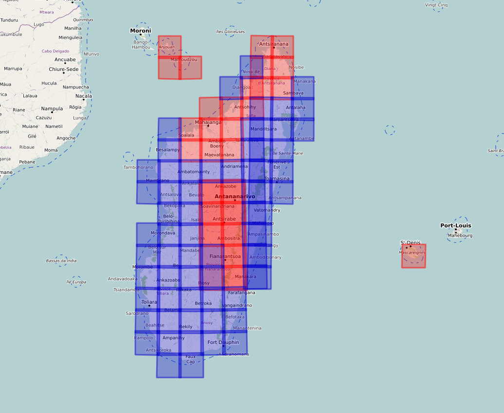
Here it comes ! Following numerous demands, we found ressources to add the great island of Madagascar to the list of zones processed by Theia. The processing with MAJA started a few days ago, with the data acquired in December 2016 by Sentinel-2. The start was only slightly delayed by the current lockdown in France, which forces thz Theia production team to telework. We will also trigger the production of monthly cloud free syntheses with WASP as soon as possible.

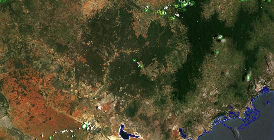
It will of course take some time to produce the four years of data until we reach near real time processing, but the first 6 months are already available, as you may see on the animation below, over tile T38JPT, South South East of Madagascar.

Plus d'actualités

IOTA2 software mailing list

Hello everyone, We have just created a mailing list for users of the IOTA2 software (iota2 — iota2 documentation). The tool will undergo significant developments in the coming months, and the purpose of this list is to communicate with the community to support these changes and to maintain the processing workflows needed by the users. […]

Rapid analysis of the GLOF in Gupis, Gilgit-Baltistan

Pakistan news media reported that a glacier lake outburst flood (the failure of a dam containing a glacial lake) occurred near Gupis, Gilgit-Baltistan, a highly mountainous region administered by Pakistan. Satellite images show that the flood triggered a debris flow, which reached the Gupis valley where it hit the Roshan (Rashon) village and blocked the […]

Dates de fauche en France

En 2024, des collègues du Cesbio ont publié un article* sur la cartographie de la date de fauche en France en 2022 à partir des données satellitaires Sentinel-2.   Leur magnifique figure 10 a attiré mon attention. La version à haute résolution fournie avec l’article (2861 × 2911 pixels) correspond à une image dont les pixels font […]

Rechercher