[MUSCATE] Theia releases Sentinel-2 L2A products on the whole Maghreb coastal region
![]() =>
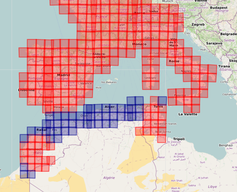
=> ![]() Since we understood the bugs which were slowing MUSCATE, and we found ways to mitigate them, the production rhythm of MUSCATE improved and we were able to extend the zones where we provide Sentinel-2 (A&B) L2A products. L2A products provide surface reflectances after correction of atmospheric effects and with a high quality cloud mask. The products we deliver are provided by MAJA processor. We just released all the data acquired on the Maghreb coastal zone, from Morocco to Tunisia. A few missing tiles have also been added in South Morocco, and on Cap Bon in Tunisia. With these new tiles, we now monitor all the lands that surround the occidental part of Mediterranean sea, adding 50 tiles to those already processed.The processing started with the images acquired on the 1st of November 2017, to allow the monitoring of 2017-2018 crop season. The processing will go on in real time. We will also try to provide the data acquired before that date, but a little later. As always, this data set can be downloaded from :
Since we understood the bugs which were slowing MUSCATE, and we found ways to mitigate them, the production rhythm of MUSCATE improved and we were able to extend the zones where we provide Sentinel-2 (A&B) L2A products. L2A products provide surface reflectances after correction of atmospheric effects and with a high quality cloud mask. The products we deliver are provided by MAJA processor. We just released all the data acquired on the Maghreb coastal zone, from Morocco to Tunisia. A few missing tiles have also been added in South Morocco, and on Cap Bon in Tunisia. With these new tiles, we now monitor all the lands that surround the occidental part of Mediterranean sea, adding 50 tiles to those already processed.The processing started with the images acquired on the 1st of November 2017, to allow the monitoring of 2017-2018 crop season. The processing will go on in real time. We will also try to provide the data acquired before that date, but a little later. As always, this data set can be downloaded from :
https://theia.cnes.fr

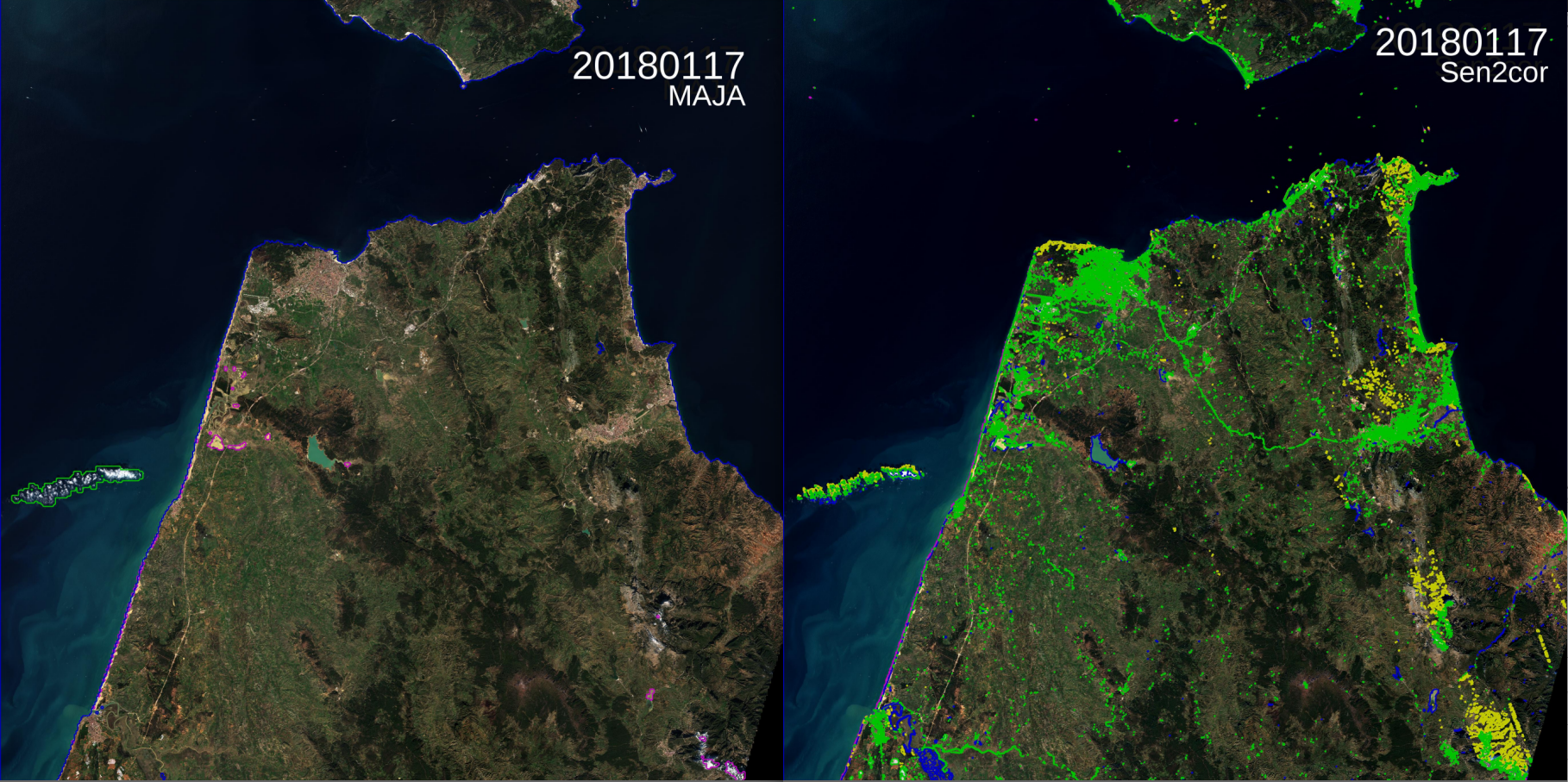
As an example, here is the amazing time already available on Gibraltar strait. Detected clouds are circled in green, while cloud shadows are circled in yellow. We see that MAJA processor is able to detect the thinnest clouds and has a very little rate of commission errors. For the shadows, omissions and commissions are more frequent: the detection of cloud shadows is even more difficult than the detection of clouds.ESA too is producing L2A products on the same tile with the Sen2cor processor. But strangely, only six images are available between beginning of November 2017 and mid February, while Theia produced about 30 images. The image below compares the surface reflectances and the cloud and shadow masks. Sen2cor tends to classify every bright pixel as a cloud, which is not the case for MAJA. Sen2cor water mask is of better quality, as MAJA’s one in processed at 240m resolution and is not aimed at being used.