Pilot site corresponding: Rim Zitouna, INRGREFAMSL
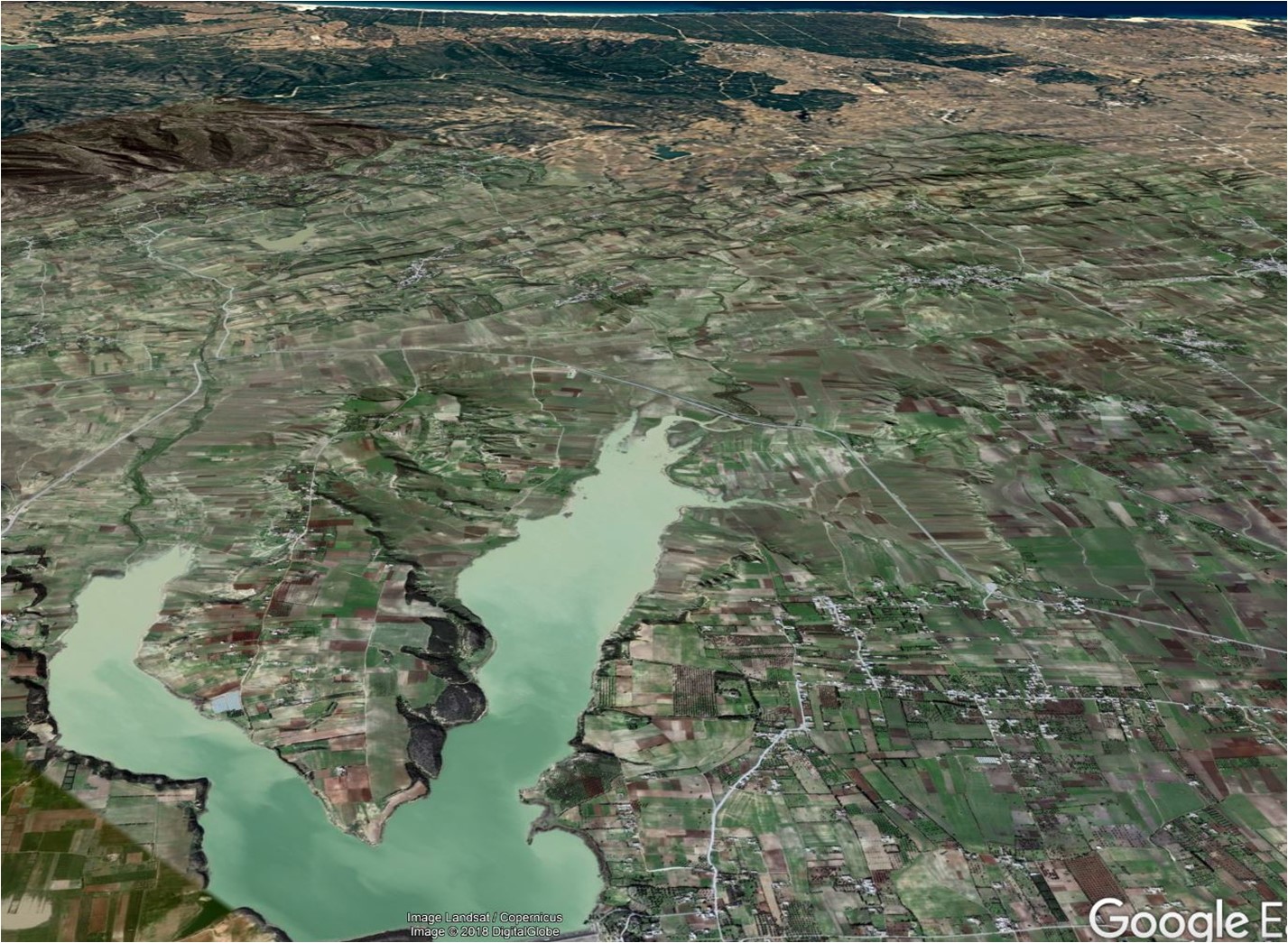
The Lebna watershed is located in north east Tunisia in the CapBon peninsula. It has a 210 km2 area, it is limited by Djebel Sidi Abderrahman which has the highest altitude (650 m above sea), it is covered by scrubland and forest. In the central part the catchment depicts hilly reliefs and it is covered by association of mixed crops and rangelands. The downstream part, altitude around sea level, is flat and it is coved by annual crops and orchards.
The climate rages from wet regime at the top of the Djebel, with rainfall over 700 mm/year, to semi-arid over the downstream pat with rainfall below 500 mm/year and evaporative demand around 1200mm. Lebna watershed presents Alfisols, Entisols, Inceptisols and vestisols.
The Lebna dam buit in 1987 at the level of the junction of two rivers (El oudiane and Boudokhane). It is located at the catchment outlet at 3 km from the sea. It is the largest dam in the CapBon peninsula with an initial capacity of 30 Mm3. The main objectives of Lebna dam are groundwater recharge, water supply for irrigation and drinking water purposes and protection of urban areas located downstream the dam. A network of about 20 hilly reservoirs upstream to the Lebna dam, which were built between 1994 and 2003 to reduce dam silting, to refill shallow aquifers and to supply irrigated perimeters, a small reforested area on the foothills of the Djebel within the upstream part of the watershed, to reduce soil loss by erosion.
One of Lebna sub-catchments, named “Kamech”, has been monitored since 2004 as a research observatory. It is one of the two sites of the agro-hydrological observatory OMERE (Observatoire Méditerranéen de l’Environnement Rural et de l’Eau). OMERE aims to document the impacts of agricultural and land management on mass fluxes in Mediterranean farmed headwater catchments. The observation strategy is motivated by monitoring water, sediment, and contaminant fluxes and hydrologic and climatic variables at different spatial scales from cultivated plots and landscape elements to the catchment scale. These measurements have been performed at a fine time resolution over a long-term scale and by surveying land use, agricultural practices, and soil surface characteristics. The long-term observation strategy intends to support integrative multidisciplinary research for elucidating the conditions that improve soil and water management and delivery of ecosystem services in a Mediterranean rainfed cultivated context (www.obs-omere.org).