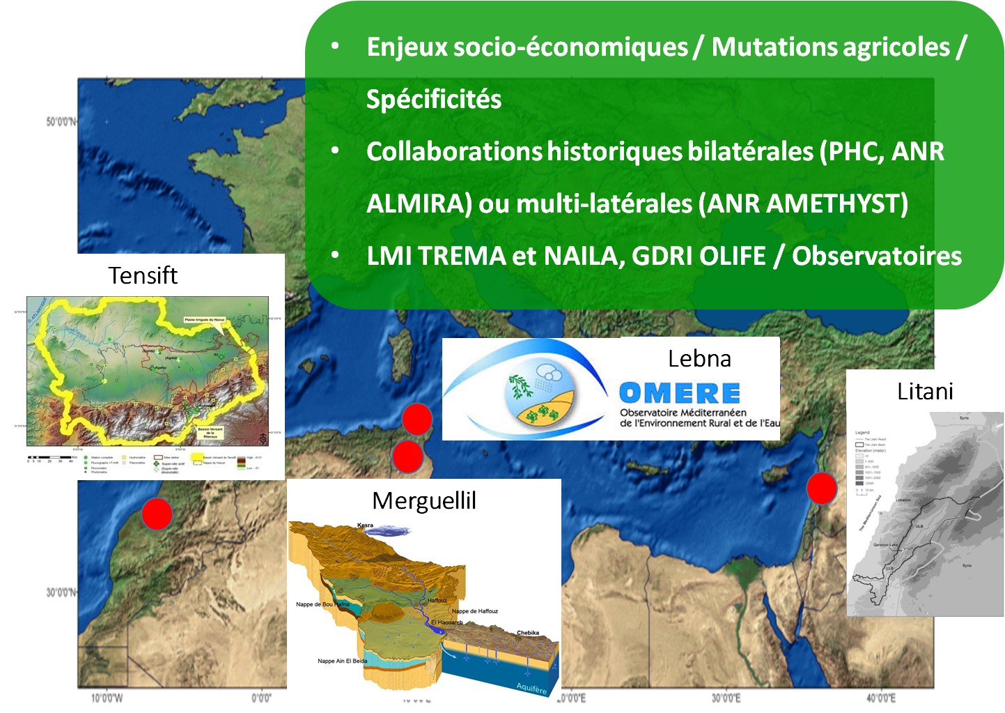
Because of the large range of situations of Mediterranean agrosystems, we choose to conduct a comparative analysis of representative and well-documented cases. Four pilot sites are selected in Tunisia (Lebna, Merguellil), Morocco (Tensift), Lebanon (Litani).
Merguellil has an important rainfed agriculture sensitive to climate changes.Tensift and Litani have a snow-dominated flow regime. In Tensift and Merguellil cases, the upstream rivers feed a dry plain or a coastal where irrigation rapidly expands (Merguellil) or already dominates (Tensift). In Litani and Lebna sites, the problem of water quality becomes essential for water management. Water governance illustrates numerous complementarities between the four sites due to environmental context, water uses, sector competitions and current water policies. All these aspects have also to be considered in the context of political breakings (as green plan for Moroccan agriculture, revolution in Tunisia, crisis of refugees in Lebanon). A detailed description of differences and complementarities is provided below.
| Site identification | Land use | Physical properties | Water related issues |
| Lebna (Tunisia) | Intensive irrigated vegetable and fruits production in the Korba plain and rainfed agriculture in the upstream part Scrubland and forest Town near the sea with agri-food industry | Surf : 210 km². Precip: 500-700, PET: 1200 mm). Elevation from 650 m to sea level. A steep hilly relief in the upstream part of the watershed. Downstream to the catchment outlet (Lebna dam) : the Korba plain is a 5 km width littoral strip Sea-shore presents relics of lagoons between coastal dunes. Presence of a coastal aquifer in the Korba Plain | * quality and quantity of water available for agricultural production along the agrosystem gradient. * Water allocation between different reservoirs (outlet dam and upstream hilly lakes, root zone in cropping systems, shallow aquifers) to fulfil a fair sharing between uses. * Saline intrusion from the seashore in coastal aquifer caused by over pumping. * decrease of the Lebna dam maximum capacity because of silting |
| Merguellil (Tunisia) | Vegetation downstream el Houareb dam is dominated by agriculture (cereals, olive groves, fruit trees and market gardens). City of Kairouan | Surf : 4200 km² Precip. 266-515 mm, PET 1600 mm in Kairouan Plain. The upstream catchment (1200 km2) presents a hilly topography (altitude between 200 and 1200 m with a median elevation of 500 m) and has diversified conditions of geology, morphology, vegetation and land use. The Merguellil downstream catchment is part of the very large and flat Kairouan alluvial plain that extends over about 3000 km2. | – a continuous decline in the water table of Kairouan due to the overexploitation, – Accentuation of the water deficit due to climate change, the important number of illegal boreholes, combined with the development of irrigated agricultural activities population growth and urban expansion. |
| Tensift (Morocco) | Haouz plain : irrigated areas (fruit, olives, vegetable) and rainfed cereals Forest (Holm Oak trees, argan trees) City of Marrakech | Surf : 20450 km² P :1000mm in the High Atlas partly in solid form, 250 mm in the plain. PET :1600mm Upstream : High-Atlas Mountains and Jbilet Hills Downstream : the Haouz plain with an aquifer and and good quality soils around the city of Marrakesh. | Accentuation of the water deficit due to climate change, combined with population growth, urban expansion, the development of tourism and the development of agricultural activities. Water redistribution within the watershed as an adaptation mean |
| Litani (Lebanon) | Irrigation of crops, vegetables and fruits in the Litani Basin. | Surf : 2175 km2 P: 700 mm/year River length : 140 km Sources at 1000 m Exits Bekaa at an altitude of 800 m. Steepest slope of 500 m within 40 km. It deviates westward at altitude of 235 meters to flow later into the Mediterranean Sea. | – No or very low inflow between May and October of each year – Very bad water quality due to the lack of functioning water treatment plants, solid waste dumping, industrial wastes, fertilizers and untreated sewage influx |
Each site benefits from many previous studies that developed socio-environmental field surveys, information systems about agricultural practices and hydrology, biophysical and socio-economical models, and strong interactions with various levels of stakeholders. The strength of CHAAMS is also to rely on long-term perennial structures, namely two international joint laboratories of the French Research Institute for Development –IRD– (TREMA, NAÏLA), an international research group (O-LIFE) and four observation systems, three of which are involved into national and/or international networks (JECAM, OMERE, O-LIFE). These structures are an essential tool to facilitate the consortium network functioning.