Pilot Site Corresponding: Ghaleb Faour, CNRSL
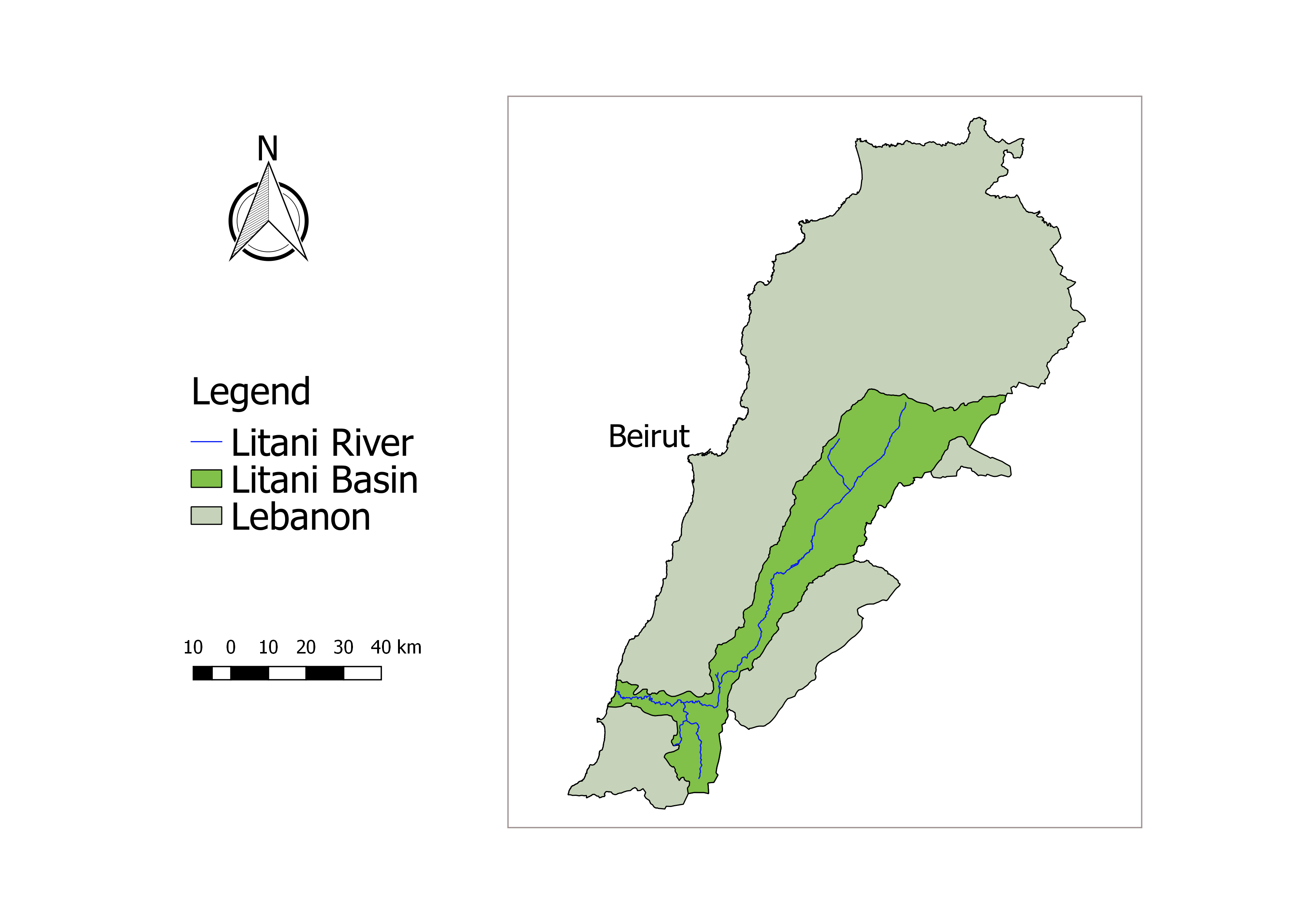
The Litani River Basin covers approximately 20% of Lebanese territory with a river system serving for irrigating some 77,000 ha of current, ongoing and proposed schemes, as well as for tourism and domestic water. The Litani produces 7.5% of national needs of clean hydroelectric power. The average discharge of the river, being the largest river in Lebanon, is 360 MCM per year. Water flowing in the Litani system amount to 30% of the water running in all the Lebanese rivers. Elaborated and reliable data related to underground water in the Litani watershed is yet unavailable. In the region of Litani, 12 aquifers are identified. The Basin encompasses a variety of climates ranging from costal subtropical to dry continental. Studies have shown no evidence of possible climatic evolution change so far. Based on the physical features and on the pressure of human activities on the surface water ecosystems, the Litani River System can be divided into three different water bodies. The Litani RB includes a mosaic of inter-linked ecosystems with different habitat and species. The Bekaa Valley which falls in its majority in the Litani is considered a biological corridor especially for migrating birds between Africa and Europe. Besides the Qaraoun Lake (12 Km2) and some riverbanks (220 ha), there is two major wetlands: Ammiq (280 ha) and Kfar Zabad (3 ha) and one reserve: Al Shouf Cedar Natural Reserve (55,000ha).
Litani basin comprises 263 villages. The sources of income within the Litani basin are mainly from the agricultural sector (31%), followed by commercial (25%), employment (16%) and industrial (13%) sectors, respectively. Studies concluded that quality of the Litani water system is on the borderline of being unusable and there is still room to reverse the pollution effects. The highest pressure on the water ecosystem comes from the untreated municipal effluents of household waste water and solid wastes dumped near the watercourses in uncontrolled way. In parallel, industries with the highest effect on Litani water system are concentrated mainly in the Upper-Middle watershed part. Almost all the facilities lack proper treatment of industrial effluents prior their release to water courses. Flooding in the Litani basin is recurrent especially in the flat upper part. Affected areas are around 416 km2. Current surface water quality status is characterized by a heavy load of organic material. Analysis showed the majority of water courses are severely affected from domestic wastewater discharge. This is evident from the concentration of organic matter, measured as chemical Oxygen Demand (COD) or Total Organic Carbon (TOC), and in the concentrations of ammonia. Hydropower generated from Litani river accounts for 34 MW, which is around 14% of the total annual energy coming from hydroelectric plants and 7.5 % of the total annual energy consumption average 2001-2010. Future climate change scenario are projecting a decreasing in the amount of precipitation and an increasing in the temperature in the basin.