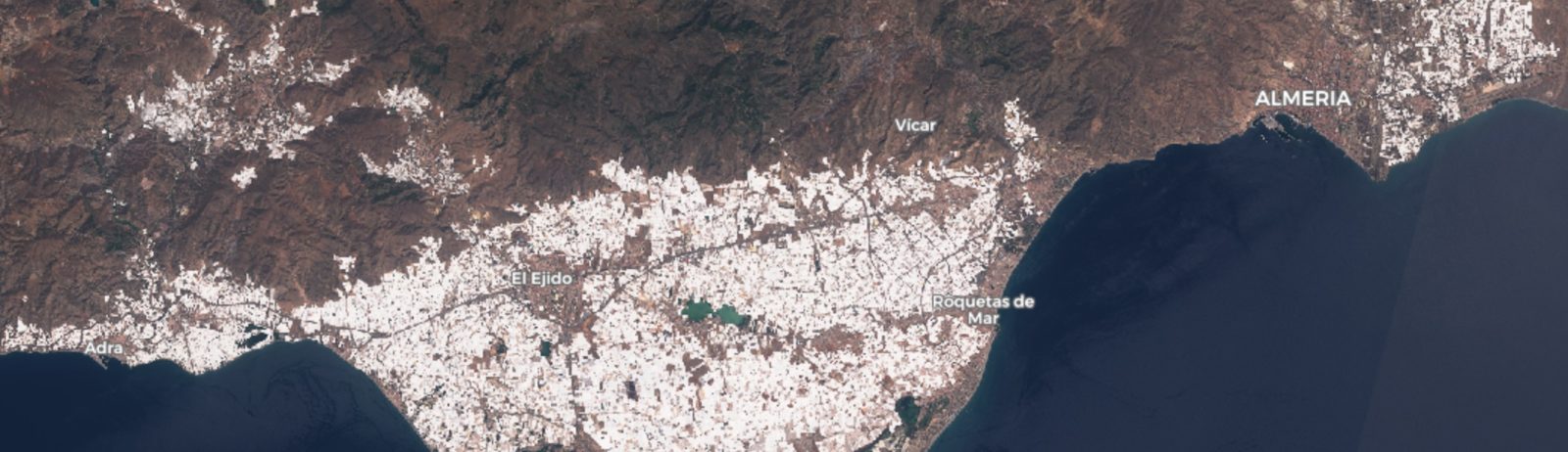
Whitewhashing the Plastic Sea near Almería

Almería province in Spain is « one of the most recognisable spots on the planet from the lens of a passing satellite. The roofs of tens of thousands of closely packed plastic greenhouses form a blanket of mirrored light beaming into space. » (The Guardian).

True color image Sentinel-2 on 22 Aug 2018

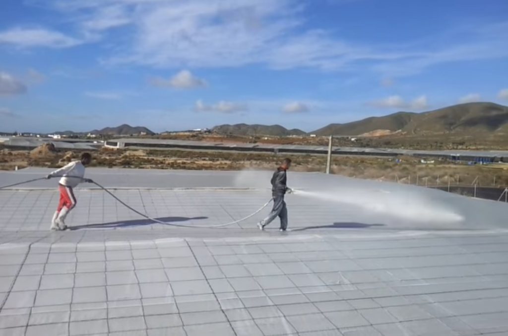
Greenhouses in Almería are typically made with transparent plastic to increase the air temperature near the crops. This enables to boost the yield and to harvest earlier than in open field. However, in summer, the temperature increases too much and must be reduced to maintain more suitable conditions for plant growth. Natural ventilation is generally not sufficient to evacuate the heat during sunny days. Therefore, the farmers cover the roofs of the greenhouses with white painting to reduce the incoming solar radiation (Baille et al. 2001). This operation is called blanqueo in Spanish.

Capture from « Blanqueo Paco Gomez » advertisement video (click on the picture to watch it in youtube)

Now, this is how it looks from space.. almost like the phenological development of natural vegetation! This is a sequence of 55 Sentinel-2 clear-sky images all acquired in 2018.

References

Baille, A., Kittas, C., & Katsoulas, N. (2001), Influence of whitening on greenhouse microclimate and crop energy partitioning, Agricultural and forest meteorology, 107(4), 293-306.

https://twitter.com/sgascoin/status/1032993061566132224

Plus d'actualités

BIOMASS, the third launched satellite mission designed at CESBIO !

After SMOS in 2009, and VENµS in 2017, the CESBIO Laboratory is very proud to see its third proposed mission, Biomass, reach orbit. As always, it has been a long journey from the idea, at the beginning of the century, to the selection in 2013 as the seventh Earth Explorer Mission by ESA, to the […]

Sentinel-2 reveals the surface deformation after the 2025 Myanmar earthquake

Sentinel-2 captured several clear-sky images of Myanmar before and after the 28 March 2025 earthquake. The animation below shows a 5-day apart sequence of images captured by Sentinel-2B and Sentinel-2C (10 m resolution) near the epicenter located close to Mandalay. The surface slip due to the earthquake follows the Sagaing Fault, a major fault in […]

Satellite Stereoscopy for Water Resource Monitoring?

=> In arid or semi-arid regions, where irrigation is widespread, monitoring agricultural water resources is essential to anticipate shortages. These resources may come from large dams, small reservoirs, or groundwater aquifers. This is the case in the state of Telangana, in South India, where numerous large dams (shown in cyan blue in the figure below) […]

Rechercher