
What about playing Take Five again with SPOT-5 ?
 =>
=>  This post is regularly updated with news (the official date of Sentinel-2 launch) or to add new arguments.
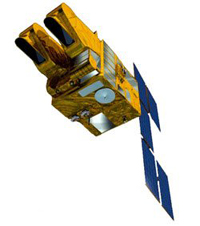
SPOT5 will soon end its career. After 12 years of image acquisitions, the satellite will retire in 2015. CNES might launch a call for scientific experiments with SPOT5 before the satellite de-orbitation. I am quite sure it would be useful to repeat the SPOT4 (Take5) experiment, for the following reasons :
- The official Launch date of Sentinel-2A in now March the 30th, 2015. Even if the satellite is launched in time, the routine acquisition on the 10 day cycle orbit will start one or two months later, and it will take several months to distribute data operationally. Data from the second Sentinel-2 satellite will probably only be available the year after, we will thus have to wait until 2016 to get data with a 5 days repetitivity.
- A new Take5 experiment based on SPOT5 would allow to go on preparing uses, methods and applications based on time series, to get ready to make an operational use of Sentinel-2 just after the data are released.
- SPOT5 provides multispectral images with a 10 m resolution, just like Sentinel-2. A new Take5 experiment would allow better simulations of Sentinel-2 data.
- SPOT4 (Take5) experiment was held in Spring and ended in June, we might this time try to extend the time period towards the Summer to monitor the summer crops.

- The SPOT4(Take5) experiment was set up very quickly and we lacked time to convince international partners to take part to the experiment. This time, thanks to SPOT4(take5). Now, thanks to SPOT4(Take5) little celebrity, it should be easier to involve new international partners, and to reach new users. The cost for international partners to get access to data for one site every fifth day during five months was about 4000€. Please contact me if you think your organism might participate.
- SPOT4 (Take5) sites were chosen very quickly, and many users complained they had no time to set-up ambitious measurement campaigns, to hire people for ground truth measurements and define protocols. This time, we might obtain a longer prior notice period to set things up properly.
- The dreadful weather we had in Europe during SPOT4(take5), nearly spoiled a few experiments, but we may hope that it would not happen again if we tried it one more time.
- ESA and JRC excepted, we did not have time to involve European partners in SPOT4 (Take5), and 95% of the sites chosen by ESA and JRC were outside Europe. This time, we could focus part of the experiment on Europe.
- We might try to have the experiment running for a longer period that in the first time, but it will mean a larger cost for CNES, and we willl need to have a convincing set of experiments to convince CNES.
Even if SPOT4(Take5) was a success, we will need to build an excellent proposal in order to convince CNES, in a constrained funding context. After the experiment was already funded once, it is not a premiere anymore, and its impact will be less straightforward. We thus need to compensate with original ideas and a large support. If you are interested to participate to a possible SPOT5 (Take5), please leave messages on this blog or on my email, Please do not forget to provide us the results you obtained with SPOT4(Take5).

