Publication of the Sentinel-HR phase-0 study final report

=> 

As agreed by CNES, the Sentinel-HR phase-0 study report has been published on HAL. This report can therefore be widely shared and cited in your own work:

Julien Michel, Olivier Hagolle, Anne Puissant, Pierre-Alexis Herrault, Thomas Corpetti, et al.. Sentinel-HR Phase 0 Report. [Research Report] CNES – Centre national d’études spatiales; CESBIO. 2022. ⟨hal-03643411⟩

This report summarizes 15 months of work from a small team at CNES, helped by an enthusiast scientific mission group, and with a greatly appreciated support and small funding from the prospective team at CNES. It is organised as follows:

  • Chapter 1 describes the programmatic context of the mission as well as objectives and means of the phase-0 study
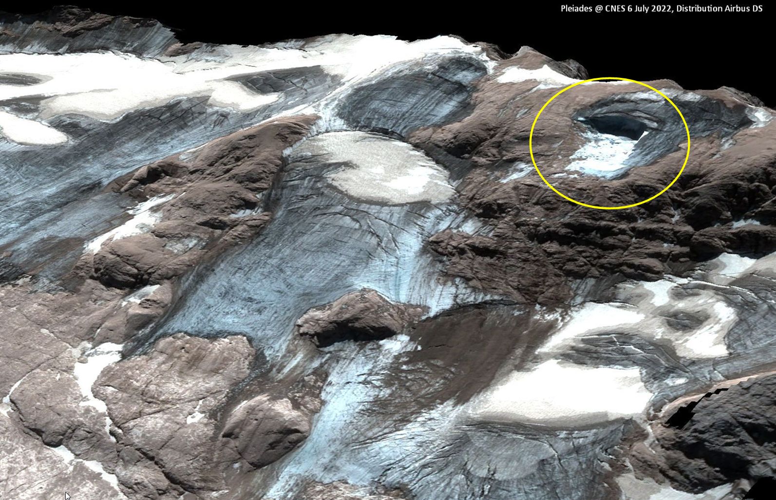
  • Chapter 2 describes Sentinel-HR expected benefits through 12 application use-cases
  • Chapter 3 describes two possible designs for the mission : one uses a pair of ad-hoc satellites, the other use 12 modified CO3D satellites
  • Chapter 4 presents our work on spatio-temporal fusion and super-resolution in order to assess the feasiblity of Sentinel-HR / Sentinel-2 (NG) hybrid products

Many thanks to all (often benevolent) contributors !

Plus d'actualités

BIOMASS, the third launched satellite mission designed at CESBIO !

After SMOS in 2009, and VENµS in 2017, the CESBIO Laboratory is very proud to see its third proposed mission, Biomass, reach orbit. As always, it has been a long journey from the idea, at the beginning of the century, to the selection in 2013 as the seventh Earth Explorer Mission by ESA, to the […]

Sentinel-2 reveals the surface deformation after the 2025 Myanmar earthquake

Sentinel-2 captured several clear-sky images of Myanmar before and after the 28 March 2025 earthquake. The animation below shows a 5-day apart sequence of images captured by Sentinel-2B and Sentinel-2C (10 m resolution) near the epicenter located close to Mandalay. The surface slip due to the earthquake follows the Sagaing Fault, a major fault in […]

Evolution de l’altitude de la ligne de neige au cours des 41 dernières années dans le bassin versant du Vénéon (Oisans)

Pour contribuer à caractériser les conditions hydrométéorologiques lors de la crue torrentielle qui a frappé la Bérarde en juin, j’ai analysé une nouvelle série de cartes d’enneigement qui couvre la période 1984-2024 [1]. Grâce à la profondeur temporelle de cette série, on constate que l’altitude de la ligne de neige dans le bassin versant du […]

Rechercher