Sentinel-2 spots best-kept secret in corporate Japan
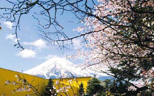
Today for lunch I went to a Japanese restaurant near the university with my wife and our oldest son. We discreetly debated whether the owners were actually Japanese because we could recognize some words in Chinese when they were speaking. However, in the main room there was a tapestry of the majestic snow-capped Mount Fuji, so it must be a real Japanese restaurant.
Another symbol of the Land of the Rising Sun is the high-tech industry. Fanuc Corp. is one of these big Japanese industrial companies, though it is not the most famous one. Yet, according to Wikipedia, « Fanuc is one of the largest makers of industrial robots in the world. (…) The company name is an acronym for Fuji Automatic NUmerical Control. »
Yesterday NASA’s Earth Observatory highlighted the MODIS image of a rare snowfall that occurred in Tokyo on Thursday Nov 24 [1]. Alas! the snow was already gone in Tokyo. I panned to the region of Mount Fuji and found a beautiful view of the iconic (and conic) mountain covered by snow. But about 15 km to the northeast of the « Fujisan » there were a number of intriguing, bright red buildings. If these buildings appear in red it means that they have a very large reflectance in the SWIR, or they are so hot that they emit thermal radiation.

The buildings are industrial facilities that belong to Fanuc Corp. An article in the Wall Street Journal explains:
« it’s the home of the best-kept secret in corporate Japan, a $50 billion-plus industrial powerhouse that hides away in the woods near Mount Fuji. Inside the complex, scores of bright yellow robots toil away 24 hours a day in 22 factories, replicating themselves. Watched over by a handful of human workers, they build more robots and other factory machinery. » [2]

And there is more. Fanuc is not the only business in the lovely village of Oshino. Fanuc’s neighbor is the Japan Ground Self Defense Force (JGSDF). Google maps illustrates this place with a photo of tanks firing toward the sky… I wonder if this could help explain the hot spot that shines on the other side of the fence.
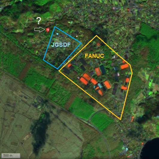
Searching for the bright spot location in Google Maps, I found a guesthouse with solar panels on the roof. Solar cells are actually very reflective in the shortwave infrared, whereas they have a low reflectance in the visible to absorb a maximum of solar energy. It seems that current generation of solar panels cannot convert shortwave infrared radiation to voltage so it is preferable to reflect the incoming photons in these wavelengths to avoid over-heating. Is the high reflectance of some Fanuc buildings rooftops due to solar panels? or is it simply due to the optical properties of the coating material?


Note
Thanks to Sinergise for giving me access to their powerful « Sentinel Mosaic Generator », which helped me prepare this post.
Reference
[1] NASA Earth Observatory (Nov 28, 2016) « Rare November Snow in Tokyo » http://earthobservatory.nasa.gov/NaturalHazards/view.php?id=89177
[2] Wall Street Journal (Mar 27, 2015) « Japanese Robot Maker Fanuc Reveals Some of Its Secrets » http://www.wsj.com/articles/japanese-robot-maker-fanuc-reveals-some-of-its-secrets-1427384420
[3] Fanuc Environmental Report 2016 http://www.fanuc.co.jp/ja/profile/environ/pdf/environreport2016.pdf