Sentinel-2A now watching Antarctica
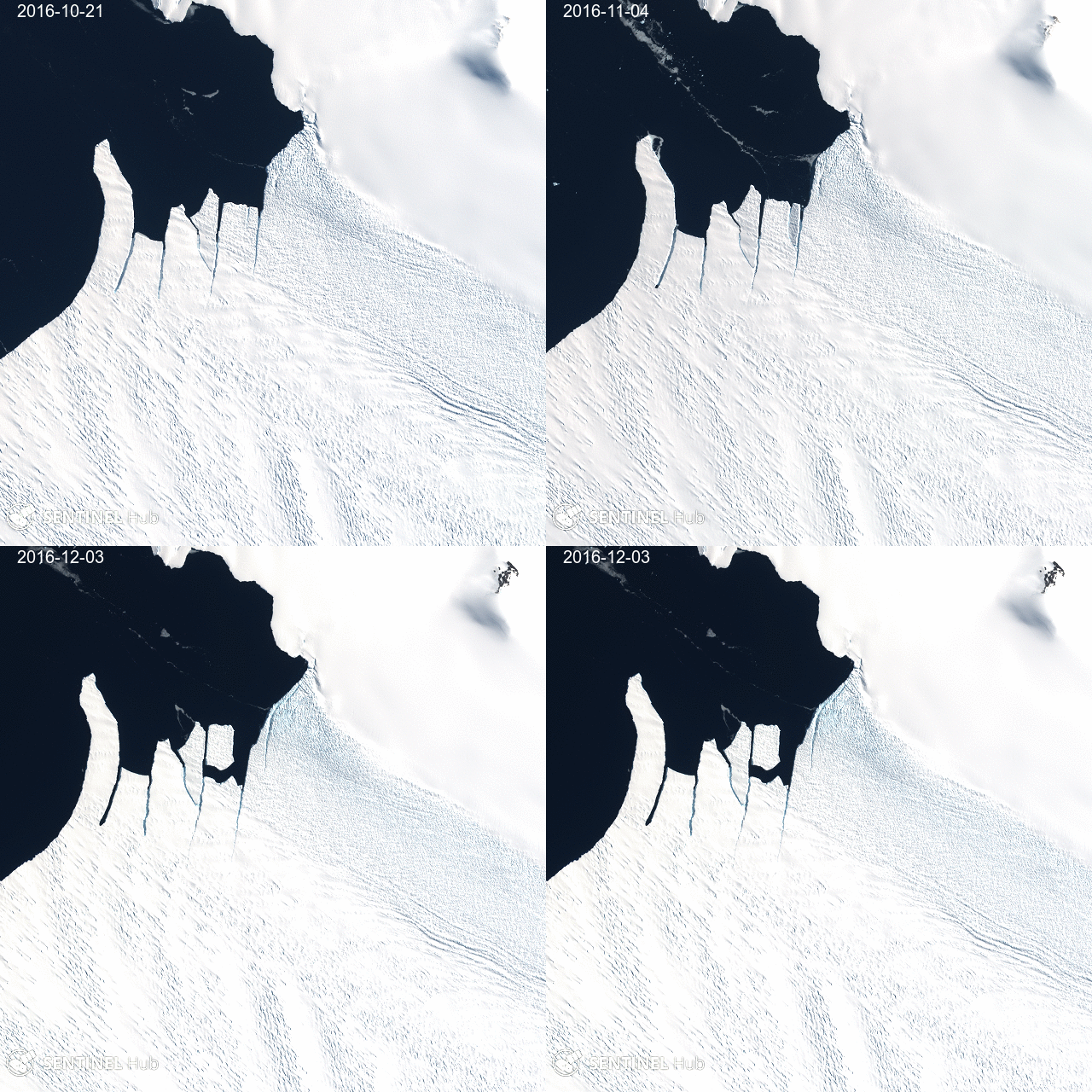
Sentinel-2A was launched on 23-July-2015 but the routine operations started in July 2016 after the ramp-up phase [1]. Now with the onset of the austral summer, the first Sentinel-2A images of Antarctica are getting available (except for Dome C, which is a calibration site).
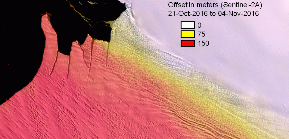
As of today only 9 images over Pine Island glacier are available for example. However this is enough to find three cloud-free images in the glacier’s terminus area. Here I selected the images of 21-Oct-2016 and 04-Nov-2016 to run my simple glacier displacement script in Google Earth Engine (the code is here). I just increased the values of the maximum offset and the patch width because this large floating ice tongue is moving faster than San Quintin glacier.
var displacement = image2RedBand.displacement({
 referenceImage: image1RedBand,
 maxOffset: 1000.0,
 patchWidth: 5000.0,
 stiffness:5
});
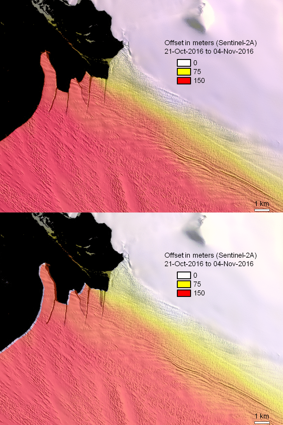
The algorithm works well since the surface features (crevasses, etc.) are well defined [2]. Also the high reflectance of the glacier surface in the visible increases the signal to noise ratio, while there is no saturation thanks to the good radiometric performances of Sentinel-2A.
[1] See https://sentinel.esa.int/web/sentinel/missions/sentinel-2/operations-ramp-up-phase
[2] Jeong et al. (2016) Accelerated ice shelf rifting and retreat at Pine Island Glacier, West Antarctica. Geophys. Res. Lett. doi:10.1002/2016GL071360 PS. I posted more Sentinel-2A images of these fascinating landscapes here, here or here… but you can explore yourself in the Sentinel Playground!