Sentinel-2 captured a jökulhlaup in Afghanistan
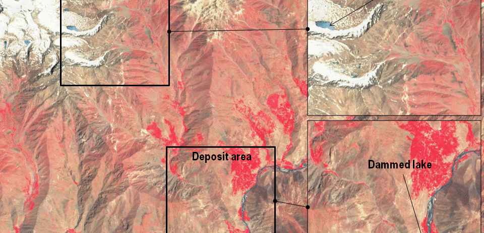
In the Landslide blog Dave Petley has analyzed Planet images of the Pashgor debris flow in Afghanistan (here and here). Here I used two Sentinel-2 images (before and after the event) to show the path of the debris flow from the high mountain area to the Panjshir Valley. Sentinel-2 images have a lower spatial resolution than Planet images but they have a larger swath and the near-infrared channel is useful to highlight the water-rich surfaces (dark blue) and the vegetation (red). Also, Sentinel-2 images are free to use for everyone.
 According to experts this event can be called a jökulhlaup since it was due to the abrupt collapse of a supraglacial lake, i.e. a lake formed on the surface of a glacier, in this case a debris-covered glacier. The debris flow (a mix of water and debris) has traveled 13 km from the source to the deposit area where it has dammed the Panjshir river.
