
S2 Tile Viewer/ Voir les tuiles Sentinel-2
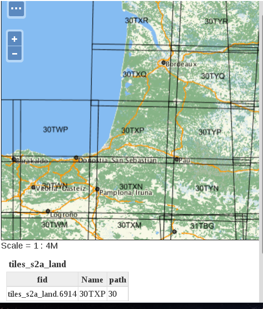
 Here is a map of all the Sentinel-2 tiles .that contain some land (some islands might have been missed). If you zoom enough, the tile number will be displayed on the map. The tool was developed by Michel Le Page, using Geoserver and openlayers. To find it next time, use the Sentinel-2 menu.
  Voici une carte des tuiles Sentinel-2 qui contiennent quelques terres (quelques îles ont été manquées). Si vous zoomez, vous pourrez cliquer pour obtenir le nom des tuiles, et, à résolution suffisante, le nom des tuiles s’affichera sur la carte. L’outil a été développé par Michel Le Page, à partir de Geoserver et openlayers. Si vous souhaitez le retrouver la prochaine fois, l’outil est accessible par le menu Sentinel-2.

