Rapid analysis of the GLOF in Gupis, Gilgit-Baltistan
Pakistan news media reported that a glacier lake outburst flood (the failure of a dam containing a glacial lake) occurred near Gupis, Gilgit-Baltistan, a highly mountainous region administered by Pakistan.
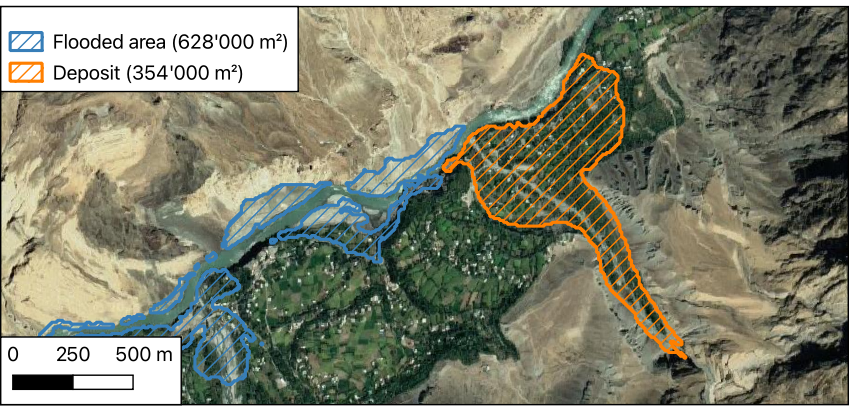
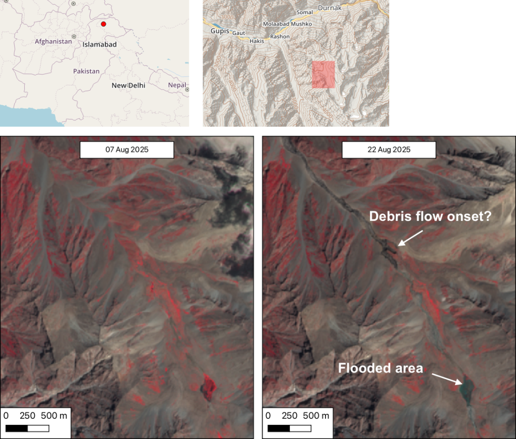
Satellite images show that the flood triggered a debris flow, which reached the Gupis valley where it hit the Roshan (Rashon) village and blocked the Gilgit river. The debris cone created a dammed-lake near in the village of Roshan (similarly to the Blatten glacier collapse in Switzerland). I estimate that the flooded area due to the sediments dam was 0.63 km² on 22 Aug 2025. The sediment deposit that fans outwards the Roshan valley and blocks the river flow was about 0.35 km².
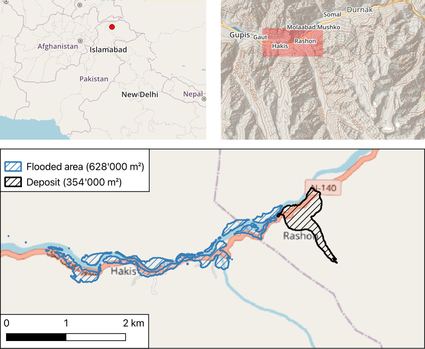
I made this map and area calculations based on Sentinel-2 imagery acquired on 22 Aug 2025 (post-event) and Sentinel-2 images acquired on 07 and 17 August 2025.
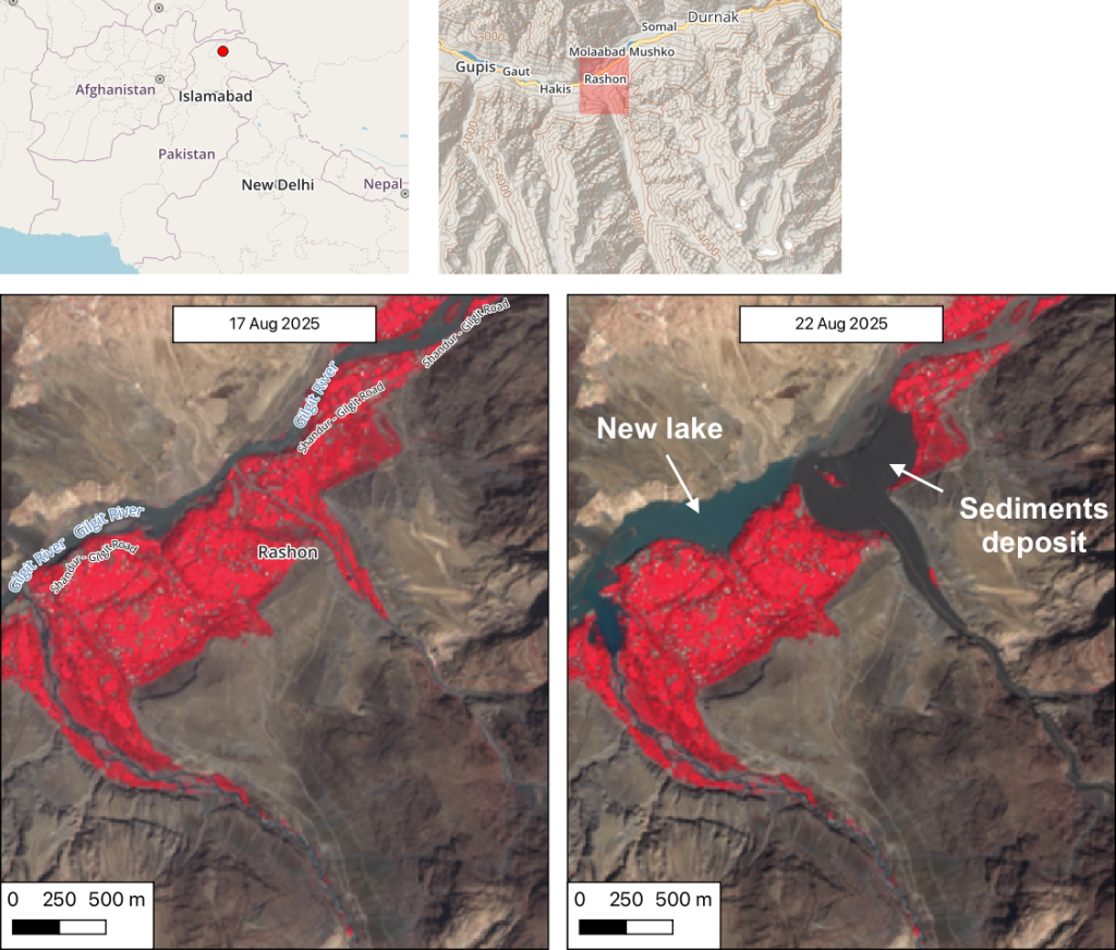
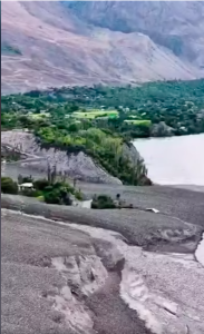
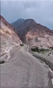
Many houses and crop fields were covered by the debris flow in Roshan. As of today, the number of victims is unknown.
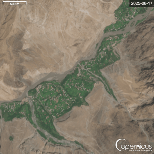
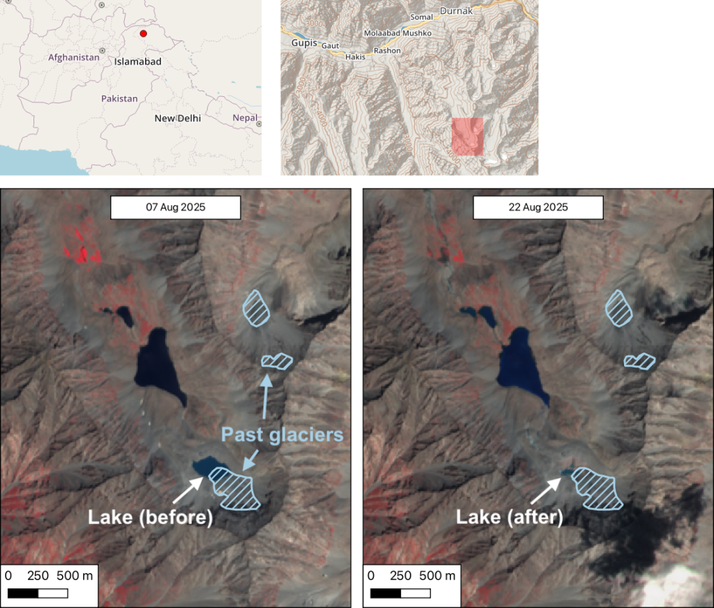
Using Sentinel-2 imagery I could also find that the source of the flood is probably a glacial lake located 12 km upstream (WGS 84 coordinates 36.146°, 73.621°).
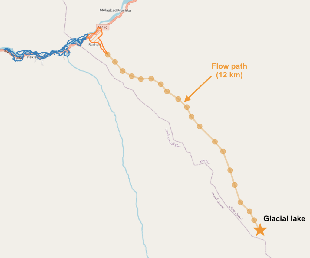
This lake was small before it collapsed (42’000 m²) and was not really a glacial lake since the glaciers are not visible anymore in 2025. Hence the primary cause of this cascading disaster may not be a « GLOF » strictly speaking?
Looking more closely it seems that the debris flow started midway downstream in the Roshan valley.
Edit: Previous Sentinel-2 images show that the glacial lake was rapidly growing fed by the melting snow cover.. Follow the discussion in this thread: https://bsky.app/profile/sgascoin.bsky.social/post/3lx4d66gxns2q
Edit: Pictures of the debris flow deposit (source):