Improvement of water vapour retrieval in MAJA


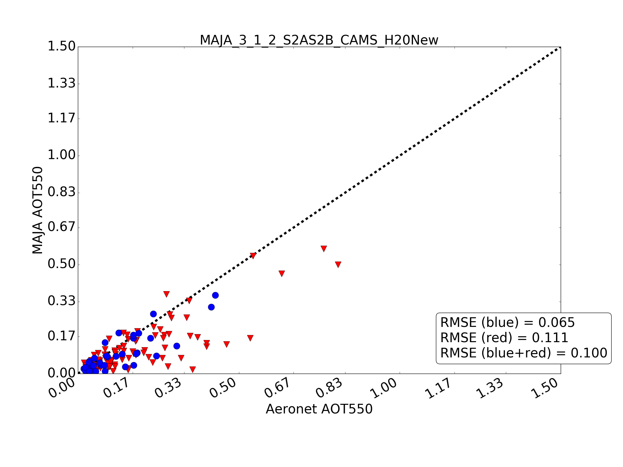
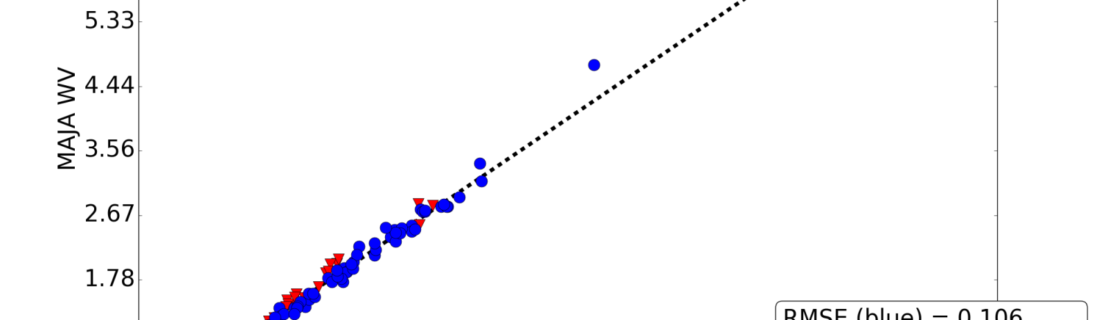
Similarly to the aerosol retrieval, the retrieval of water vapour in MAJA atmospheric correction has also been improved, thanks to the work of Elsa Bourgeois (Cap Gemini) and Camille Desjardins (CNES). An accurate estimation of water vapour is not necessary to perform an accurate atmospheric correction, because water vapour absorption in most of Sentinel-2 bands is much lower than 5%. But the Sentinel-2 water vapour product could also prove useful, and when we plot validation results, showing a large bias for high water vapour contents is not nice. Here is the kind of results we have been having with MAJA from the beginning, with a large bias when water vapour content is high :Our very simple method uses the ratio between Sentinel-2 B9 and B8a bands to estimate the water vapour. B9 is located within a water vapour absorption band at 940 nm, while B8a serves as reference and is only moderately affected by water vapour. The ratio is converted thanks to the use of a Look-up table, which is obtained using radiative transfer calculations. Our method assumes that the water vapour is above the scattering layer, which is obviously not true. The errors due to this assumption increase with the amount of water vapour. Elsa and Camille just empirically computed a new water vapour LUT to cancel this bias, and it works! As you can see, the RMS errors have been divided by a factor 2, from 0.2 g/cm2 to 0.1 g/cm2.We will put this new parameter set in production in January within Theia, and make it available to the users of MAJA processor.