MAJA 3.1.2 with CAMS option finally validated
We had announced quite a long time ago the coming availability of MAJA 3.1 to correct for the atmospheric effects on Sentinel-2, Landsat 8 or Venµs satellites. This version brings a significant improvement in the estimation of Aerosol Optical Thickness, thanks to the use of Copernicus Atmosphere Monitoring Service (CAMS) data to constrain the aerosol type. The details of the methodscan be found here. Bastien Rouquié obtained them on our python prototype of MAJA. We then implemented them in the operational and fast version of MAJA. If the validation tests of MAJA 3.1 were correct on the two test products we had defined, a large scale validation using 10 sites over two year time series showed that instead of improving, using the CAMS option was degrading the results. We had to search for the cause (a bad interpolation of CAMS data in space and time), and correct the errors and perform again a large validation. This time, the validation results are improving a lot, as it may be seen on the figures below.
| Without CAMS option | With CAMS option |
 |  |
 |  |
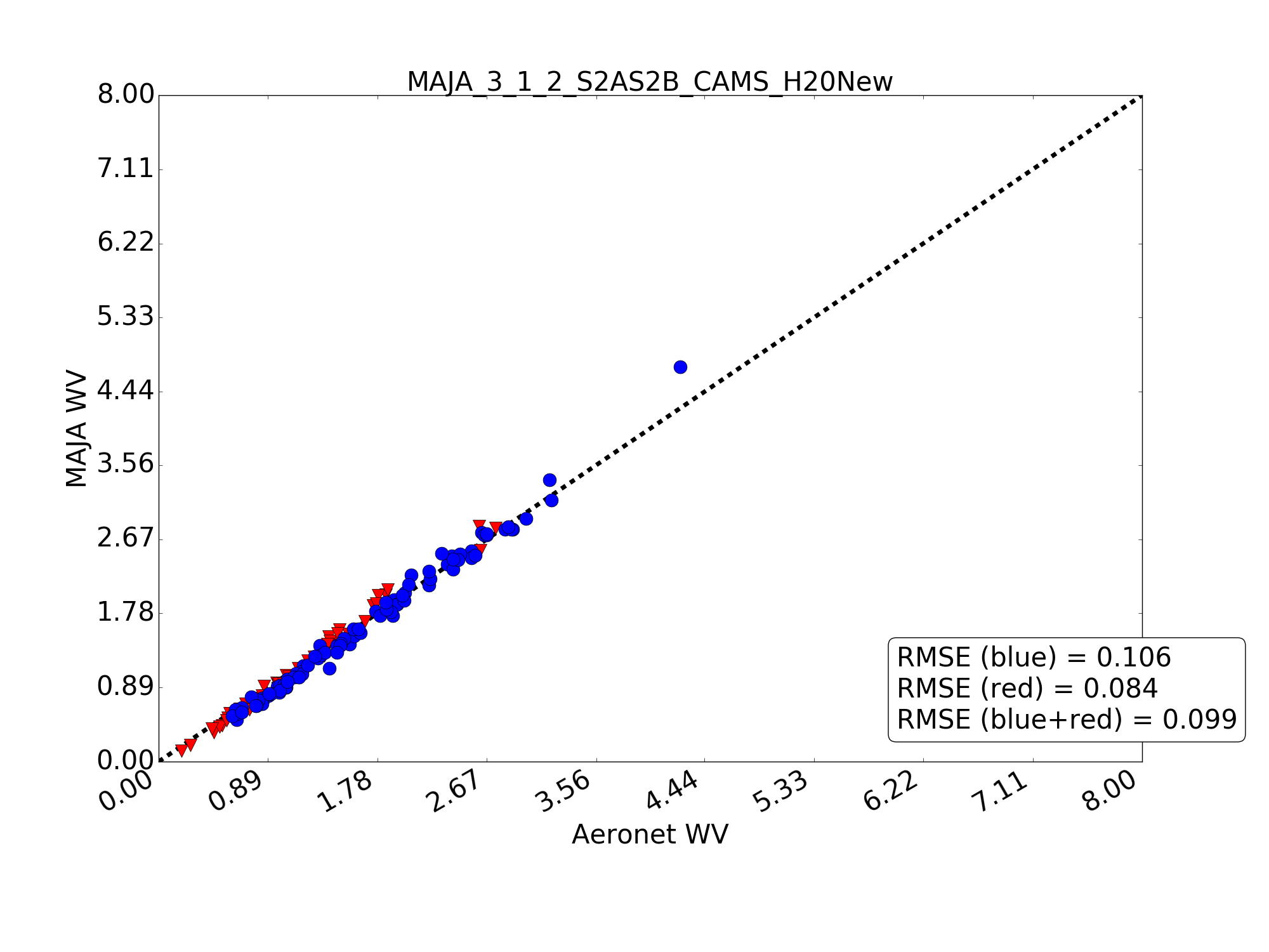
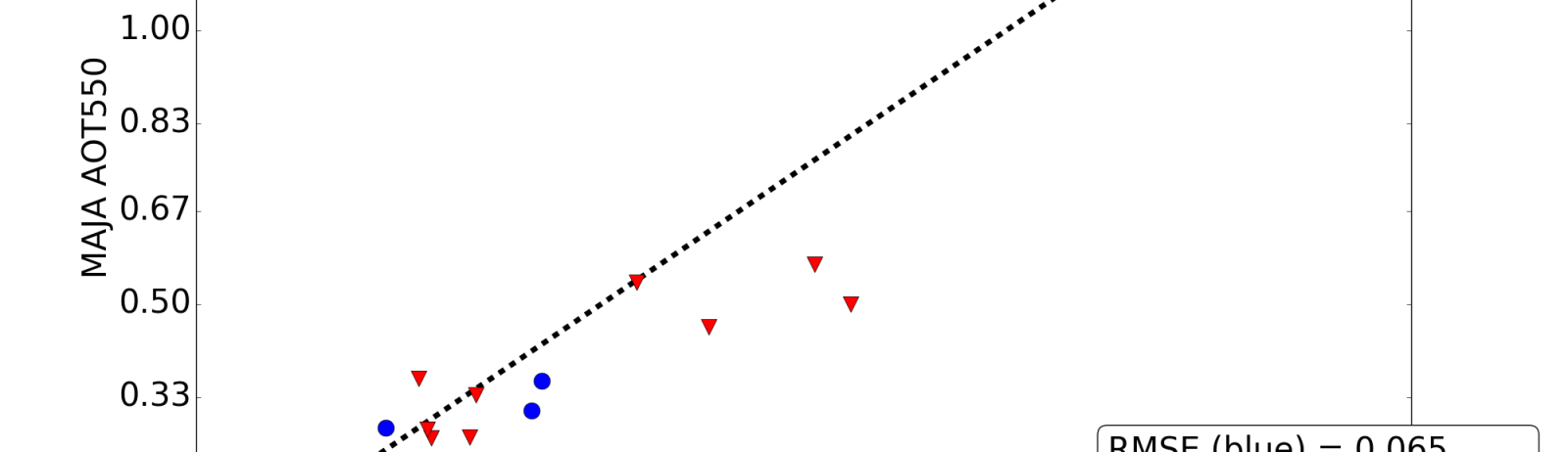
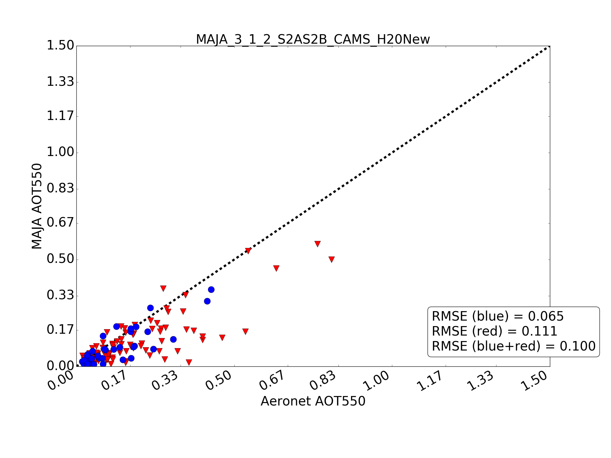
On the left column, we provide the results without activating CAMS option, while on the right, it is activated. The top row corresponds to the comparison between Aeronet AOT used as reference, and MAJA AOT, for eight sites in diverse landscapes. The bottom row provide an example on the well known validation site in Mongu, Zambia.The blue dots correspond to good quality aerosol measurements (no clouds, level 2.0 aeronet values), while red dots correspond to degraded conditions (with either clouds or not quality assured aeronet data (level 1.5 data)
Using CAMS to constrain the aerosol type improves the results by 25%, compared to the use of a continental aerosol model everywhere. Errors for the quality assured validation pixels decrease from 0.085 to 0.065 on the 8 sites, and from 0.143 to 0.094 on Mongu site in Zambia. This site has various types of aerosols depending on the season, including dust, biomass burning and continental aerosols. The results are still far from perfect, and we have work for the next 5 years, but it is still good to have them improved ! MAJA 3.1.2 is available starting from this link on github, as an executable program for linux. To be allowed to use it, you will have to sign the licence first, from this site. If you want to use it for commercial applications, you should ask for a special licence (still for free), sending me an email. In January, I will provide the parameters to allow activate the CAMS options. Regarding the production of Theia, our ground segment has been adapted to use MAJA version 3.1.2, and will soon be able to fetch the CAMS products from Copernicus Atmosphere. Then we will have an operational qualification phase, to check that we can download CAMS products in time for real time production. We should be able to start using in in February or March. And after a few months, if the results are good, yoohoo, we will reprocess everything ! Many thanks to Bastien Rouquié, CESBIO, who did the scientific work, to Camille Desjardins w ho helpled with the validation, to Aurelien Bricier and Benjamin Esquis, at CS-SI for coding the operational version, and Peter Kettig (CNES) and Bruno Angeniol (Cap Gemini), and Bastien, for checking the consistency between prototype and operational versions.