Geomystery near Mount Everest

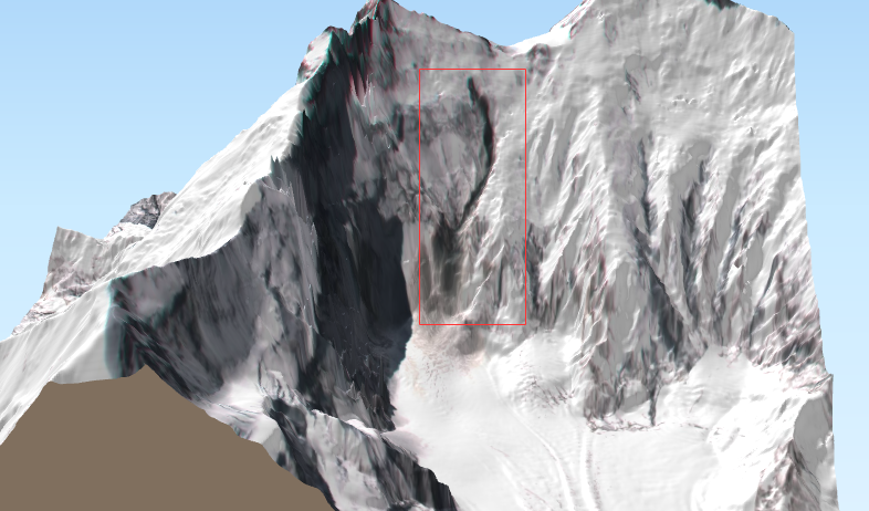
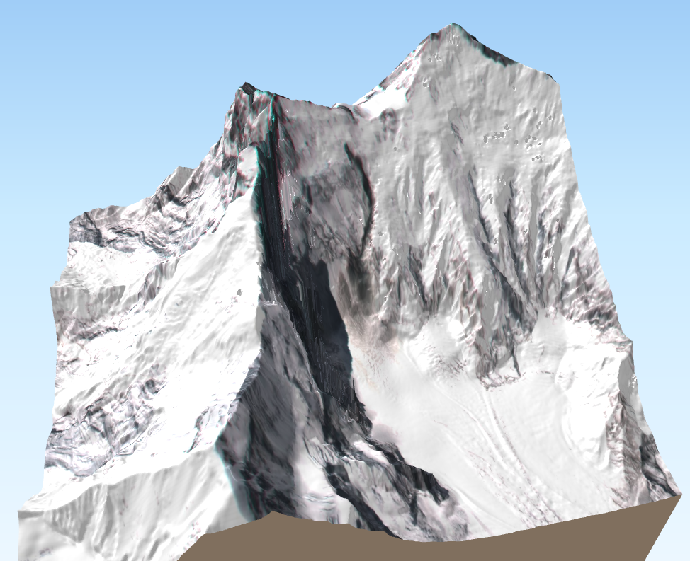
I noted a curious dark trace on the steep slope below South Col between Mount Everest and Lhotse in this 3D view of a Sentinel-2 image (2019 Mar 29)…

The dark thing is visible in the Venµs Khumbu time series (5 m resolution). It shows that it appeared between 24 and 28 March 2019. It is about 1.3 km long. Click on the picture below to enlarge.

After a quick correction of the Venµs image geolocation [1], I made some 3D views using Qgis2threejs and the HMA DEM (8m resolution):

Footnote

[1] Be careful the orthorectification of Venµs images is a bit shaky in this steep area. Here I collected five control points using the hillshaded HMA DEM as a reference and warped the image using a thin plates spline transform in QGIS. The average shift between source and target points was close to 500m! This allowed me to make a quick correction of the main horizontal distortion for this post but there probably remain large errors in the image geolocation.

Plus d'actualités

Three Sentinel-2 satellites instead of two: impact on the retrieval of the snow disappearance date

Due to the success of Olivier’s petition, ESA kept Sentinel-2A operational after the launch of Sentinel-2C. Having three operational satellites instead of two increases the revisit, which should improve the quality of the derived products, and therefore the reliability of operational services based on Sentinel-2 data. One of this service is the Copernicus’ High Resolution […]

Autumn snow drought on Mount Damavand

« We are currently experiencing the driest autumn the country has experienced in 50 years » said Iran’s meteorological organisation. Near Tehran, Mount Damavand, the highest peak in Iran (5609 m) was reported to be « unusually bare of snow ». I checked this statement using my MODIS snow cover data processing algorithm implemented in Google Earth Engine (Gascoin […]

Evolution des glaciers du Vignemale sous l’œil des satellites Pléiades (2013-2025)

Grâce à DINAMIS, un couple d’images stéréoscopiques a été acquis par Pléiades 1B le 14 septembre 2025. Le modèle numérique de surface (MNS) produit à partir de ces images peut être comparé à un autre MNS de septembre 2013 produit à partir des images Pléiades 1A commandées par Marti et al. (2014). Le glacier d’Ossoue […]

Rechercher