Geodes, the next generation access platform for CNES EO data.
 =>
=> 
Context
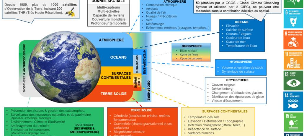
In 2021, CNES decided to implement a service hub for the dissemination of Earth Observation (EO) satellite data. Integrated in a national and European ecosystem, in the framework of Data Terra and at the service of scientific communities and CNES projects, the GeoDataHub project (GDH, which has more recently been renamed Geodes) will offer services for the dissemination, exploration, incubation and management of space-derived data, in order to promote and foster innovation and science in the field of the « Earth System ».
GDH will provide access to all EO data for which CNES has had a major contribution, including Sentinel 1 and 2 data. From the end of 2023, the dissemination of Sentinel data will be carried out in France by the GDH platform, replacing the PEPS platform.
The GDH or Geodes platform will soon allow to:
- ingest data produced by CNES EO missions in order to enhance their value,
- integrate into the Data Terra research infrastructure to facilitate access to services and data for scientific users
- interoperate with institutional service platforms (e.g. GeoPlatform from IGN)
- rely on private relays when necessary (Cloud hosting or other services) to promote economic development around the use of the data.
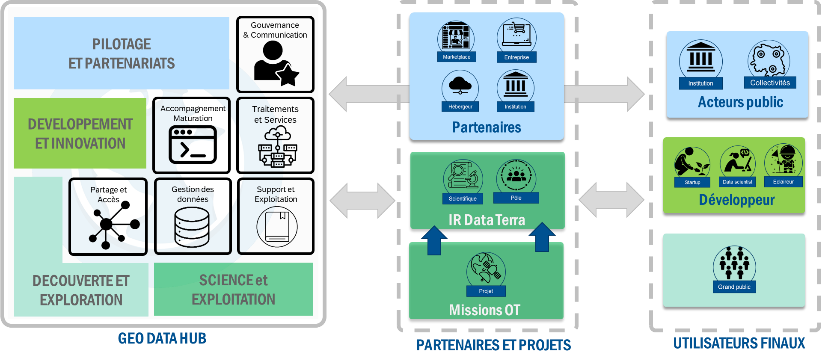
The platform and its services
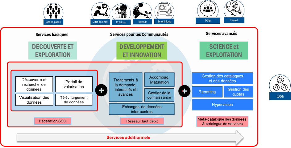
In order to meet these challenges and to ensure better integration into the ecosystem, the service offer has been designed in three layers of services to meet the different types of use. The diagram above summarises the service offering, which addresses:
- Basic services: discover and explore data
- Services for communities: enable the development and maturation of new services,
- Services for projects and clusters: disseminate data and value-added products for CNES or partner production centres
GDH will use the following components
- A WEB portal for communication functions: publication of articles to promote CNES EO activities (EO Missions, Contributions to the Poles, EO Lab, SCO, Downstream Program, PEPS Booster, etc.) and to help new users access to satellite data
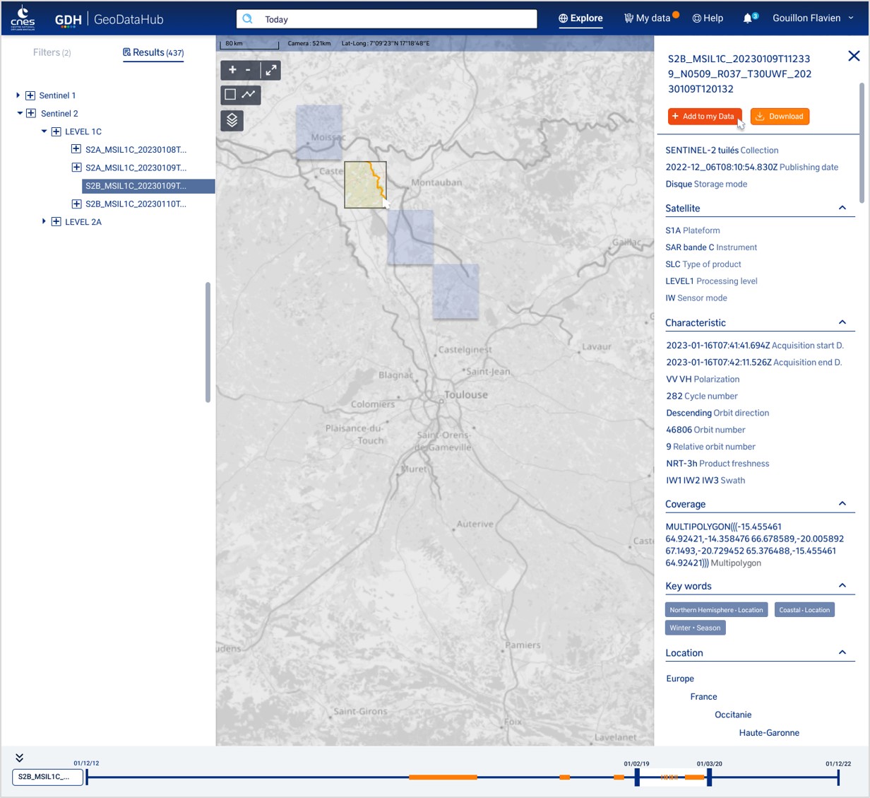
- A WEB GIS component for the discovery (consultation of the catalog), visualisation, downloading and processing of data on demand
- A DATALABS component (like JupyterLab) for interactive processing (maturation of processing algorithms on the data).
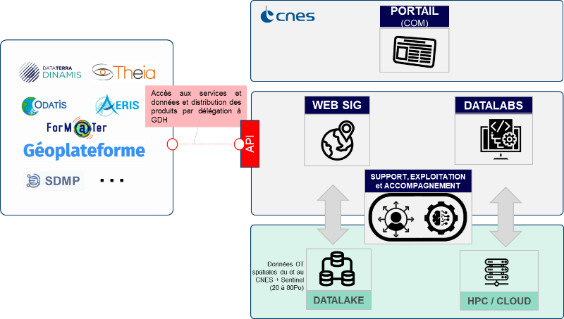
Interoperability with other platforms and integration in the IR Data Terra will be ensured by the use of standards (OGC, STAC, COG). Other technical subjects are in progress within the framework of the Gaia Data project, such as the federation of authentication and authorisations, inter-centre data exchanges, federation of services, etc. Particular attention is paid to support and operation, help and expertise in order to provide the best possible assistance to all users on thematic, technological and operational issues. The team relies in particular on feedback from PEPS and the CNES operating teams.
The resulting platform will be based on two strategic CNES resources that are currently being renewed – storage (DATALAKE) and computing (HPC6G) – and will group in a single access server all the EO datasets that CNES is making available now and in the future. These infrastructures allow for a significant increase in load, while also considering responsible digital use (storage on tape, monitoring and energy optimisation of HPC).
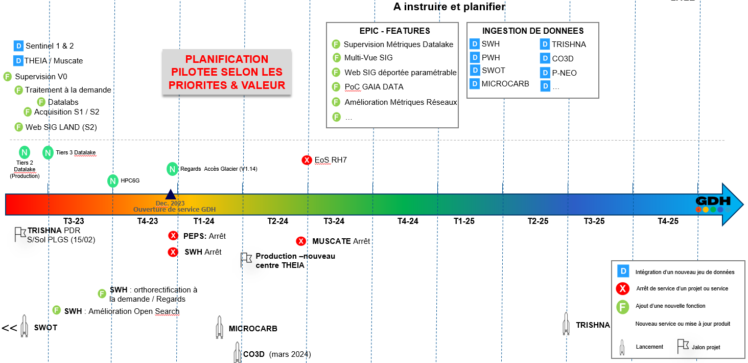
Roadmap and evolutions
The platform is currently under development and is based on the integration and reuse of generic software components developed as part of the Hysope II project. The development method chosen is an Agile and DevOps method that also integrates a « UX Design » approach in which users are involved to help us build the solution that is best aligned with their expectations and needs. CNES has chosen to define an « MVP » (Minimum Viable Product) scope for the first development phase with the selected industrial company, Cap Gémini. This phase is scheduled to run from September 2022 to July 2023. It will enable the implementation of the takeover of PEPS services and the dissemination of THEIA / Muscate data. The next phase will consist of implementing additional services and ingesting eligible data to GDH. Priorities will be defined according to the added value and possible external constraints. The migration of PEPS users and the official opening of the service will be at the end of 2023.
Contacts
For more information, you may contact the Project Manager : Francois.jocteur-monrozier@cnes.fr or the Product Owners : Benjamin.Husson@cnes.fr et Marjorie.Robert@cnes.fr for more technical questions.