Satellite Missions

Soil moisture maps at a high resolution over Occitania region

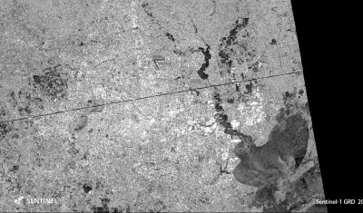
=> Translated from Theia website.The Theia forges just released a new product based on Sentinel-1 and 2 data. Le « High resolution soil moisture » Scientific Expertise Center, driven by Nicolas Baghdadi, from Tetis lab in Montpellier and Mehrez Zribi from CESBIO, distributes Soil Moisture maps from the French Occitania region at 20 m resolution, produced every […]

30.09.2017

Des cartes d’humidité du sol à haute résolution en Occitanie

=>Article rédigé à partir des articles du site Theia.Les forges de Theia viennent de mettre à disposition un nouveau produit basé sur les données Sentinel 1 et 2. Le CES “Humidité du sol à très haute résolution spatiale”, animé par Nicolas Baghdadi, du laboratoire Tetis à Montpellier et Mehrez Zribi du CESBIO, propose des cartes […]

[MUSCATE news] 40 000 Sentinel-2 L2A products !

Our MUSCATE ground segment just passed a new milestone, with 40 000 L2A products processed with MAJA ! Last week was a bit difficult, with a new repetition of the Friday Night Bug (on Saturday morning this time), followed by a « NFS » issue on CNES computing center that blocked production during two days. We are […]

26.09.2017

Deux gros glaçons quittent l’Antarctique

L’Antarctique sort à peine de sa torpeur hivernale que déjà deux évènements majeurs viennent de se produire sous l’œil de Sentinel-1.  Le 12 juillet dernier, une crevasse géante à fendu la barrière de glace Larsen C [1], mais il a fallu attendre que la banquise desserre son étau en septembre pour que l’iceberg A68 commence […]

25.09.2017

MAJA presentation at the Recent Advances in Quantitative Remote Sensing symposium, fifth edition

I just came back from Valencia, where I attended the fifth edition of the  Recent Advances in Quantitative Remote Sensing Symposium. It is one of my favourites, thanks to an amazing team of organizers led by Jose Sobrino. It is a unique symposium, because it has only one session  where you can even see opticians […]

24.09.2017

Aftermath of Mathew hurricane over Haiti in 2016

Following Simon’s publication on Saint Barthelemy island after Hurricane Irma, one of our twitter friends, @Pierre_Markuse, posted a comparison of the South Western part of Haiti, before and after Mathew huricane ravaged it last year, on the 4th of October 2016. As you can see, the whole lands turn brown just after the hurricane. I […]

15.09.2017

Saint-Barthélemy après Irma

Sentinel-2A a capturé une image de Saint Barthélemy le 12 septembre, soit 6 jours après le passage de l’ouragan Irma. Une autre image avait été acquise juste avant le passage de l’ouragan le 04 septembre par sa petite sœur Sentinel-2B. Le contraste entre ces deux images est saisissant. Ici j’ai utilisé un rendu qui mixe […]

13.09.2017

[MUSCATE] 1141 L2A products in a day !

Yesterday, MUSCATE facility at CNES produced 1141 Sentinel-2  L2A products in a day, while the previous record was 762. A few glitches had reduced the production on the previous days, and yesterday allowed us to catch up the back log. At the same time we have started producing data acquired in 2016 for several zones […]

30.08.2017

Flooded areas in Houston by Sentinel-1

Hurricane Harvey hit Texas on August 25. The first Sentinel-1 image of Houston since landfall was acquired on Aug 29 at 00:26 UTC. I’m writing this post at 21:09 UTC. As reported by the local news website chron.com « The most severe flooding is around the Highway 90 and Eastgate areas ». This is also what we […]

29.08.2017

Rechercher