
Soil moisture maps at a high resolution over Occitania region
 =>
=>  Translated from Theia website.The Theia forges just released a new product based on Sentinel-1 and 2 data. Le « High resolution soil moisture » Scientific Expertise Center, driven by Nicolas Baghdadi, from Tetis lab in Montpellier and Mehrez Zribi from CESBIO, distributes Soil Moisture maps from the French Occitania region at 20 m resolution, produced every sixth day from September 2016 to May 2017.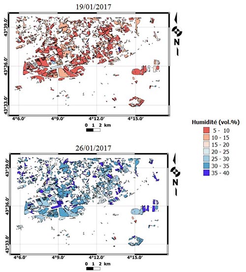
The product uses time series of the Copernicus S1 and S2 satellites. The inversion method is based on neural networks. It is applied only on crop lands (with or without vegetation), which are extracted from the Sentinel-2 2016 land cover map of France produced by Theia (Jordi Inglada et al., CESBIO).
These maps were developed and produced thanks to support from IRSTEA (UMR Tetis) and CNES (Tosca Project). The first data are available following this link. It is of course planned to turn to an operational production on the whole France, but as always, going from prototype to operational processor will take some time.

