In English

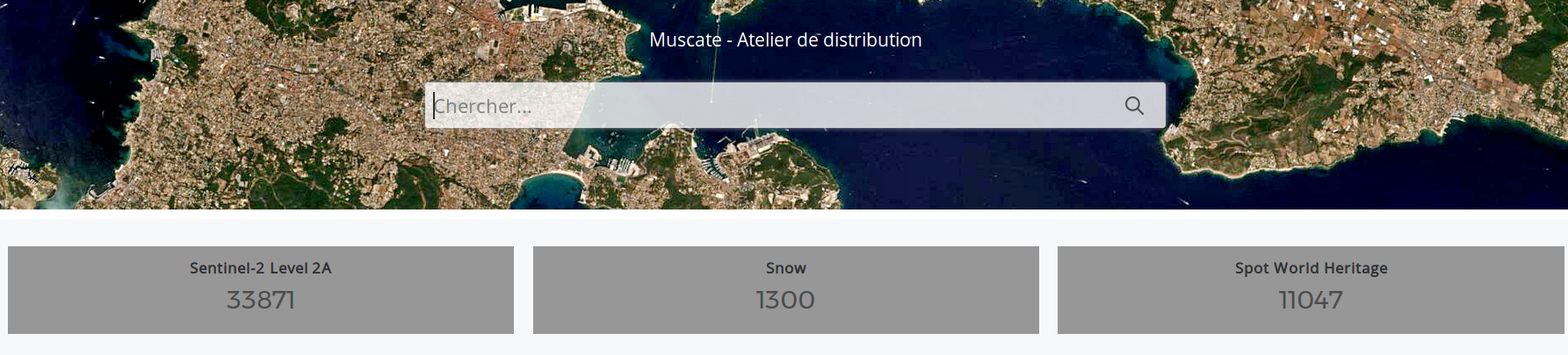
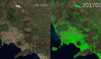
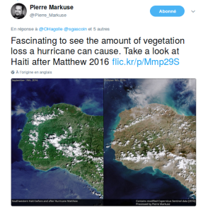
Aftermath of Mathew hurricane over Haiti in 2016

Following Simon’s publication on Saint Barthelemy island after Hurricane Irma, one of our twitter friends, @Pierre_Markuse, posted a comparison of the South Western part of Haiti, before and after Mathew huricane ravaged it last year, on the 4th of October 2016. As you can see, the whole lands turn brown just after the hurricane. I […]

15.09.2017

The Delta of the Ebro seen by Venμs

=> The Ebro (Iberus in Latin) flows into the Mediterranean in Catalonia after a journey of more than 900 km from its source in Cantabria. The current morphology of the Delta results from the significant increase in sediment inputs caused in the 15th century by the intensive deforestation of the river catchment: the conquest of […]

01.09.2017

[MUSCATE] 1141 L2A products in a day !

Yesterday, MUSCATE facility at CNES produced 1141 Sentinel-2  L2A products in a day, while the previous record was 762. A few glitches had reduced the production on the previous days, and yesterday allowed us to catch up the back log. At the same time we have started producing data acquired in 2016 for several zones […]

30.08.2017

Flooded areas in Houston by Sentinel-1

Hurricane Harvey hit Texas on August 25. The first Sentinel-1 image of Houston since landfall was acquired on Aug 29 at 00:26 UTC. I’m writing this post at 21:09 UTC. As reported by the local news website chron.com « The most severe flooding is around the Highway 90 and Eastgate areas ». This is also what we […]

29.08.2017

Vavilov Glacier in 2016 and 2017

The organizers of the 2017 International Glaciology Society meeting in Boulder tweeted this animation of the Vavilov Glacier (October Revolution Island, Russian Arctic):

18.08.2017

THEIA distributes L2A Sentinel-2 data over Italy, Switzerland, and most of Alps

Done ! All Sentinel-2 data acquired above Italy, Switzerland and Austrian Alps, and processed at level 2A, are now available on Theia website! The data format is described here. We would be very thankful if users in Italy or Switzerland could help us spread the news among remote sensing users in both countries. The level 2A […]

17.08.2017

An anomaly provisionally prevents real time production in ESA’s Sentinel-2 ground segment

That’s bad luck, just before the long week-end of the 15th of August, ESA Sentinel-2 ground segment failed and ceased production. This explains why Theia ground segment is not producing in real time anymore.Pas de chance, le segment sol de Sentinel-2 À L’ESA est tombé en panne juste avant le week-end du 15 août. Ceci […]

NASA selected CESBIO’s land cover map of France as « image of the day »

=> It is a well deserved recognition for the land cover product developed at CESBIO : NASA’s earth observatory blog dedicated its « image of the day » blog post for the 15th of August to this product. This work was done in the framework of Theia, using iota2 free software also developed at CESBIO. Thanks to the information conveyed […]

16.08.2017

THEIA distributes L2A Sentinel-2 data over Spain and Netherlands in near real time.

=>  Sentinel-2 data acquired above Spain and Netherlands are now available on Theia website! Portugal was already available. We also completed the little part of Belgium that was missing. The level 2A product provides surface reflectances with a good cloud and shadows mask. The processing is done at CNES, within MUSCATE facility, using the MAJA software, […]

02.08.2017

Rechercher