
Production of LANDSAT L2A data at THEIA to begin shortly.
 =>
=> 
At CNES, the prototype MUSCATE production facility of THEIA land data centre will soon start the production and distribution of Level 2A Landsat 5 and 7 data, and shortly after of LANDSAT 8 data covering the entire surface of France.
For Landsat 5 and 7, we use data from both USGS and ESA : indeed, up to now only ESA has the LANDSAT 5 data that were acquired over the receiving stations of Mas Palomas (Canary Islands), Matera (Italy), and Svalbard (Norway). A transfer to USGS of ESA’s data is expected, it may have started in Svalbard, but it has not yet begun for the Matera station, which covers France.
Level 1C
The USGS data are orthorectified, but those from ESA are not, so, as for SPOT4 (Take5), we set up an ortho-rectification processing using the SIGMA tool provided by CNES. The ESA’s products we received 2 years ago also have some flaws (which may have been corrected by now, but given it took months to obtain the data we did not ask for a reprocessing): the thermal band is unusable and you will find here and there colourful bright spots, such as those produced by your neighbour moped on your TV when you were a child. Nevertheless, we can produce correct Level 1 products, although we look forward to the reprocessing of these products by USGS. ESA has now it own processing of LANDSAT data, but it stops at level 1C.For Landsat 7, this processing is not necessary because the data are already ortho-rectified. We interpolate only a small portion of the missing data due to LANDSAT 7 SLC breakdown, and then we discard the parts of the image where the gaps are too large. For LANDSAT 8, none of these processings are needed.
Level 2A
The Level 2A products (Cloud Mask, Atmospheric correction) will be produced by the prototype of MACCS software developed and maintained by Mireille Huc (CESBIO, CNRS). Two years ago, I had already produced such a data set on the most Southern part of France, at CESBIO. These products are already distributed on THEIA web site and are also used to illustrate this post.
LANDSAT 5 and 7 :
Starting in April, we will process the LANDSAT 5 & 7 data acquired above France from 2009 to 2011.
LANDSAT 8 :
From April or May, we will process the LANDSAT 8 data acquired since april 2013, and we will try to keep the pace so as to produce the incoming new LANDSAT 8 acquisitions with a short delay.
Data Format :
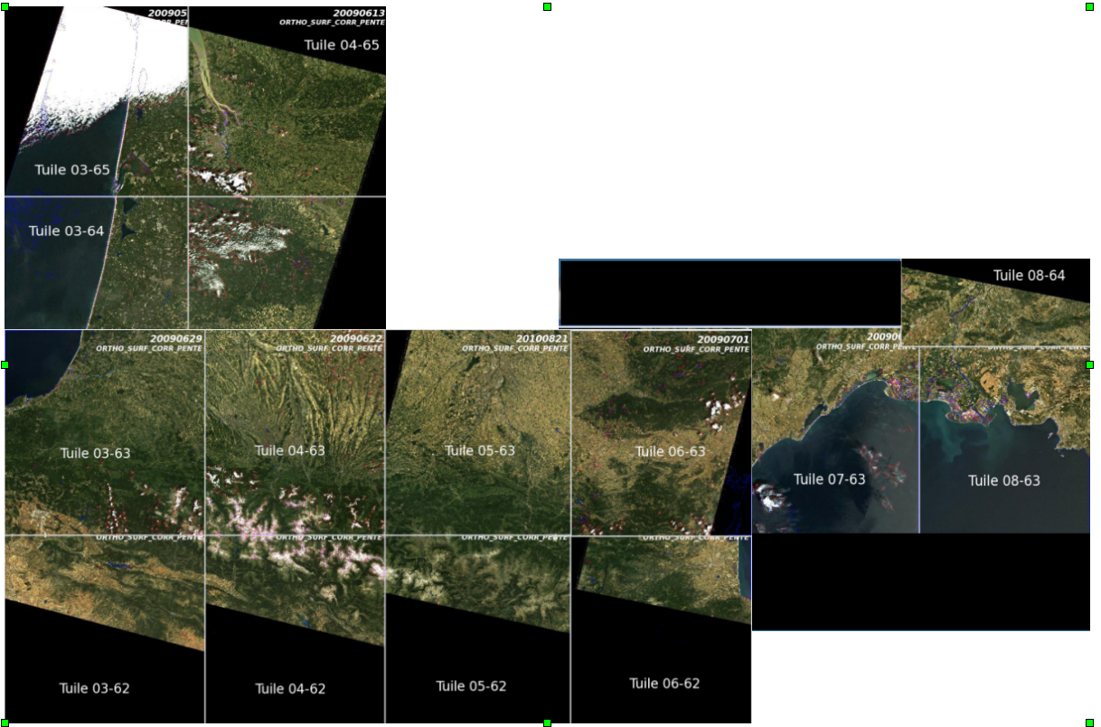
We will reuse the data format of SPOT4 (Take5). France will be split into 110*110 km² tiles with a 10 km overlap with their neighbours. (See the image mosaic obtained for the South of France).Depending on the success of the distribution of these data, we will decide if it is worth producing older time periods or other regions. Please tell us if you need such data.
Exemple : available LANDSAT images from July to October 2009 for the tile centered on Toulouse. For each date, we provide the level 1C image tTOA reflectance), on the left, and the level 2A image on the right (surface reflectance). The detected clouds are circled in red.

