In English

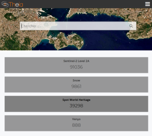
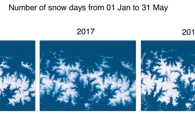
Over 10’000 snow products in Theia

To celebrate the 10’000th snow product in Theia, here is the latest snow map over the Vicdessos area in the french Pyrenees near Andorra. The snow is in blue and the clouds are in white! Pan and explore the map below.. See full screen Big up to the Muscate team!

In English

A mining company doing land art?

On March 9th, 2018, a tailings dam has failed at Cadia, a large open pit gold mine in Australia. Dave Petley for the AGU landslide blog collected aerial and satellite (Planet) images of the dam before and after the event. The Newcrest mining company also published a report on the failure. The embankment slump is […]

In English

Slides and conclusions of the MAJA/Theia worskhop

The Theia workshop for Sentinel-2 L2A MAJA products was held in Toulouse on the 13th and 14th of June 2018.    About 80 people participated either on the 13th or 14th, and nearly 70 participants attended each day of  this workshop,  whose object was to collect feedback and share experiences on the quality, use and applications […]

In English

[Venµs News] L1C processor upgraded to V1.0

Summary   Until V0.9, only a small proportion of Venµs L1C data were available at L1C level on Theia’s website. Now, with the version V1.0, a greater proportion of products will be distributed to users, but we advise users to check their geometric quality in the metadata, as explained below.  Distribution of V1.0 products should […]

In English

NDVI time series in 2018 World Cup stadiums

The figure below shows the evolution of the Normalized Difference Vegetation Index (NDVI) in the pitches of all the 2018 World Cup stadiums. I retrieved these data from Sentinel-2 observations using the new time series plotter in the EO Browser. I just drew a polygon in each of the 12 stadiums to get the average […]

MAJA

[MUSCATE News] Some bad and good news

  The bad news The MUSCATE ground segment that delivers Sentinel-2A products has had several issues these past two weeks. We have had some performance issues with the data base which tells MAJA processor which product must be processed next. These lower performances caused traffic jams and disruptions in the data production, and the system […]

In English

Vegetation recovery in Saint Barthélemy after Irma

Last year, in this post, I showed the comparison of two Sentinel-2 images of Saint Barthélemy in the Caribbean before and after the powerful Hurricane Irma. A new feature in the EO Browser enables to plot the evolution of the mean NDVI within a polygon. I drew a rough polygon of Saint Barthélemy to check […]

CESBIO

Three snow seasons in the Pyrenees through the eyes of Sentinel-2 and Landsat-8

On June 23 we will celebrate the third anniversary of Sentinel-2A in orbit. With three years of data we can start looking at the inter-annual variability of biophysical variables, like.. (random example), the snow cover. This is what I attempted to do for the Theia workshop. I downloaded all available snow cover products from Theia over […]

CESBIO

La vectorisation du produit OSO, comment ça marche ?

Le produit vecteur d’OSO 2017 est enfin sorti ! Après plusieurs semaines de traitements, les vecteurs de chaque département sont disponibles ici. La production requiert la mobilisation d’une grande quantité de ressources de calcul et une stratégie de traitements un peu particulière. Nous voulions vous expliquer comment parvient-on à produire cette couche d’information. A priori, […]